Country:
 City:


Start from the Porsmilin bus stop (line 11), Rue Jean Colle.
Signs for Porsmilin beach
(S) Head towards the crossroads and turn slightly left onto Rue de Quelarguy towards the beach. At the first junction, turn left onto Rue de Porsmilin. Follow the road down to the beach car park.
Red and white markings
(1) Then turn right. At the three-way junction that you’ll soon come to, veer left and follow the coastal path along theGR® 34 to the former military site at Toul Logot.
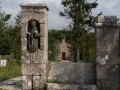
(2) Continue along the coastal path to the memorial stone at Place des FFI.
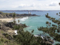
(3) Leave the memorial on your right and continue along the coastal path, skirting Sainte-Anne Beach.
(4) Leave the seafront by heading uphill to the right and following the GR®. When you reach the houses, turn right into Impasse Sainte-Anne, then turn left into Impasse de la Baie.
(5) At the end, turn left onto Rue Henri Gourmelin. Continue down this road until you reach Trez Hir Beach. Then take a beachside path on the left.
(6) Follow Boulevard de la Mer to the left. Pass Rue Saint-Yves on your right and turn left onto Boulevard de la Corniche. Walk the entire length of this boulevard until you reach the junction with Rue Pen Ar Mean.
(7) Opposite, head down the coastal path overlooking Perzel Beach.
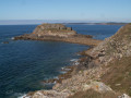
(8) You’ll come out onto Rue de Perzel; turn left onto it (lovely view of Fort de Bertheaume).
(9) Go round the buildings on the right and cross a tarmac road. A little further on, turn right to continue along the coastal path.
(10) Continue to follow theGR® along Rue Poulizan. At the first junction, turn left. At the left-hand bend that comes up immediately, carry on straight ahead along the path. After a right-hand bend followed by a left-hand bend, you’ll reach a T-junction (please note that the purple route on the map is no longer up to date; follow the route description and the red and white markings carefully).
(11) Follow the bend to the left and head down to the seaside. Join the coastal path and follow it to the right as far as Pointe de Créac’h Meur.
(12) Stay on the coastal path and ignore the paths on the right that lead inland. Walk for a long while until you reach the junction with a small road coming from Keryunan.
(13) Continue along theGR® route, which runs slightly further inland than the coastal path (the purple line on the map is out of date; follow the red and white markings carefully). At a T-junction, turn sharply left. Rejoin the coastal path and follow it westwards until you reach the junction with a sign pointing to the Jardin de Vaéré.
The Jardin de Vaéré is well worth a visit: leave theGR® by turning right and walk a few hundred metres uphill.
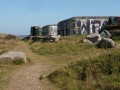
(14) Continue to follow the coastal path westwards. Pass several blockhouses along the way and reach Pointe Saint-Matthieu (worth visiting: ruins of an abbey, chapel, cenotaph, lighthouse).
(15) Carry on along the coastal path, which goes round the buildings to the left. The path runs parallel to the D85 for a long stretch and reaches Pors Liogan Beach.
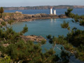
(16) Carry on along theGR® coastal path to Pointe des Renards (beautiful views: to the north over Le Conquet harbour and the Kermorvan Peninsula; to the south, over Pointe Saint-Matthieu).
(17) Walk down the path to Portez Beach.
(18) Walk back up the road to Pointe Sainte-Barbe. Just past the hotel of the same name, go down the steps on the left. At the bottom, turn right and walk along the harbour. Follow the Corniche Sainte-Barbe and cross Place Saint-Christophe. Then follow Rue Troadec and then Quai du Drellach. Walk along the Ria du Conquet as far as the footbridge.
No signposting
(19) Leave theGR® by turning right, then right again onto Rue Amiral Guepratte. At the roundabout (tourist office), turn right onto Rue Lieutenant Jourden. Take thefirst left, at the corner of the town hall, to arrive immediately at the bus stop (E).


 Visorando Member
 Easy