Heritage highlights in the Locmaria-Plouzané countryside

As well as its much-loved seaside, Locmaria-Plouzané boasts a countryside rich in heritage: manor houses and various wayside crosses lining the small roads and paths. Let’s not forget the Chapel of Saint Sebastian, whose history is linked to the plague epidemic that ravaged the parish in 1640.

Details

331850
Creation:
Last update:
Last review:
  • Walking
    Activity: Walking
  • ↔
    Distance: 5.99 mi
  • ◔
    Average duration: 2h 55 
  • ▲
    Difficulty: Easy

  • ⚐
    Back to start: Yes
  • ↗
    Ascent: + 171 ft
  • ↘
    Descent: - 171 ft

  • ▲
    Highest point: 344 ft
  • ▼
    Lowest point: 167 ft

Photos

Description of the walk

(S/E) From the church car park, take Rue de la Fontaine, which runs between the church and the car park. Head towards the fountain situated 100 metres south of the church, which is topped by a statue of Christ carved from Kersanton stone dating from 1623.
At the roundabout, turn right into Rue de Pen Ar Menez, and at the junction turn left into Rue de Gorrequear, then right into Rue de Varlaès. At the junction with Route de Kerfily, turn left.

(1) At the École Sainte-Anne, cross the road and follow the signs for Ker Yan and Dreizoc (dead-end sign), then follow this small road. Pass through the hamlet of Ker Yan and continue along the road.

(2) Before the entrance to the Dreizoc farm, turn right onto a dirt track that goes round the farm and, at the next junction, continue along the track on the right. Go round Brendégué-Bihan on the left.

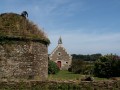
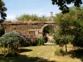
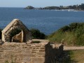
(3) At the junction with a road (marked by a mountain bike signpost), turn left then immediately right onto a grassy track, which you follow straight on. At the next junction, turn left to ride alongside the Domaine de Kerscao, then left again onto the small road to reach the Manoir de Kerscao with its chapel and dovecote. Continue along the small road to reach the Croix de Kerscao, preceded by an avenue of chestnut trees.

(4) Turn left and follow this fairly busy road. Walk along a disused section of road for a few metres until you reach a crossroads. Turn left towards Moguérou. You are now at the highest point in the commune (104m), with Le Conquet and Ploumoguer – recognisable by their wind turbines – in the background.

(5) Opposite the entrance to the woods of the Manoir de Brendéqué and Moguérou (stone pillars), veer left (dead-end sign). At the Croix de Brendégué, continue along the path opposite, ignoring a wide track on your right. Follow this path and, at each junction (mountain bike marker posts), carry on straight ahead.

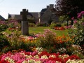
(6) At the junction with the Route de Goulven, turn right and follow this road, which leads to the Manoir de Goulven (16th century). Continue to the entrance to the ornamental garden, where a cross crowns a ten-sided Christianised stone (lech) (7).

(7). Retrace your steps and turn right onto the signposted mountain bike trail, continuing to the next junction.

(8) Turn left onto the farm track (signposted ‘GAEC de Kerprigent’), leaving the mountain bike route to continue straight ahead. Follow this wide track; in the hamlet, turn left to cross it and join a road.

(9) Follow it to the left, ignoring all other roads on both the right and the left.

(10) At the Stop sign, turn right and carry on.

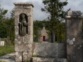
(11) At the sign reading “50 rappel”, turn left towards the municipal leisure centre and continue along Impasse de la Chapelle. Head towards the Chapel of Saint-Sébastien, preceded by a long avenue whose pillars bear statues of Saint-Fiacre with his spade and Saint Catherine with her wheel.

::12 Retrace your steps and continue to the left to reach the leisure centre. At the road, turn left

(1) Walk past the École Saint-Anne again and continue towards the church. In front of the town hall, look out for two Christianised Iron Age megaliths and turn right to return to the car park (S/E).

Waypoints

  1. S/E : mi 0 - alt. 174 ft - Church car park
  2. 1 : mi 0.37 - alt. 203 ft - Junction on the circular loop
  3. 2 : mi 1.09 - alt. 226 ft - On the right, a dirt track
  4. 3 : mi 1.57 - alt. 276 ft - At the road, turn left then right
  5. 4 : mi 2.08 - alt. 276 ft - On the left, at the Croix de Kercao
  6. 5 : mi 2.71 - alt. 341 ft - On the left, opposite the entrance to the manor’s woodland
  7. 6 : mi 3.48 - alt. 269 ft - On the right, the road to Goulven
  8. 7 : mi 3.93 - alt. 249 ft - Goulven Manor
  9. 8 : mi 4.15 - alt. 226 ft - Sign for GAEC de Kerprigent, path on the left
  10. 9 : mi 4.44 - alt. 177 ft - Road junction
  11. 10 : mi 4.95 - alt. 197 ft - At the stop sign, turn right
  12. 11 : mi 5.19 - alt. 217 ft - Turn left towards the municipal leisure centre
  13. 12 : mi 5.47 - alt. 207 ft - Saint-Sébastien Chapel
  14. S/E : mi 5.99 - alt. 174 ft - Church car park

Notes

Toilets near the car park.
The route can be completed in low-cut shoes and is also suitable for mountain bikes.
It mainly follows small roads.

On two sections of the route, you’ll come across numerous banners reading ‘No to fox farming’. These are unwarranted protests by a private individual who keeps free-range hens.

NB: at (3), if the grassy path is too difficult to navigate (in winter), continue along the road to (4).
From there, make a return trip to the Manoir de Kercao and continue along the route.

Worth a visit

Near the town hall, there are two Christianised menhirs dating from the Iron Age.

The Manoir de Kerscao can be visited in summer by arrangement with the Tourist Information Centre.
It is a 15th-century feudal manor house, featuring around thirty external and internal arrow slits. The building is constructed from various types of granite and harbours a fabulous treasure: a spiral staircase made entirely of cut stone, with a diameter of approximately 6 metres.
The Saint-Claude Chapel, adjoining the dovecote, has also been restored.

The Manoir de Goulven, built in the 16th century, now houses a rural lodge; it features a vomitorium, used in the Middle Ages following lavish feasts.
A lech (a Christianised stone) topped with a beautiful cross adorns the entrance garden.

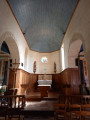
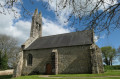
The originalSaint-Sébastien Chapel was erected in 1640 on the site of a wayside shrine. At that time, 53 victims of a plague epidemic were buried there. It was dedicated to Saint Sebastian, invoked against scourges of all kinds: disease, war, etc. At the entrance, before turning onto the tree-lined path, two pillars house, within their niches, the statues of Saint Fiacre, patron saint of gardeners, recognisable by his spade, and Saint Catherine, patron saint of young girls, with the wheel symbolising her martyrdom. The chapel was rebuilt in 1862.

The Fountain, on Rue de la Fontaine, adjoining the vicarage and the car park, near the Ty Izella rest area, is built from the remains of an old calvary. It is surmounted by a figure of Christ, also carved from kersantite – commonly known as kersanton after the name of the quarry from which it was extracted – and bears the date 1623.
The fountain was believed to possess sacred powers; a whole ritual was performed to heal sick children.

Reviews and comments

3.7 / 5
Based on 5 reviews

Reliability of the description
4 / 5
Ease of following the route
4.2 / 5
Route interest
3 / 5
FLOCH
FLOCH ★

Thank you for your feedback.
I have carefully re-read my description, which accurately reflects the markings I noted whilst out on the trail.
During my hike, I came across a few mountain bike trail markers, which I have indicated.
I have also made it very clear that this route runs partly along minor roads.
The route is not signposted as such.
If you could let me know which points caused you problems, that would help me try to improve the description.
It must be said, however, that this route allows you to discover some of the region’s heritage sites.

Kind regards

Machine-translated

stef29
stef29

Overall rating : 3 / 5

Date of your route : Jul 19, 2023
Reliability of the description : ★★★☆☆ Average
Ease of following the route : ★★★☆☆ Average
Route interest : ★★★☆☆ Average
Very busy route : No

The route description is vague (especially as there are no signposts). Too many sections on roads.

Machine-translated

A pied
A pied

Overall rating : 4.7 / 5

Date of your route : Aug 26, 2019
Reliability of the description : ★★★★★ Very good
Ease of following the route : ★★★★★ Very good
Route interest : ★★★★☆ Good

A pleasant route. Much of the route is suitable for people with reduced mobility.

Machine-translated

FLOCH
FLOCH ★

I’m sorry you were disappointed with this route.
I’ve added to the description that the route mainly follows small roads.

As for the comment that ‘there are very few historical sites or monuments to see’, perhaps we don’t see things in quite the same way. For me, ‘heritage’ is a very broad term that isn’t limited to just extraordinary monuments.
The photos attached to the walks are there to illustrate this.
Kind regards

Machine-translated

Trotti
Trotti

Overall rating : 4 / 5

Date of your route : Jun 27, 2019
Reliability of the description : ★★★★★ Very good
Ease of following the route : ★★★★★ Very good
Route interest : ★★☆☆☆ Disappointing

Most of the walk is along tarmac roads and, contrary to what is advertised, there are very few ruins or monuments to see, which is disappointing.

Machine-translated

FLOCH
FLOCH ★

Thank you for your comment.
You might not be able to visit the sites themselves, but exploring the surrounding area is always interesting.
What’s more, meeting a friendly owner means you can get all the information you need.

Kind regards

Machine-translated

danapied
danapied

Overall rating : 4.7 / 5

Date of your route : Oct 18, 2018
Reliability of the description : ★★★★★ Very good
Ease of following the route : ★★★★★ Very good
Route interest : ★★★★☆ Good

Hello. I found this route very interesting, despite the sections on main roads. We were given plenty of useful information by the friendly owner of the Goulven Manor. There were lots of points of interest along the way.

Thank you

Machine-translated

henri57
henri57 ★

Hello,

Thank you for your comment.

You noted:

Accuracy of the description: Disappointing

Did the description cause any problems? If so, how can we resolve this?

Kind regards

Machine-translated

cricri37
cricri37
• Edited:

Overall rating : 2.3 / 5

Date of your route : Sep 19, 2018
Reliability of the description : ★★☆☆☆ Disappointing
Ease of following the route : ★★★☆☆ Average
Route interest : ★★☆☆☆ Disappointing

Exploring the heritage of the Locmaria-Plouzané countryside.
We spend three-quarters of the time walking along the road with average visibility. The places of interest are closed to the public. I can’t see any point in this walk.
Cricri37

😢😢

Machine-translated

Other walks in the area

For more walks, use our search engine .

The GPS track and description are the property of this route's author. Please do not copy them without permission.