Country:
 City:
City:


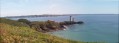
Start from the Pointe du Petit Minou car park.
Please note: this is the car park before the beach, not the one near the lighthouse
GR®®34signposting: White and Red.''
(S/E) From the car park, take the steps located at the gable end of a house on the right towards the coastal path (signposted ToulBroc’h). Climb a long flight of steps to reach a dirt track (view of Pointe du Minou with its fort and lighthouse).
''No signposting.''
(1) At the first fork, turn right, leaving theGR®® to continue straight down, and follow the path along the hillside. At the gate, continue along the small road (Route de la Corniche) and follow this road as it bends to the right
''Yellow markings.''
(2) Turn right and head towards the Toulbroc’h crossroads, ignoring the roads to the right and left
(3) Turn left onto this ascending path, pass the entrance to Kervaër Farm and look out for a grassy path on the left (yellow markings on an electricity pole on the right, but the path is no longer marked by these).
No markings.
(4) Take this path, which winds through the fields and leads to a small road in the village of Kerhoaloc’h. Turn right onto the small road.
(5) After the last houses, turn left onto a narrow grassy path, ignoring the Yellow Cross. Follow this shaded path until you reach a crossroads by a house (mountain bike signpost). Continue along the path on the left, ignoring a path on your right, until you reach a fork with a signpost marked ‘Yellow + MTB’.
Yellow markings.
Turn left, pass through a slightly damp area and reach a small stream on your right.
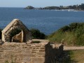
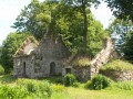
(6) Cross it without difficulty and begin an 800-metre round trip to the Lesconvel site, following a wide path made of red quartz. Arrive at Lesconvel, where you’ll find a small restored chapel, a cottage with its bread oven, a wash house, a pond used as a fish pond and a private manor house. Walk along the road to catch a glimpse of it, whilst keeping a low profile (information board).
(7) Turn back towards the stream.
(6) Continue to the right along this path, which leads to a road near a transformer and a school bus shelter. Cross the road and continue straight ahead along a small road that descends steadily towards the sea, despite the Red Cross, which relates only to the mountain bike signposting.
At the next junction, turn right (signposted Penjer–Milin Nevez) and continue downhill.
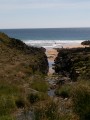
(8) At a sign indicating the bend and a house on the right, turn left onto an inconspicuous path (which is a little damp) that leads straight down to the coastal path at Grève de Déolen. Note the imposing buildings of the Maison de la Compagnie Françaises des Câbles on your right. In 1879, a telegraph cable was laid from this cove to the American coast, via Saint-Pierre and Miquelon. Cables are still visible on the beach towards the sea.
Signposting:GR®® 34 (white and red) +PR®®(yellow).
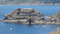
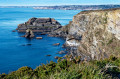
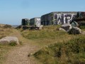
At the Déolen signpost, turn left towards the east and follow the coastal path. Descend to the bottom of Anse de Dalbosc, a favourite spot amongst surfers. Immediately afterwards, begin a steep climb up well-maintained wooden steps. You’ll soon come across the Toulbroc’h site (badger’s hole), a major German coastal battery dating from the Second World War, built to control the Goulet de Brest.
(2) Follow the signposts carefully as they take you through this battery, then cross the old fort, dating from 1884, via a footbridge. Turn left, then right, walking alongside the renovated former military barracks.
Take the Route de la Corniche, then turn right onto the coastal path which continues towards the Pointe du Petit Minou. This section includes several sections with steps.
(1) When you reach the fork where you started, retrace your steps along the route you took on the way out to return to the car park (S/E).






 Visorando Member

 Easy
Easy