Via the coastal path and the countryside around Trégana

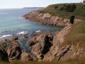
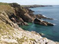
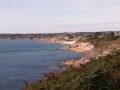
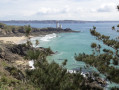
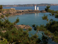
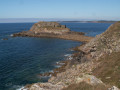
After skirting the quiet beaches of Porsmilin, Portez and Trégana, the coastal path climbs higher and overlooks the rocky coast, at times from a height of 60 metres, offering beautiful views over Bertheaume Bay and the headlands of Camaret on the Crozon Peninsula. The return journey along small roads and sunken lanes winds through the hinterland, passing close to two lighthouses that remained in service until 1970 after 100 years of operation.

Details

299603
Creation:
Last update:
Last review:
  • Walking
    Activity: Walking
  • ↔
    Distance: 5.25 mi
  • ◔
    Average duration: 2h 50 
  • ▲
    Difficulty: Moderate

  • ⚐
    Back to start: Yes
  • ↗
    Ascent: + 449 ft
  • ↘
    Descent: - 436 ft

  • ▲
    Highest point: 240 ft
  • ▼
    Lowest point: 23 ft

Photos

Description of the walk

Porsmilin Beach car park (toilets).

GR®34, marked in white and red

(S/E) Take the path heading eastwards uphill to Portez Beach.

(1) After the beach, turn right onto the path closest to the seafront, where stone benches and tables have been installed. This path veers slightly away fromthe GR® but rejoins it before Trégana Beach.
Walk along the beach and follow the road uphill, which is flanked by a cycle path. Here, as in other places, private property means you cannot follow the coastline in its entirety.

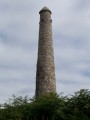
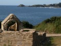
(2) Turn right into Impasse du Goulet and walk past some superb properties. Look out for a very tall sea mark on the left, situated on private land. Take the coastal path on the right and follow it south-east. The coast becomes rocky and rugged, towering over the sea by as much as 60 metres in places. There are stunning views of Anse de Bertheaume and, opposite, Camaret, the Pointe du Toulinguet and the Pointe de Pen Hir, famous for the Tas de Pois.

(3) Go down the steps, then turn left onto theGR® to pass close to an old ruined windmill and a customs officer’s house. TheGR® turns right twice to rejoin the coastal path. Turn left and continue north-east-east.

(4) At a crossroads of paths, take the one furthest to the right – a relatively narrow track – which descends to the bottom of Anse de Déolen. On the left, you can see the former building of the Compagnie Française des Câbles Téléphoniques, one of whose cables connected to Cape Cod on the American coast, 5,185 km away. Cross the small stream via a footbridge.

Off the marked trail

(5) Leave theGR® to continue towards Fort de Toulbroc’h, which can be seen on the hilltop, and take the small, inconspicuous path on the left, which climbs steeply up to a minor road.

Yellow markings

At the top of the climb, opposite house no. 915, turn left
Follow this small road as it descends into the valley and look out for a small fountain and a wash house on the right, both of which deserve a better fate. At the hamlet of Milin Nevez, turn left then right. The road continues to climb. Ignore the signposting heading left at the hamlet of Créac’h; it joins the coastal path.

No signposts

(6) Carry on to the right until you reach Kerabomés.

Yellow signposting

(7) Turn left towards Neïz Vran. Walk round this old manor house, currently undergoing restoration, which was once a small fortress surrounded by a walled enclosure with a watchtower at each corner. Continue along this sunken path and look out for a small fountain and a stone washhouse with two basins on your left, which too deserve a better fate.
The path widens as it passes through cultivated fields and becomes a gravel track near the houses.

No signposting

At the Stop sign, leave the signposted route heading down towards Trégana Beach, cross the road at the pedestrian crossing and continue straight ahead. Turn left into Rue de Coat Losquet.

(8) Turn right into Allée Coat Losquet and head towards a navigation mark on the right-hand side of the road. Turn left and walk past another navigation mark which still bears the rings that were used to attach ropes during maintenance work.

(9). Walk alongside the Portez municipal campsite and head for the esplanade in front of the beach.

GR®34, marked in white and red

(1) Follow the path back along the same route as on the way there to return to the Porsmilin Beach car park (S/E).


Waypoints

  1. S/E : mi 0 - alt. 30 ft - Porsmilin Beach car park
  2. 1 : mi 0.28 - alt. 30 ft - Junction on the circular loop
  3. 2 : mi 0.85 - alt. 121 ft - Impasse du Goulet on the right
  4. 3 : mi 1.62 - alt. 151 ft - Turn left towards the ruined mill
  5. 4 : mi 2.41 - alt. 82 ft - Path leading down to the right
  6. 5 : mi 2.59 - alt. 30 ft - Path leading uphill to the left
  7. 6 : mi 3.01 - alt. 164 ft - Turn right when you leave the yellow markings
  8. 7 : mi 3.31 - alt. 240 ft - Towards Nëiz Vran
  9. 8 : mi 4.24 - alt. 138 ft - Turn right into Allée Coat Losquet
  10. 9 : mi 4.53 - alt. 177 ft - Amer
  11. S/E : mi 5.25 - alt. 30 ft - Porsmilin Beach car park

Notes

Please note: From 1 July to 31 August, between 12 noon and 6 pm, the car park location is different.
It is situated about 300 metres back from the beach (a gentle descent at the start but a steep climb at the end of the walk).
Toilets near the starting beach.
Walking shoes are recommended for certain sections of the coastal path.

Worth a visit

Three lovely beaches for a swim, depending on the season.

Porsmilin: This beach is lovely for relaxing and swimming, and for exploring shellfish foraging with the children at low tide.

Portez: a venue for summer entertainment. The lifeguard station is none other than the Countess of Queleren’s bathing pavilion. She lived in the château, situated just above. It has now been converted into flats. Three countesses have succeeded one another.
Trégana, its beach and its three sea markers. It was one of the first holiday destinations for the people of Brest, discovered by the wider public thanks to the tramway that once linked Brest to Le Conquet.

Déolen, situated within the Conservatoire du Littoral, boasts a wild and natural beauty with its cliffs.
On this site, you’ll discover the ruins of the old Ru Vras windmill. A little further on, you’ll find a customs hut and the remains of an old farm that was still in operation in the 19th century, complete with its adjoining bread oven. To the delight of summer visitors, a former baker brings it back to life each summer, much to the delight of the taste buds.
Déolen still stands the Compagnie des Câbles building, which overlooks the cove. This was the starting point of a telegraph cable which, in 1879, linked Saint Pierre and Miquelon to Cape Cod in the USA; the second cable linked Déolen directly to Orléans near Cape Cod.

Always be cautious and plan ahead when you're outdoors. Visorando and the author of this route cannot be held responsible for any accidents occurring on this route.

The GR® and PR® markings are the intellectual property of the Fédération Française de Randonnée Pédestre.

Reviews and comments

3.7 / 5
Based on 5 reviews

Reliability of the description
3.6 / 5
Ease of following the route
3.4 / 5
Route interest
4.2 / 5
CARIO64
CARIO64

Overall rating : 4.3 / 5

Date of your route : Jan 20, 2020
Reliability of the description : ★★★★☆ Good
Ease of following the route : ★★★★☆ Good
Route interest : ★★★★★ Very good

stunning panoramic views

Machine-translated

yves.gerard;jacqueline

Overall rating : 4.7 / 5

Date of your route : Sep 30, 2019
Reliability of the description : ★★★★★ Very good
Ease of following the route : ★★★★★ Very good
Route interest : ★★★★☆ Good

a very interesting coastal path, a rather unremarkable country path, a lovely walk overall

Machine-translated

muse_88_
muse_88_

Overall rating : 3.7 / 5

Date of your route : Nov 05, 2017
Reliability of the description : ★★★★☆ Good
Ease of following the route : ★★★☆☆ Average
Route interest : ★★★★☆ Good

A lovely walk along the coastal route with superb views of Plougonvelin, the Penn Hir ‘pea-shaped’ rock formation and the Brest strait. It is a strategic location that gives a good understanding of the challenges faced during various wars and of how ships were able to navigate the harbour safely in those days. There are a few interesting historical features, such as the customs officers’ house, the old mill and the first telephone link to the rest of the world, which are well worth a look. Despite the occasional rain, it’s a place that quickly brightens up again. Well worth a repeat visit.

Machine-translated

FLOCH
FLOCH ★

Good evening,

As I am currently in the area, I have altered my route, which previously went via Anse de Dalbosc, and have therefore updated my description.
Unfortunately, the sentence referring to this cove remained in my description.
Apologies for this oversight.
I see you enjoyed the walk, and that’s what matters most.
Kind regards

Machine-translated

bibi
bibi ★

Thank you for your feedback; the author, FLOCH, should get back to you shortly.
Kind regards

Machine-translated

mauricemear
mauricemear

Overall rating : 3 / 5

Date of your route : Jun 27, 2017
Reliability of the description : ★★☆☆☆ Disappointing
Ease of following the route : ★★☆☆☆ Disappointing
Route interest : ★★★★★ Very good

The map and the description do not match. You mention Dalbosc Cove, yet the walk does not go there.

Machine-translated

FLOCH
FLOCH ★

Check carried out on 3 July.
There is indeed a barrier at the start of the path marked with a Red Cross. It indicates that mountain bikes are not permitted on the coastal path.

Machine-translated

FLOCH
FLOCH ★

Thank you for clarifying that.
Was there any information about this barrier? I walked this route without any problems in July 2016 and it follows the GR34 route as well as the Pointe Saint-Mathieu to Santiago de Compostela route.
It may be a diversion from the coastal path following the winter storms.
I’ll have the chance to visit the area next July and will update my description then.
Kind regards.

FLOCH

Machine-translated

KVGR
KVGR

When coming from Tregana and heading through the residential area, you used to be able to reach the coastal path by turning right after the car park. When I went there, there was a barrier blocking access to the GR34.

Machine-translated

FLOCH
FLOCH ★

Hello,
Could you please let me know which part of the route is no longer possible?
The return journey follows small roads and streets whilst still offering views of the sea.
Apart from a return trip along the coastal path, I can’t see any other way to make it circular.
Kind regards

Machine-translated

KVGR
KVGR

Overall rating : 3 / 5

Date of your route : May 07, 2017
Reliability of the description : ★★★☆☆ Average
Ease of following the route : ★★★☆☆ Average
Route interest : ★★★☆☆ Average

Part of the route is no longer accessible, and there’s too much road for my liking.

Machine-translated

Other walks in the area

For more walks, use our search engine .

The GPS track and description are the property of this route's author. Please do not copy them without permission.