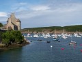
Route via the Notre-Dame-du-Val Chapel in Trébabu

From the pretty, flower-filled village of Trébabu, the route takes us to theGR®34, which runs alongside part of the vast Plage des Blancs Sablons. The return journey, via small country lanes and sunken paths, will take us past the old Kerléo Mill and the Notre-Dame-du-Val Chapel (Itron-Varia-an-Traon).

Details

322374
Creation:
Last update:
Last review:
  • Walking
    Activity: Walking
  • ↔
    Distance: 5.65 mi
  • ◔
    Average duration: 2h 55 
  • ▲
    Difficulty: Easy

  • ⚐
    Back to start: Yes
  • ↗
    Ascent: + 348 ft
  • ↘
    Descent: - 348 ft

  • ▲
    Highest point: 187 ft
  • ▼
    Lowest point: 16 ft
  • ⚐ Country: France
  • ⚐ City: Trébabu (29217)
  • ⚑
    Start/End: N 48.371385° / W 4.73603°
  • ❏
    IGN map(s): Ref. 0317OT, 0417ET
  • Hour-by-hour weather

Photos

Description of the walk

Starting point: Place de l’Église in Trébabu.
At the start or finish, take the time to visit the cemetery, where you’ll notice the coats of arms on the graves of several noble families.

Yellow markings, few and far between and very faint

(S/E) Leave this pretty little village, adorned with flowers, behind you and head back up the road you arrived on. On the right, you’ll notice a small, well-maintained wash house.

No markings

(1) After the sign marking the village exit, turn right at the stop sign and take a cycle path that runs alongside the D67 towards Le Conquet. Just before the end of this path, you can see a manor farm on the left, flanked by a tall, square defensive tower.

(2) At the end of the cycle path (cross on the left), turn right (signposted ‘Syndicat des Eaux de Kermorvan’) and follow the wide, tree-lined path. It ends with a flight of concrete steps before joining a road. Cross carefully and follow the road for 50 m.

Yellow markings, few and very faint

(3) Turn left into a car park, continue along the path through the Bois de Lanfeust and follow the edge of the Ria du Conquet.

(4) When the path approaches the ria, turn right at a house (no. 27), go through a gate and continue along this wide path through the maritime pine forest.
Walk past ‘Village de Kerber’, the premises of a holiday camp, then turn left to walk past a water tower.
At the next three-way junction, carry on straight ahead, then turn left at a ‘dead end’ sign. Be sure to take the first path that crosses a dune area.

(5) At the road leading to Pointe de Kermorvan, turn left, cross at the pedestrian crossing and, in the car park, follow the sign for ‘Départ route 13’. This west-facing path joins the coastal path at Blancs Sablons Beach. Beautiful view of the Kermorvan peninsula.

GR34: marked with red and white signs.

(6) Take theGR® which heads northwards and follow it until it leaves the coast to go round a private property.

(7) Cross a road and take the wide, carriageable track opposite, marked with yellow signpost no. 15.

Yellow markings

Follow this wide track, which passes near Kervillou (a farm contracting firm). The path becomes a small road that bends left then right.

(8) At a place called Gorem ar Prat (not shown on the IGN map), ignore the yellow markings heading left and carry on straight ahead.

No markings

Carry on straight ahead along the ascending road until you reach the D28, then cross it.

Yellow markings

Carry on straight ahead along the wide path that runs through the fields. When you reach a road, turn left then right (signposted ‘Toaré / Milin Toaré’ on the map) and begin a steep descent. As you approach the Kerléo Mill and the chapel, leave the yellow markings, which head off to the left.

No markings

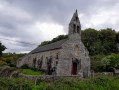
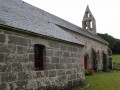
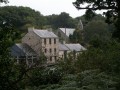
(9) Begin the climb which passes close to the old mill, now converted into a dwelling, and reach the 16th-century Notre-Dame-du-Val or Traon Chapel, a pleasant spot featuring a garden laid out by a team of volunteers. Continue uphill and, at the next three-way junction, turn right. Pass close to the dairy farm of Métairie, where you can see an old dovecote, and carry on, noting an old wayside cross with its altar of repose at the bend. Return to the village of Trébabu and its parish church, rebuilt in 1787 (S/E).


Waypoints

  1. S/E : mi 0 - alt. 79 ft - Car park at Trébabu Church
  2. 1 : mi 0.2 - alt. 135 ft - Cycle path on the right
  3. 2 : mi 0.74 - alt. 89 ft - End of the cycle path; take the path on the right
  4. 3 : mi 0.99 - alt. 23 ft - Crossing the car park
  5. 4 : mi 1.29 - alt. 16 ft - Path leading uphill to the right
  6. 5 : mi 2.01 - alt. 105 ft - Road leading to Kermorvan Point
  7. 6 : mi 2.39 - alt. 30 ft - GR34 junction
  8. 7 : mi 2.9 - alt. 98 ft - End of the GR, farm track opposite
  9. 8 : mi 3.81 - alt. 138 ft - Straight ahead
  10. 9 : mi 4.89 - alt. 72 ft - The climb up to the chapel is in sight
  11. S/E : mi 5.65 - alt. 79 ft - Car park at Trébabu Church

Notes

The section of theGR®34along the coastal path requires constant vigilance.
Walking boots are recommended for this section of the trail.

Worth a visit

Trébabu Church
For a guided tour, please contact the town hall

Notre-Dame-du-Val Chapel
The chapel is open every Wednesday afternoon from 3.00 pm to 6.00 pm
and may be open on other dates by request
(02 98 89 48 38).

Always be cautious and plan ahead when you're outdoors. Visorando and the author of this route cannot be held responsible for any accidents occurring on this route.

The GR® and PR® markings are the intellectual property of the Fédération Française de Randonnée Pédestre.

Reviews and comments

3.7 / 5
Based on 4 reviews

Reliability of the description
3.3 / 5
Ease of following the route
4 / 5
Route interest
3.8 / 5
Pierre isa
Pierre isa

Overall rating : 3 / 5

Date of your route : Aug 22, 2026
Reliability of the description : ★★★☆☆ Average
Ease of following the route : ★★☆☆☆ Disappointing
Route interest : ★★★★☆ Good
Very busy route : Yes

The signposting for the walk has been altered to follow a trail.
As a result, some arrows have been replaced by crosses.
At point 5, the starting point is no longer 13 but 18
All these changes meant we ended up walking an extra 2 km
A lovely walk all the same

Machine-translated

Les pommiers
Les pommiers

Overall rating : 3.3 / 5

Date of your route : Feb 06, 2022
Reliability of the description : ★★★☆☆ Average
Ease of following the route : ★★★★☆ Good
Route interest : ★★★☆☆ Average
Very busy route : No

We had some difficulty finding the route through the pine forest

Machine-translated

Pierre Quellec
Pierre Quellec

Overall rating : 4.3 / 5

Date of your route : May 23, 2021
Reliability of the description : ★★★★☆ Good
Ease of following the route : ★★★★★ Very good
Route interest : ★★★★☆ Good
Very busy route : No

A lovely land-and-sea route to enjoy with the family, offering wonderful sights with a stretch along the coast and beautiful trails inland, plus a lovely chapel to explore (Notre Dame du Val). Do take care when crossing the road at the Moulin d’En Bas – this is the most dangerous part of the route.

Machine-translated

gazok54
gazok54 ★

Thank you, Sylvain Michel
Could you tell us what issues you encountered with the description?

Machine-translated

Sylvain Michel
Sylvain Michel

Overall rating : 4 / 5

Date of your route : Nov 13, 2016
Reliability of the description : ★★★☆☆ Average
Ease of following the route : ★★★★★ Very good
Route interest : ★★★★☆ Good

A lovely family walk taking in the countryside, the sea and the river

Machine-translated

Other walks in the area

For more walks, use our search engine .

The GPS track and description are the property of this route's author. Please do not copy them without permission.