Country:
 City:
City:


Start from the car park on Rue de l’Église, opposite a warehouse with a sign reading “Chocolat Lanvin”.
(S/E) From the car park, look across the street to the slatted wall of the shed, where you’ll see a “Chocolat Lanvin” sign by François Curlet. Just to its right, on the ground, is the totem “La Sentinelle” by Jef Gays (2014).
Turn right into Rue de l’Église and, immediately, enter the courtyard of a house. Note the double-curved staircase and the date 1773 carved above the door. On the left, a building where, in the last window, stands a ‘Corps d’Osier’ car, created (2012) by Christian Ragot.
Turn left into the narrow passageway where a doorframe opens onto a grassy area. Opposite, you’ll see a wayside shrine with, in the alcove, a small statue of the Virgin Mary placed inside a bottle.
On the right is a sculpture (four superimposed lozenges) entitled “All the Young Dudes” (2012) by Neal Beggs and, further on, a cross on a plinth made of Roussard stone.
Leave the garden at the bottom and follow Rue de l’Église to the right.
On the right-hand side, three works follow one after the other:
- an enamelled plaque, “Sortir du romantisme et du fumier” (2011) by France Fiction,
- a double vertical window, edged in red, entitled “Archive Window” (1952–1954) by Le Corbusier and Prouvé; and a composition of nine coloured and/or translucent rectangles, described by Jean Prouvé as “Facade Panels”.
On the left-hand side of the street,
- the entrance gate to the Moulin de Blaireau, with two leaves each adorned with iron wheels, entitled “Le grand Piggly Wiggly” (2015) by Stéphane Wigny.
Leave Rue de l’Église and continue left along a footpath to the entrance of a wooded and grassy area opening up on the left (signpost for walking routes).
In this meadow, on the left, is a yellow and blue structure entitled “La Villa Motte” (2012) by Raphaël Galley. On the right are two structures, “Villa Parmentier” (2010–2015) by Florence Doléac and David Tscharner, and in line with the path are several wooden structures (seats and tables) known as “Autoprogettazione” (1975) by Enzo Marie.
Head towards the banks of the Bienne.
(1) Turn left before the small footbridge. Walk past the structure made of fishing rods, “Le Coin du pêcheur” (1990) by Daniel Nadaud.
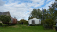
Cross the field to the fenced-off area behind the Moulin de Blaireau, where you’ll find a concrete table, “Unité d’habitation” (2012) by Neal Beggs, and a white structure, “La bulle à six coques” (1964–1968) by Benjamin Maneval, topped by a flag flying in the wind, “Proposition pour un nouveau drapeau européen” (2009) by Christophe Terlinden.
To its left is another “brown futuristic house” and, in the background, a “Black Habitat” fitted with two bunks (2020).
(2) Cross the river towards the mill courtyard, where you can discover ‘Parpaing’ (2011) by Lilian Bourgeat.
Note: during temporary exhibitions, the works are displayed in the lower rooms of the main mill building.
Return to the rear of the mill. Leave the black wooden enclosure and walk round the left-hand side of the copse to reach and follow the bank upstream along one of the branches of the Bienne.
(3) At the metal footbridge, below the stream branching off to the right, look out for a smiling face within a circle, entitled “Stoned happy face” (2011) by Jocelyn Villemont. Directly opposite, on the other bank, somewhat hidden in the grass, you can just make out an elongated structure and a concrete bench entitled “Obstacle” (2014) by Pierre Huyghe.
Head back and return to the footbridge over the Bienne.
(1) There, look carefully to the left into the foliage above the stream to discover, perched on a branch, a mischievous little caterpillar called “Suspens” (2009) by Hugues Reip.
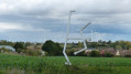
Continue along the uphill path. To the right, in the pasture, a giant yew tree, “Entre N. Hérisson et M. Duchamp” (2011) by Liliant Bourgeat, does not seem to disturb the cattle that are the usual inhabitants of these parts. Carry on along this path for 850 metres until you reach the top of the hill. Stéphane Vigny’s work “Un Poteau électrique” (2013), with its cells filled with coloured glass, stands majestically against a backdrop of wind turbines.
Continue for 330 metres until you reach the first wrought-iron installation, then another 560 metres further on. These two works, entitled “Complex Figures” (2020), are by Charlie Youle and Brevis Martin.
Continue downhill. Turn right into Rue Saint-Julien. At Cour Saint-Julien, enter the cemetery surrounding Saint-Julien Church. On your right, you’ll find a beautiful stone cross.
Walk round the church and exit by following the low boundary wall. Head right onto Chemin du Lavoir, which leads down towards the River Sarthe and the leisure area.
(4) At the wash house, on your right is a wooden structure housing a picnic table called “La Villa Parmentier” (2011–2016), a work by Florence Doléac and David de Tsharner.
Head back along this path until you reach the D338. At the junction, look out for a coachman’s plaque on the façade opposite.
Cross this road at the pedestrian crossing just past the bend and return to the junction.
(5) Turn left towards Place du Général Leclerc.
Just below this square stands the town hall, incorporated into the medieval residence known as ‘Du Gesclin’. Adjacent to its left is a complex of ruins, including a heptagonal Gallo-Roman building (currently undergoing restoration).
Head back to the square, walk past the General Leclerc monument and the Koufra Oath marker before turning right into Rue Du Gesclin.
After 350 m, at a place called Noira, turn left onto the path, which starts as a stony track but gradually becomes a deeper track. At the end of the path, turn left onto Route le Haut du Bourg. About 100 m further on, on the left, at the edge of a garden, you’ll see a hemp kiln.
Continue along this road for 420 m before turning right (blue/white signposting) onto the road (with a view of the wind farm on the right). Walk for 980 m before turning left onto a stony track (blue signposting) and crossing Les Aigremonts.
(6) Turn right, then after 270 m, turn left at the next junction (cross). Follow this road where, on the right, a beautiful lime tree is adorned with “pairs of eyes”. This artwork, entitled “Mini Brothers, Chloropool” (2016), is by Vidya Gastaldon.
At the next crossroads, turn right towards Chérancé (C3). Follow this road for 500 m before turning left onto a stony track which, at the fence, veers to the left and quickly becomes a pretty sunken path leading downwards, opening out onto a small road at a sandstone cross next to a “wooden bench”.
Turn right and follow this tarmac road for 240 m, then take the path branching off to the left and continue for 620 m. At the next Y-junction, turn sharply right to follow the path until it joins a small road, which you’ll follow to the left for 360 m.
At the crossroads (cross), turn left and follow the Route de l’Écotay (D 129). At the farmstead, note the wayside cross and continue along this road, which curves to the right before joining the D338.
(7) Walk alongside the D-road to the right before crossing it (caution: danger!) and turning onto the small road opposite.
Further on, directly opposite a majestic oak tree, you’ll find a microlight base. Continue along this road for 2 km.
(8) On the right-hand side of the road, at a place called Saint-Léger – situated on private land but open to the public during exhibitions – you’ll find a concrete structure entitled “Meurtrière” (2012), a work by Nicolas Milhé.
To reach it, enter the courtyard and head left towards the Chapelle Saint-Léger de Piacé. Once there, turn left and walk into the field where the sculpture lies below. Return to the road and walk a few metres to the right.
(9) Very close by, a quirky little figure entitled “Western” (2016), created by Jacques Le Keeq, overlooks the village, with the wind farm in the background. Continue downhill to the crossroads.
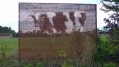
(10) On the right, at the edge of the field, is a perforated sign, predominantly brown in colour. Look for the right angle (which varies depending on the natural light) to make out a magnificent cow, aptly named “Vache”, a work by Kenji Harai.
Turn right towards the wayside cross. At the cross, on the other side of the road, at the corner of the field, a structure made of tubes called “Joli Turbin” is the work of Séverine Hubard.
Walk up Rue de l’Église.
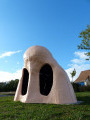
(11) At the village hall, turn left towards the car park. To your right, a path opens up leading onto a tarmac road. On the right-hand side of this street is a telephone box called “Rendez-vous” (2008–2017), a work by Anita Molinero. Continue uphill to the crossroads featuring the “Grotte de nez” (2018), a work by Jean Bonichon.
(12) Turn right onto Rue du Hameau de Saint-Léger. Continue along the footpath leading to the square bordering the D338. There, two giant barriers on Place “Vauban” (2011) are the work of Lilian Bourgeat. Walk down the D338.
(13) At the junction of the D338 and Rue de l’Église, on the left-hand façade of the town hall, in a small niche, is a Lego model entitled “Legoblaster” (2010) by Christophe Terlinden; above it is a coachman’s plaque.
Follow the D338 for 300 metres.
(14) Cross the road at the pedestrian crossing to reach Le Paradis, a hamlet downstream from the cemetery.
On the left-hand side of the road, take the small path leading downhill to discover, by the stream, a hut entitled “La cabane pour Jean Genet” (2009), a work by David M. Clarke.
Return to the road. A little higher up than the cemetery, in a field below the road, is a work in progress entitled “Portable Garden” (1994–2019) by Lois Weinberger.
Return to the D338 and follow it back up to No. 9.
(15) Note the mural (yellow, white and blue) on the gable of the house, symbolising “La route d’or” (The Golden Road), a work by Jean-Baptiste Sauvage.
Carry on until you reach Rue de l’Église on the left. On the façade of No. 4, there is a sign reading “Je suis fou du chocolat LANVIN”.
Head to the car park (S/E).

 Visorando Member
 Difficult
 Tourist office
 Easy
Easy