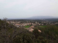
On the hills above Cadolive and Saint-Savournin

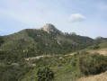
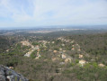
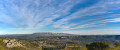
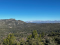
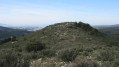
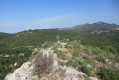
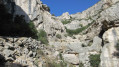
This hike, rich in points of interest, offers a striking contrast: a peacefulfirst section towards Cadolive and Saint-Savournin via the Chemin du Calvaire, the ruins of the feudal castle Le Castellas, and a visit to an unnamed cave. Then, after following the Mimet botanical trail, comes a more challenging and technical section along a lesser-known path leading to the Vallon de la Figuière, which you’ll then follow upstream before climbing Mont Julien and visiting the Grotte des Voleurs. There are some truly stunning views throughout the route.

Details

32461094
Creation:
Last update:
Last review:
  • Walking
    Activity: Walking
  • ↔
    Distance: 8.57 mi
  • ◔
    Average duration: 6h 10 
  • ▲
    Difficulty: Difficult

  • ⚐
    Back to start: Yes
  • ↗
    Ascent: + 2,539 ft
  • ↘
    Descent: - 2,523 ft

  • ▲
    Highest point: 2,313 ft
  • ▼
    Lowest point: 1,283 ft
  • ⚐ Country: France
  • ⚐ City: Peypin (13124)
  • ⚑
    Start/End: N 43.384921° / E 5.553033°
  • ❏
    IGN map(s): Ref. 3244ET
  • Hour-by-hour weather

Photos

Description of the walk

By car, park in the small car park next to the start of the DFCI track no. ET215, on the north side of the D908 between Pichauris and Le Terme.

(S/E) Go through the barrier and follow the track, which winds its way up towards the north before levelling out into a straight line heading north-east, with Mont Julien in sight. Pass by numerous fire watch posts before reaching a junction of tracks.

(1) Turn right, heading north. Go through a barrier and follow the signposted direction for Cadolive. Look out for two water sources on the left, one after the other, followed by an old, sealed-off well. The track then becomes a tarmac road and leads to Puits Germain.

(2) Turn left onto the Chemin du Calvaire. Cross a road and continue straight ahead. Look out for the numerous crosses along the route (see the ‘Practical Information’ section). Turn right at the Y-junction and arrive at the Saint-Savournin calvary.

(3) Turn left and you’ll soon reach the castle ruins (Le Castellas). The path becomes more rugged. Ignore the paths to the left and right.

(4) Turn left towards the south. Walk for about 300 metres and look out for a more open area on the right, between two scree slopes, with afirst cairn followed by asecond a few metres higher up, marking the start of a path that is not very easy to spot.

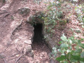
(5) Turn right and follow this track as it heads diagonally towards the cliffs. You’ll reach the unnamed cave.
Explore it (see the ‘Practical Information’ section), then head back the way you came.

(5) Turn left towards the north.

(4) Carry on straight ahead towards the north. The rugged path descends steeply, then levels out before climbing again as it runs along the heights of Saint-Savournin. You’ll reach a T-junction.

(6) Turn right and walk past a developed spring. Keep to the left at all times, staying as close as possible to the rocky outcrops, and look out for a DFCI track below. Turn right to join it and follow it to the left. Further up, pass by fire tank No. 637, continue along the track, then reach a barrier and a signpost at elevation 577.

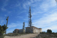
(7) Turn left towards Tête du Grand Puech on the Mimet botanical walking trail. At the summit, admire the 360° panorama. Join a DFCI track and turn left. Keep left at a Y-junction, pass the underground cistern no. 175 and descend to a hairpin bend.

(8) Keep to the left and follow the path which descends due south into the valley. Take care not to slip: some sections are steep with scree. You’ll reach the Vallon de la Figuière at elevation 397.

(9) Turn left to head back up the valley. Keep left at a T-junction, then cross a few rocky slabs without difficulty. Reach the summit at elevation 535, with a burnt-out fire station on the left.

(10) Turn right towards the south, heading for Mont Julien. At the summit, take in the 360° panorama, then follow the ridge along the cliffs. Look out for a gap when the path starts to descend.

(11) Turn left into the gap, negotiating a few rocks. Stay close to the rock face and discover a narrow but deep karstic cave. Further on, take a detour to the left to explore the Grotte des Voleurs.

(12) Explore the cave, then head back the way you came.

(11) Turn left towards the south onto the steeply descending path. Join a DFCI track.

(13) Head straight down to the left, heading north-east along the rugged path with Cadolive in sight. You’ll see the DFCI track junctions below.

(14) Turn right at the Fork in the road, then left onto the DFCI track, and cut across the bend to reach the junction you passed on the way out.

(1) Turn right and follow the track back to the starting point (S/E).

Waypoints

  1. S/E : mi 0 - alt. 1,283 ft - DFCI car park – ET215
  2. 1 : mi 0.82 - alt. 1,401 ft - Junction of the circular loop
  3. 2 : mi 2.07 - alt. 1,430 ft - Chemin du Calvaire
  4. 3 : mi 2.39 - alt. 1,699 ft - Calvary
  5. 4 : mi 2.48 - alt. 1,772 ft - Crossroads
  6. 5 : mi 2.63 - alt. 1,877 ft - Junction for the unnamed cave
  7. 6 : mi 3.15 - alt. 1,634 ft - T-junction
  8. 7 : mi 3.84 - alt. 1,896 ft - Crossroads
  9. 8 : mi 5.14 - alt. 2,149 ft - Path and steep descent
  10. 9 : mi 6 - alt. 1,286 ft - Vallon de la Figuière
  11. 10 : mi 6.7 - alt. 1,755 ft - Crossroads
  12. 11 : mi 7.2 - alt. 1,959 ft - Brèche
  13. 12 : mi 7.26 - alt. 1,909 ft - Grotte des Voleurs
  14. 13 : mi 7.47 - alt. 1,749 ft - Turn left at the fork
  15. 14 : mi 7.64 - alt. 1,522 ft - Fork in the road
  16. S/E : mi 8.58 - alt. 1,283 ft - DFCI car park – ET215

Notes

For reference: the author’s time for this route was 5 hours 30 minutes (excluding a lunch break).

The Way of the Cross is marked by 12 crosses representing the stations of Jesus carrying his heavy cross. As they are not maintained, some of these crosses are in poor condition or buried in the undergrowth (10 are easily visible).

Curiously, the unnamed cave is not marked on IGN maps, unlike the Grotte des Voleurs, for example. However, despite its narrow and deep entrance, the interior is vast and features beautiful rock formations. You’ll need a rope and a torch to descend into this cave.

Worth a visit

Detour to the Tête du Grand Puech.

Reviews and comments

4.5 / 5
Based on 2 reviews

Reliability of the description
4.5 / 5
Ease of following the route
4.5 / 5
Route interest
4.5 / 5
jeanpierrecahn@gmail.com

Overall rating : 4 / 5

Date of your route : Jan 06, 2025
Reliability of the description : ★★★★☆ Good
Ease of following the route : ★★★★☆ Good
Route interest : ★★★★☆ Good
Very busy route : No

A walk that’s a bit dull to start with, on tarmac, but which starts to get interesting once you reach the Way of the Cross!
The unnamed cave is of no interest as it’s hidden beneath the vegetation!
The panoramic views over the ridges and Mont Julien are superb!
The descent towards the Vallon de la Figuier is technical and requires a good level of fitness

Machine-translated

GMGALD
GMGALD

Overall rating : 5 / 5

Date of your route : May 07, 2023
Reliability of the description : ★★★★★ Very good
Ease of following the route : ★★★★★ Very good
Route interest : ★★★★★ Very good
Very busy route : No

A beautiful, very varied route; I was lucky there wasn’t too much wind along the rock face.
I enjoyed the Way of the Cross, then the unnamed cave – to get to it there’s a small path that goes uphill, but you do get there; I didn’t go down it.
There’s a lovely botanical trail – I learnt a few things.
The section along the ridge offered superb views; I followed the rock face without taking any risks, then descended to the left towards the Thieves’ Cave. There’s a slightly tricky section, nothing too serious; when you reach the cave, the rock face is black – the thieves must have lit fires there.
Some sections can be very slippery.
I completed this hike in 6 h 30 min, but in places – given the 45 km trail – I lost time; I saw plenty of people but no other hikers.
Well worth doing again.

Machine-translated

Other walks in the area

For more walks, use our search engine .

The GPS track and description are the property of this route's author. Please do not copy them without permission.