Country:

 City:


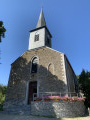
(S/E) From the church, walk down Rue Sainte-Anne and take the second right, then go round the fountain and turn left onto Rue Gurnifalize. Follow this road down to the woods.
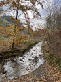
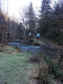
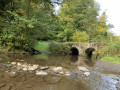
(1) Shortly after entering the woods, the path takes a left-hand bend: take the path leading down to the right of the track. This path forms a hairpin bend, crosses a first stream and then a second (small bridges), before joining a wider track: this is the route of the old local road (line 553).
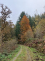
(2) Turn left at an acute angle and begin the climb, keeping to the opposite side of the track. After about 5 km, the track emerges from the woods, passes a farm and joins a small tarmac road (Rue du Bois d’Auge).
(3) Carry on straight ahead towards the village of Houdremont.
(4) When you reach the square (with trees and grass), turn sharply left onto Chemin de Merreau and follow it for about 400 m.
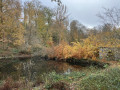
(5) At the junction, keep to the left. The path narrows and is lined with tall hedges. It soon runs alongside some ponds. Continue down the slope, following (at a distance) the Ruisseau du Fayai.
(6) As the path approaches the stream, do not cross it but take the steep path straight ahead to stay on the right bank of the stream. The path veers away slightly to allow you to cross a footbridge over a tributary. After this footbridge, return to the left onto the path running alongside the Ruisseau de Fayai (still on its right bank).
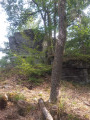
(7) At the fork in the road, near a rocky outcrop, keep to the right on the path; fifty metres further on, take a path on the right that forms a hairpin bend and head up the entire slope (ignore the forest track on the right).
(8) At the top, at the large junction in the middle of a clearing, take the forest track on the left. This descends and leads to a series of ponds.
(9) Take the path on the right to go round them and head back up towards the houses. Just before reaching the main road, turn left onto Rue Grande Voie.
(10) Walk down this street to the first junction (small chapel of the Virgin Mary), then turn right onto Rue Saint-Denis; continue towards the church by turning left, then take the second right (S/E).
 Visorando Member

 Difficult
 Easy