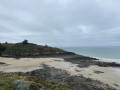
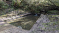
Pont Rolland Dam and Grandville Beach in Hillion

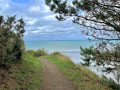
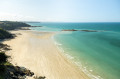
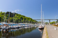
The walk starts at Bon Abri Beach and continues to the Pont Rolland dam. You’ll discover Hillion via theGR® trail and its little side routes.

This walk is not recommended from May to September! See practical information.

Details

19113993
Creation:
Last update:
Last review:
  • Walking
    Activity: Walking
  • ↔
    Distance: 4.72 mi
  • ◔
    Average duration: 2h 40 
  • ▲
    Difficulty: Easy

  • ⚐
    Back to start: Yes
  • ↗
    Ascent: + 545 ft
  • ↘
    Descent: - 525 ft

  • ▲
    Highest point: 207 ft
  • ▼
    Lowest point: 16 ft
  • ⚐ Country: France
  • ⚐ City: Hillion (22120)
  • ⚑
    Start/End: N 48.524716° / W 2.654556°
  • ❏
    IGN map(s): Ref. 0916ET, 0916OT
  • Hour-by-hour weather

Description of the walk

Parking is available between the riding centre and the beach.

(S/E) Head east via the dunes or along the beach, depending on the tide (choose your route).

(1) Continue along the dunes to the end to reach Grandville Beach. Head up to the right towards the car park.

(2) Turn left onto the Chemin des Douaniers towards Erquy.

(3) Keep to the left to stay as close to the coast as possible.

(4) Keep to the left and follow the Gouessant river to the Pont Rolland.

(5) Follow the road to the left for about 200 metres.

(6) Turn right down the road, then turn right again at the junction.

(5) Cross the road and head straight on along the outward route.

(4) Turn left, walk alongside the two ponds on your left, then take the hairpin bend to the right.

(3) Continue in the same direction.

(2) Stay on theGR®34and head for the car park (S/E).

Waypoints

  1. S/E : mi 0 - alt. 26 ft - Bon Abri beach car park
  2. 1 : mi 0.25 - alt. 26 ft - The route passes along the beach
  3. 2 : mi 0.74 - alt. 33 ft - Shared start and finish point
  4. 3 : mi 1.04 - alt. 105 ft - Junction with the circular dam loop
  5. 4 : mi 1.67 - alt. 26 ft - Shared start and finish point
  6. 5 : mi 2.05 - alt. 105 ft - The Rolland Bridge
  7. 6 : mi 2.17 - alt. 62 ft - Pont Rolland Dam - Gouessant (fleuve)
  8. S/E : mi 4.72 - alt. 26 ft - Bon Abri beach car park

Notes

From May to September, thousands of tonnes of green algae cover the beaches along the Breton coast. As they rot, they release a highly toxic gas, making the air difficult to breathe. Best avoided at this time of year.

The route is suitable for beginners and requires no special equipment.
Bring water, walking shoes and something to keep you warm, as it can be windy.

Always be cautious and plan ahead when you're outdoors. Visorando and the author of this route cannot be held responsible for any accidents occurring on this route.

The GR® and PR® markings are the intellectual property of the Fédération Française de Randonnée Pédestre.

Reviews and comments

4.6 / 5
Based on 3 reviews

Reliability of the description
4.7 / 5
Ease of following the route
4.7 / 5
Route interest
4.3 / 5
CaGo
CaGo

Overall rating : 5 / 5

Date of your route : Mar 04, 2026
Reliability of the description : ★★★★★ Very good
Ease of following the route : ★★★★★ Very good
Route interest : ★★★★★ Very good
Very busy route : Yes

A superb hike, as the scenery is truly magnificent!
One downside, however: it’s only a one-way route. We had to turn back to get back to the starting point.

Machine-translated

eugénie
eugénie

Overall rating : 3.7 / 5

Date of your route : Jul 25, 2022
Reliability of the description : ★★★★☆ Good
Ease of following the route : ★★★★☆ Good
Route interest : ★★★☆☆ Average
Very busy route : No

a route for keen walkers

Machine-translated

CACOIN
CACOIN

Overall rating : 5 / 5

Date of your route : Jun 05, 2022
Reliability of the description : ★★★★★ Very good
Ease of following the route : ★★★★★ Very good
Route interest : ★★★★★ Very good
Very busy route : No

A lovely route, well signposted. Quite a few climbs for such a short route, especially before you reach the dam.
On the way back, once you leave the GR, the path is difficult to follow due to the tall grass and stinging nettles…
I’d recommend it for a half-day HIKE.

Machine-translated

Other walks in the area

For more walks, use our search engine .

The GPS track and description are the property of this route's author. Please do not copy them without permission.