Country:
 City:
City:


Starting point and access: Marles-en-Brie station.
- Transilien – Line P, on the section between Paris-Est and Coulommiers.
Take the Place de la Gare exit, on the side of platform 1.
No signposting
(S) Walk past the station building, keeping it on your left and staying parallel to the railway line. Cross a small car park and, at the Stop sign, turn left onto the D436 (Avenue du Général de Gaulle). Continue straight on for approximately 600 m. At the junction, turn left onto the D143 towards Marles-en-Brie Centre. At thefirst ‘Stop’ sign, continue straight ahead.
Red and white + yellow signposting
(1) Atthe second Stop sign, go straight on again and immediately take thefirst left. At the Fork in the road that appears straight away, turn left onto Chemin du Moulin. After passing houses and gardens, walk through the fields. You’ll come back onto the tarmac road and walk past the cemetery on your left. At the corner of the wall, turn left (path not shown on the map). You’ll come out onto the D143E on the outskirts of Marles-en-Brie and follow it to the left for about 1 km. Cross a stream and then pass under a power line.
(2) Shortly after the power line and before a water tower, turn right onto a field path. Pass under the power line asecond time, then athird time after turning left with the path. Continue along the grassy path, heading north and ignoring all the side paths, and pass at the foot of a large, solitary tree. Walk alongside a copse on your right and, at the T-junction that appears shortly afterwards, turn left towards some houses. Continue straight on until you reach the railway line.
N.B. Between points (3) and (7), the purple route line intended to represent theGR®1on the IGN map is out of date.
(3) Cross the railway line at the designated crossing ( – be extremely careful, as there are no audible or visual signals; look carefully in both directions before crossing). Continue straight ahead along a grassy path between fences or walls on the left and a field on the right. At the end, carry on along the tarmac and immediately ignore a small lane on the left. At the next junction, turn left.
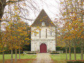
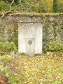
(4) At the Stop sign, turn right. Walk past the Jodelle memorial and then the Priory of Saint-Martin. When you reach Place du Maréchal Augereau, turn left. At the castle gates, turn right (information sign) and walk past the chancel of the church.
(5) At the junction, veer left to quickly reach the castle entrance. Retrace your steps.
(5) Walk alongside the church on your right and return to Place du Maréchal Augereau (note an old house on the right). Turn left at the foot of the town hall and take thefirst right, Rue du Général Leclerc. When the street bends to the right, turn left onto the Sente de la Fosse au Diable, a gravel path between two walls. At the end, cross a small lawn and turn left onto a tarmac path.
(6) Just before a row of posts, turn right onto a shaded path and walk alongside a fence on your left. At the end, follow the road to the right, ignoring the entrance to a car park on the right-hand side, and walk alongside the cemetery on your left. At the Stop sign, turn left and walk alongside the wall of a farmhouse on your right. At the corner, turn right. Facing a pond, turn left then cross a stream. Walk between horse pastures and, at a Fork in the road (not shown on the map), take the path on the right.
Red and white + mauve markings
(7) When you reach a level crossing, follow a small road to the left. Cross the D216 ( busy road) and continue straight ahead along a field track. After about 300 m, turn right then immediately left, and walk alongside a hedge on your left. Enter the forest and pass through a forest gate.
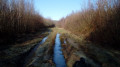
(8) At the fork in the road that appears immediately, turn left. Walk alongside a stream on your left and note several relatively tall old sandstone boundary markers. At a junction, turn right. Cross a stream and continue straight ahead.
(9) At the junction, veer to the right. Continue straight on, ignoring a few side paths, and cross several damp patches (which can easily be bypassed on either side if necessary). You’ll emerge onto a wide track at the boundary between forest plots nos. 1 and 2; follow it to the left for about 200 m.
N.B. Between points (10) and (12), the purple route line intended to represent theGR®1on the IGN map is out of date.
Purple signposting
(10) At the junction where plots nos. 2, 3, 29 and 30 meet, take the path on the right. Carry on straight ahead, passing through some damp sections, and cross a stream. At a junction, continue straight ahead. At the next junction, turn left and walk alongside a recently thinned plot on your right. Cross two streams and navigate a few more damp sections. At the end, follow a wide path to the right. Pass through a forest gate and emerge at the side of the D231.
(11) Cross the road ( – heavy and fast-moving traffic) and continue along the path opposite (sign for the Crécy State Forest). Walk alongside a fence on your right and ignore the vague paths branching off to the left. At the corner of the fence, veer left into an area of perchis. At the three-way junction that appears shortly afterwards, turn right. After just under a hundred metres, turn left. Follow a wide grassy path, still through the perchis, and at the end, go through a forest gate.
Red and white + mauve markings
(12) Then follow a path to the right, stabilised with stones, between two plots of perchis. Carry straight on, descending gently, and ignore all side paths (private property, numerous warning signs). Leave the forest and you’ll immediately come to a crossroads.
Red and White + Mauve + Yellow markings
(13) Continue straight on, passing a farm shed on your right. You’ll come out onto a small road; follow it to the right. Turn right with the road, then left, and pass under the railway viaduct. Note a large square tower on your left (a former lime kiln).
(14) Shortly afterwards, leave the road to the right, pass through a forest gate (chicane) and head onto a path through the woodland. After crossing a stream, the path widens. At a junction, continue straight ahead, keeping a large meadow on your left at a distance. The path narrows again into a narrow track. Pass a second forest gate (chicane). Continue below the station car park on your right. At the end, turn right twice to reach Mortcerf station (E).
To get back home:
- Transilien – Line P, towards Paris-Est or Coulommiers (check the display screens to find out which platform to use).

 Visorando Member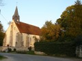
 Easy
Easy 
 Difficult