From the Mont Jarron plain to the Verdillon

This walk, in the immediate vicinity of Melle, takes you past the Saint-Martin-lès-Melle wind farm near the Mont Jarron plain, the wash houses at Font Maye and Saint-Romans-lès-Melle, and along part of the private grounds of the Château de Gagemont.
Please note: the route has been altered towards the end of the walk (see the ‘Practical Information’ section)

Details

n°747983
Creation:
Last update:
Last review:
  • Walking
    Activity: Walking
  • ↔
    Distance: 6.59 mi
  • ◔
    Average duration: 3h 15 
  • ▲
    Difficulty: Moderate

  • ⚐
    Back to start: Yes
  • ↗
    Ascent: + 253 ft
  • ↘
    Descent: - 240 ft

  • ▲
    Highest point: 430 ft
  • ▼
    Lowest point: 269 ft

Photos

Description of the walk

The car park is located at the Saint-Martin-lès-Melle village hall (next to the Town Hall and the sports ground).

(S/E) Leave the car park by turning left onto the Route de Saint-Romans-lès-Melle. Head out of Saint-Martin-lès-Melle. Take the first farm track on the right (about three hundred metres from the village exit and before the top of the slight incline on the road). A little further on, the track takes a right-angled bend to the left.

Further on, the track joins a road: turn right and follow this road to the next junction. Go straight across the junction and continue straight on. The road climbs slightly before descending slightly. After a gentle bend to the right, you will see the hamlet of Le Maillet on your right.

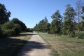
(1) Shortly afterwards, turn left onto the first farm track (do not continue all the way to the road from Melle to Niort). This farm track runs across the Mont Jarron plain (climbing slightly before descending again) and, further on, passes close to the first wind turbine in the Saint-Martin-lès-Melle wind farm (at the top).

At the next crossroads, take the farm track on the left. The track winds slightly.
Pass a farm track on your left which leads to a second wind turbine. Continue straight on.
Further on, the forest track joins a road; turn left and, about a hundred metres further on, you’ll come to a ‘Y’-shaped junction (the road you’re on is one of the two branches of the ‘Y’).

(2) At the junction, a farm track begins opposite, lined with a few trees. Take this track. Further on, at a crossroads, continue straight ahead. A little further on, the farm track passes under a high-voltage power line and shortly afterwards reaches a road. At this track-road junction, turn right onto the road. At the next crossroads, first turn left then right to join Rue de Pompérain, almost directly opposite.

(3) At the houses in the hamlet of Pompérain, turn left onto a road that runs past a beautiful property before becoming a fairly shaded farm track. The track passes through a small wood.
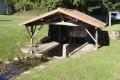
When the track emerges into a clearing, turn left to visit the Font Maye washhouse and fountain. Just before the washhouse is a picnic table made of cut stone.

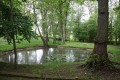
(4) Return to the farm track leading out of the small wood and turn left onto the Font Maye track, which forms a wide circular track. A little further on, on the right, you can see a stone fountain at the edge of a grassy plot, with steps leading down to the small fountain.

Further on, the Chemin de Font Maye joins the Route de Saint-Martin-lès-Melle in Saint-Romans-lès-Melle: the 12th-century church of Saint-Romans-lès-Melle is opposite. Cross the road and take the Chemin des Lavandières opposite, which passes by the washhouse and fountain of Saint-Romans-lès-Melle. Continue along the Chemin des Lavandières, which winds round a large grassy square.

(5) Just before the Chemin des Lavandières joins the road from Saint-Martin-lès-Melle to Saint-Romans-lès-Melle, to the north of the solitary house that seems to cling to the hillside, take the path leading uphill behind this house: this is the Venelle aux Rats. This alley soon opens out onto Rue de la Garenne, which you follow by turning right.

(6) At the next junction, turn right onto the Rue du Merlet, which slopes downwards, and follow it. The Rue du Merlet eventually joins the Rue des Hirondelles in the Pontreau neighbourhood. Turn right onto this street.

(7) Immediately, turn left onto Rue du Moulin, which is quite narrow and flat at the start. A little further on, take Chemin de la Fontaine on the left and admire the small stone fountain on the ground on the right-hand side of the path (right at the start). The path climbs. Take the first path on the right, which runs on level ground between gardens and then behind a house before joining a road. Turn left onto the uphill road to rejoin Rue des Hirondelles. When you reach this street, turn right and continue along it until you reach Rue de Bel Air.

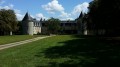
(8) At this junction, carry on straight ahead. At the next junction with Route de Trappes, continue straight ahead onto the road, which continues to climb slightly before descending to cross the Argentière stream. The road climbs again, bending first to the left and then to the right to go round the private grounds of Château de Gagemont and its outbuildings. Continue to the junction with the Chemin du Prieuré on the left. When you reach it, look to your right at the magnificent gate of Gagemont Castle, which has just been completely renovated following a car accident that had severely damaged it. Opposite the gate stands the castle chapel.

(9) Turn left and follow the Chemin du Prieuré with care. Walk past the cemetery on your right and, taking the new footpath, continue to the junction with the D101 road, Rue de la Mairie. At the junction stands a beautiful property called Le Prieuré (also known as Génélerie).
Turn left after crossing the D101 road so that you can walk safely on the pavement towards the Town Hall of Saint Martin-les-Melle. On your left, you’ll reach the car park for the village hall, which marks the end of this walk (S/E).

Waypoints

  1. S/E : mi 0 - alt. 351 ft - Car park at the Salle des Fêtes in Saint-Martin-lès-M.
  2. 1 : mi 1.18 - alt. 413 ft - Road junction – farm track
  3. 2 : mi 2.58 - alt. 374 ft - Y-junction
  4. 3 : mi 3.62 - alt. 322 ft - Road–path junction at Pompérain
  5. 4 : mi 3.86 - alt. 279 ft - Font Maye wash house
  6. 5 : mi 4.32 - alt. 282 ft - Junction of the Chemin des Lavandières and the path
  7. 6 : mi 4.46 - alt. 322 ft - Junction of Rue de la Garenne and Rue du Merlet
  8. 7 : mi 4.64 - alt. 269 ft - Junction: Rue des Hirondelles – Rue du Moulin. Nearby - Béronne (rivière)
  9. 8 : mi 5.3 - alt. 328 ft - Junction of road and farm tracks
  10. 9 : mi 5.89 - alt. 358 ft - Junction of Route de Saint Romans and Chemin du Prieuré
  11. S/E : mi 6.59 - alt. 351 ft - Car park at the Salle des Fêtes in Saint-Martin-lès-M.

Notes

This walk, which takes in varied terrain, requires suitable footwear.

A longer walk (approximately 13 km) will soon be published online (“From the Argentière wash houses to the Béronne”) _ Editor’s note: August 2017_

Along the route, you may come across yellow (PR®) or white and red (GR®) signposts, but the suggested route does not follow them for its entire length.

Route change effective from 28/07/2020: at the request of the new owner of the Priory of Saint Martin les Melle, the end of this route has been altered as the owner does not wish hikers to pass through the grounds as was previously the case. Please respect this instruction and follow the Chemin du Prieuré (road) to complete this route.

Worth a visit

Saint Martin-les-Melle
The Priory of Saint-Martin (private property): founded in the Middle Ages, the estate currently comprises a manor house built around 1830, which replaced the priory’s living quarters. Following the partial demolition of the church, a second home, outbuildings and a greenhouse were built. Within the priory grounds, you can also see a washhouse dating from 1880 and a dovecote which may date back to the 17th century.
The fully enclosed priory has an English-style garden.

The washhouses: The parish has several old washhouses in Chaillé, Rabalot and another next to the school. The latter was renovated in July 2003 as part of ‘international work camps’, thanks to the help of young volunteers from all over the world. Assisted by a local council employee, they worked on restoring the wash house situated on the edge of the Route de Negressauve. During those three weeks, the young volunteers lived in tune with the rhythm of the village, as every resident was free to join in with the group as they wished: paying a visit, sharing a meal, and so on. It was an opportunity for everyone to experience other cultures, whilst respecting the heritage of Saint-Martin-lès-Melle.

Chaillé Castle: was built between 1603 and 1604 on the ruins of an ancient medieval castle. The outbuildings certainly predate the construction of the château and were restored in 1650 and 1658. The south façade of the château is notable for its two superimposed arcaded galleries, situated on the side facing the terraces and the other two courtyards. This architectural feature may be due to Italian influence.
Having served as a grain store and a prison during the French Revolution, the château is now a care home.

The Argentière Valley: quiet and peaceful, it is a place that epitomises the commune of Saint-Martin-lès-Melle. In recent years, a great deal of work has been carried out to make the valley safer, improve its facilities and plant flowers there.
The Argentière is a small tributary of the Béronne valleys that run through Saint-Martin. The stream rises near Chaillé, a place closely linked to the history of the commune. Also worth noting is the magnificent plane tree at the stream’s source; two hundred years old, it is an imposing sight, standing 40 metres tall with a circumference of 5 metres.

Saint-Romans-lès-Melle
The 12th-century Romanesque church,
The church, first mentioned at the beginning of the 12th century and under the jurisdiction of Saint-Cyprien Abbey in Poitiers, was probably rebuilt during the 12th century, as indicated by two inscriptions on the façade.
Saint-Romans-lès-Melle was the seat of a barony. The buttresses of the façade still bear coats of arms belonging to Jean de Poix, Lord of Saint-Romans (1559), and his daughter Jeanne.
The church was listed as a Historic Monument in 1977.
The Church
A church was inaugurated in 1846 and served the Protestant communities of Brioux, Périgné, Mazières-sur-Béronne and Paizay-le-Tort.
The Manor House(private property)
Built in the 15th century, the manor house at Saint-Romans has undergone various alterations over the years. One of its towers was demolished, but the other, on the garden side, has been preserved. It is topped with battlements, some of which have been rebuilt. The coat of arms of the de Poix family, which once surmounted the door of the demolished tower, was reused when an additional wing was added to the manor house. Of particular note is a monumental fireplace bearing the arms of the same family.
The washhouse at the Font Maye fountain
The washhouse situated near the church.
Situated a few metres from the Romanesque church, this washhouse is built over the stream. The basin (unfortunately cemented over) is covered by a canopy.
The whole structure is surrounded by a low wall providing protection from the wind and running water.

Always be cautious and plan ahead when you're outdoors. Visorando and the author of this route cannot be held responsible for any accidents occurring on this route.

The GR® and PR® markings are the intellectual property of the Fédération Française de Randonnée Pédestre.

Reviews and comments

4.7 / 5
Based on 1 review

Reliability of the description
5 / 5
Ease of following the route
5 / 5
Route interest
4 / 5
GILMIC79
GILMIC79

Overall rating : 4.7 / 5

Date of your route : Dec 03, 2023
Reliability of the description : ★★★★★ Very good
Ease of following the route : ★★★★★ Very good
Route interest : ★★★★☆ Good
Very busy route : No

A lovely, flat and well-maintained route, perfect for the wet season and a gentle walk. As part of it runs very close to the Niort–Melle three-lane road, it’s best to save this walk for Sundays and public holidays.

Machine-translated

Other walks in the area

For more walks, use our search engine .

The GPS track and description are the property of this route's author. Please do not copy them without permission.