From Hôpital-Saint-Blaise to Mauléon-Licharre

A lovely stage through Soule (Xiberoa) to its capital, Mauléon-Licharre (Maule-Lextarre).

Details

1671897
Creation:
Last update:
Last review:
  • Walking
    Activity: Walking
  • ↔
    Distance: 10.39 mi
  • ◔
    Average duration: 6h 30 
  • ▲
    Difficulty: Moderate

  • ⚐
    Back to start: No
  • ↗
    Ascent: + 1,952 ft
  • ↘
    Descent: - 2,011 ft

  • ▲
    Highest point: 1,434 ft
  • ▼
    Lowest point: 456 ft

Description of the walk

Red and white markings onthe GR®78

(S) From the municipal refuge at Hôpital-Saint-Blaise, return to the village centre, cross the D25 and head back to the church. In front of Saint-Blaise Church, turn right, then straight on to leave the village. Turn left and cross the Lousset. At the last houses, the road becomes a track; after 20m, take a path on the left and head uphill. Continue straight on until you reach a road. Turn left onto it for a few metres until you reach the junction with the D859, where there is a cross.

(1) Turn right, go downhill to the Latxerreka stream and then uphill to the crossroads in the hamlet of Merkhapidea.

(2) Continue to the right, passing the hamlet of Merkhapidea. At the hamlet of Zintoa, the road becomes a path. Follow the path and climb to the highest point. Ignore a path on the right. Head back down, ignoring two paths on the left.

(3) Pass the Gagneko Hegui farm. Climb up along the edge of the woods. Ignore a path on the right. Reach the Xaharrenborda ruins.

(4) Walk past it, stopping if possible at the spring on the right. Continue climbing gently until you reach Garaxea. The path becomes a track. Head back down to the crossroads at Capdepont.

(5) Turn right past the houses and immediately head up the path into the forest.

(6) Cross a stream at a right-hand hairpin bend and, at the next left-hand hairpin bend (the highest point), take the path straight ahead and head back down as you leave the forest. You’ll reach a path junction.

Leave theGR® here

(7) Take the path on the right. Descend via a series of hairpin bends to reach the hamlet of Aihendoia.

(8) The path becomes a track. Pass the Etxegoihenea farm; at the Y-junction, turn left and head towards the Ühartea farm.

(9) The track becomes a path again. Head downhill, cross a stream and immediately take the path on the right. You’ll reach the junction with the D24.

(10) Turn left onto it for a few metres where it runs alongside theGR®; leave it very quickly by turning right. Cross a stream and pass the hamlet of Süstülarrea. At the next bend, take the shortcut along the path; pass the hamlet of Capou.

(11) At the junction with a path, take the path on the right. At the T-junction of paths, turn right, cross the stream and join theGR® on a track, continuing straight ahead.

Red and white markings ofthe GR®78

(12) At the crossroads, turn left and continue straight down the edge of the forest, ignoring the various paths and tracks branching off to the right and left. Arrive at Mauléon-Licharre.

(13) Cross the Saison and enter the town via the road on the right at the roundabout, passing in front of the church. Head to the lodge on Rue Des Frères Barenne (S/E) .

Waypoints

  1. S : mi 0 - alt. 522 ft - L’Hôpital-Saint-Blaise municipal refuge
  2. 1 : mi 0.55 - alt. 679 ft - Junction D859
  3. 2 : mi 1.14 - alt. 801 ft - Crossroads in the hamlet of Merkhapidea
  4. 3 : mi 2.16 - alt. 784 ft - Gagneko Hegui Farm
  5. 4 : mi 2.65 - alt. 997 ft - Xaharrenborda Ruins
  6. 5 : mi 3.42 - alt. 997 ft - Capdepont
  7. 6 : mi 3.9 - alt. 1,260 ft - Ruisseau
  8. 7 : mi 4.51 - alt. 1,358 ft - Crossroads at the end of the GR route
  9. 8 : mi 4.94 - alt. 945 ft - The hamlet of Aihendoia
  10. 9 : mi 5.54 - alt. 768 ft - Ühartea Farm
  11. 10 : mi 5.95 - alt. 604 ft - D24 - Lauset (rivière) - Affluent du Gave d'Oloron
  12. 11 : mi 6.87 - alt. 889 ft - Path junction after Capou
  13. 12 : mi 7.51 - alt. 719 ft - Crossroads where the GR trail rejoins
  14. 13 : mi 10.15 - alt. 456 ft - Passage of the - Saison (rivière) - Afluent du Gave d'Oloron
  15. E : mi 10.39 - alt. 463 ft - Lodge Rue Des Frères Barenne

Notes

Where to stay:

(E) Mauléon-Licharre: Tourist Office. Tel. 05 59 28 02 37
- Municipal lodge: Pilgrims’ reception (Association des Amis du Chemin de St-Jacques P.A.) Rue des Frères Barenne. Open from 1 April to 30 October. €8 / 8 beds. Collect keys from the Town Hall until 6.00 pm (on the right just after the bridge). After 6.00 pm, collect the keys from the Eskualduna bar (opposite the Town Hall).
- At Mrs Michèle Ellisalt’s: 8 Lotissement Gorre. Tel 05 59 19 10 98 or 06 80 52 62 33. 4 people.

Hotels, restaurants and all shops.

Worth a visit

(S) Saint-Blaise Hospital. Saint Blaise Church.

(E) Mauléon-Licharre
The fortified castle. Capital of the Basque espadrille.
Also worth seeing: in winter, the Mascarades, inspired by medieval carnivals, and in summer, the Pastorales, equally medieval open-air theatre performances, all in Basque, of course.

Always be cautious and plan ahead when you're outdoors. Visorando and the author of this route cannot be held responsible for any accidents occurring on this route.

The GR® and PR® markings are the intellectual property of the Fédération Française de Randonnée Pédestre.

Reviews and comments

4.6 / 5
Based on 4 reviews

Reliability of the description
4.8 / 5
Ease of following the route
4.5 / 5
Route interest
4.5 / 5
dpi64
dpi64

Overall rating : 4.3 / 5

Date of your route : May 27, 2024
Reliability of the description : ★★★★★ Very good
Ease of following the route : ★★★★☆ Good
Route interest : ★★★★☆ Good
Very busy route : No

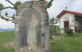
Don’t miss a visit to the Romanesque church of Hôpital-Saint-Blaise at the start of the route.
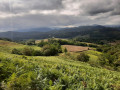
The first part of the route is very varied, with woodland and pleasant paths, and very little tarmac. There are fairly steep and sometimes long ascents and descents. There are a few muddy sections, which can be tricky in wet weather. In fine weather, there are lovely views of the Pic d’Anie and the Pyrenees mountain range.
Once you reach the D24 about halfway along the route, the route is entirely on roads, but mostly on minor roads with very little traffic. This second section from Hoquy to Mauléon is less interesting; the descent to Mauléon is quite steep and the final few kilometres can seem long, but there are beautiful views and you arrive in the old town, which is well worth exploring.

Machine-translated

marcrizzi
marcrizzi

Overall rating : 4.7 / 5

Date of your route : Jul 16, 2022
Reliability of the description : ★★★★★ Very good
Ease of following the route : ★★★★★ Very good
Route interest : ★★★★☆ Good
Very busy route : No

A lovely walk, with plenty of shaded sections, though quite strenuous due to the steep gradients. The sunny sections can be a bit of a struggle in hot weather.

Machine-translated

capitaine nemo
capitaine nemo

Overall rating : 4.3 / 5

Date of your route : Sep 29, 2021
Reliability of the description : ★★★★☆ Good
Ease of following the route : ★★★★☆ Good
Route interest : ★★★★★ Very good
Very busy route : No

A very beautiful and varied walk. The only issue is that, before reaching Mauleon, the path after the Uhartea farm is impassable in wet weather, and after the stream it simply disappears, leaving you to make your way through ferns and gorse. In my opinion, it’s best to take the GR 78 route via the higher path; otherwise, it’s a truly beautiful walk through Soule.

Machine-translated

xiberotarra
xiberotarra

Overall rating : 5 / 5

Date of your route : Apr 23, 2021
Reliability of the description : ★★★★★ Very good
Ease of following the route : ★★★★★ Very good
Route interest : ★★★★★ Very good
Very busy route : No

To get a clear idea of the advantages of taking this route rather than the classic St James’ Way (GR78), I’ve done both. And my conclusion is simple: the route suggested here is a thousand times better because it avoids miles of tarmac. In fact, it takes the best of the GR, from the Hôpital St Blaise to the highest point (413 m). After that, the descent via Aihendoia, Etxegohenia and Uhartea is no problem at all. The link between Uhartea and the D24 takes a bit of finding, and the climb via Xüstularrea and the Capou farm leads to the other ‘wild’ aspect of this hike: a little-known and clearly rarely used path that emerges above Mükürrea and joins the GR all the way to Mauléon.
A trip off the beaten track, in ideal weather and (too?) dry conditions which at least eliminated any trace of mud.
Thanks to Netra for this route.

Machine-translated

Other walks in the area

For more walks, use our search engine .

The GPS track and description are the property of this route's author. Please do not copy them without permission.