From Kinlochleven to Fort William

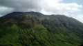
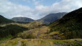
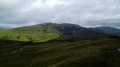
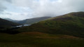
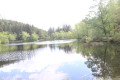
The seventh and final stage of the WHW takes us through stunning scenery at the foot of the Mamore range. We then pass through fairly open woodland, offering superb views of Ben Nevis, Britain’s highest peak. Our arrival in the town of Fort William marks the end of this multi-stage walk.

This walk is part of a multi-day hike: The West Highland Way

Details

2445297
Creation:
Last update:
Last review:
  • Walking
    Activity: Walking
  • ↔
    Distance: 15.03 mi
  • ◔
    Average duration: 8h 25 
  • ▲
    Difficulty: Difficult

  • ⚐
    Back to start: No
  • ↗
    Ascent: + 1,706 ft
  • ↘
    Descent: - 1,722 ft

  • ▲
    Highest point: 1,093 ft
  • ▼
    Lowest point: 13 ft

Photos

Description of the walk

Start from Lochaber Road, on the right bank of the River Leven.

Official WHW signposting: signposts featuring a thistle flower + signposts with a yellow arrow for changes of direction + directional signposts.

(S) Follow Lochaber Road north-north-west, preferably on the left-hand pavement (the right-hand one is patchy). Cross a river.

(1) Leave the road and take a path branching off to the right towards Fort William. Head uphill through the woodland. At a Fork in the road, take the left-hand path.

(2) Cross a small road and continue along the path opposite, still climbing. Ignore a path coming from the left and veer to the right. Navigate several hairpin bends.

(3) Cross a footbridge over a torrent. You’ll reach open ground and continue climbing.

(4) You’ll come out onto a track and follow it to the left: this is a former military road, which you should follow for about ten kilometres. Start by descending gently.

(5) Climb gently between peaks reaching around 750m on the left and 950m on the right.

(6) Pass an unnamed pass and begin the descent. Pass the ruins of an old fort and continue downhill.

(7) Pass through a gate and continue along the path heading north-west.

(8) Go round a cattle paddock on the left. Continue along the path through a wooded area that has recently been heavily thinned.

(9) Cross a track and, at the information sign with a map, turn right onto a path that leads uphill. Climb a small hill and you will reach a junction (not shown on the map).

(10) Continue straight on through the ferns and then along the hillside. Climb a small hill and descend slightly into a thinned-out woodland.

(11) Cross a footbridge and continue north-east, alternating between short ascents and descents. Note the view of Ben Nevis (Britain’s highest peak) opposite.

(12) Cross another footbridge and continue north-east.

(13) Pass a signpost and begin an ascent.

(14) You’ll come out onto a wide track; follow it to the right and climb a little further.

(15) At the junction, carry on straight ahead and downhill towards Braveheart Car Park.

(16) You’ll come to another track; follow it to the left.

(17) At the junction, carry on straight ahead towards Braveheart Car Park (temporarily leave the WHW, which branches off to the right; this ‘detour’ will save you a good kilometre on tarmac).

(18) At a fork in the road, turn right and cross the car park to come out onto a road.

(19) Follow the road to the left, using the kerb on the left-hand side (there is no kerb on the right-hand side). After about 1.25 km, you’ll reach the roundabout which marks the original finish point of the WHW.

(20) Go round the roundabout on the left and continue straight ahead towards the town centre.

(21) After about 1 km and just before a roundabout, turn right. Walk along the main road on your left-hand side and turn right to reach the entrance to Fort William railway station (E).

Waypoints

  1. S : mi 0 - alt. 36 ft - Kinlochleven – Lochaber Road
  2. 1 : mi 0.37 - alt. 46 ft - Start of the route
  3. 2 : mi 0.76 - alt. 256 ft - Short drive
  4. 3 : mi 1.29 - alt. 705 ft - Footbridge
  5. 4 : mi 1.44 - alt. 801 ft - T-junction with a cycle path
  6. 5 : mi 1.9 - alt. 784 ft - Crossing a stream
  7. 6 : mi 3.65 - alt. 1,083 ft - Unnamed Pass
  8. 7 : mi 5.58 - alt. 948 ft - Barrier
  9. 8 : mi 6.5 - alt. 794 ft - Livestock park
  10. 9 : mi 7.65 - alt. 623 ft - Junction with a trail
  11. 10 : mi 8.21 - alt. 810 ft - Intersection
  12. 11 : mi 8.85 - alt. 719 ft - Footbridge
  13. 12 : mi 9.83 - alt. 719 ft - Footbridge
  14. 13 : mi 10.35 - alt. 679 ft - Waymark
  15. 14 : mi 10.71 - alt. 879 ft - T-junction with a cycle path
  16. 15 : mi 10.84 - alt. 892 ft - Crossroads
  17. 16 : mi 12.61 - alt. 184 ft - Intersection
  18. 17 : mi 12.97 - alt. 171 ft - Crossroads
  19. 18 : mi 13.54 - alt. 89 ft - Fork
  20. 19 : mi 13.64 - alt. 52 ft - Braveheart Car Park
  21. 20 : mi 14.43 - alt. 43 ft - Original starting point of the WHW
  22. 21 : mi 14.91 - alt. 26 ft - Junction
  23. E : mi 15.03 - alt. 16 ft - Fort William Station (Gare de Fort William)

Notes

Equipment:
Waterproof walking boots. Rain protection: rain cape, rucksack cover, etc. Protection against the cold, depending on how sensitive you are to the cold. Midge repellent.

Guidance:
The route is relatively straightforward and the route is very well signposted at junctions. A paper map is useful (at the very least the one accompanying this description) or a route track on a smartphone (remember to cache the base map beforehand).

Food and drink:
Make sure you have a supply of water and a packed lunch before setting off.
(E) In Fort William, there are bars and restaurants, various shops and a supermarket.

Accommodation on arrival (E):
Plenty of accommodation options available; search using your favourite search engine.

To return to Glasgow:
- Daily trains to Glasgow Queen Street Station. Timetables: see the ScotRail website. Fares are around £32 per person (August 2019).
- Daily buses. Timetables and fares: check the Citylink website.
The train and bus timetables mean you can plan to return to Glasgow straight after completing this stage if you wish.

Worth a visit

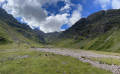
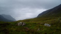
- From (4) to (8): stunning, wild landscapes at the foot of very high hills.
- From (11) to (17): beautiful views of the Ben Nevis massif, Britain’s highest peak.

Reviews and comments

Delphinium
Delphinium ★

...

Other walks in the area

For more walks, use our search engine .

The GPS track and description are the property of this route's author. Please do not copy them without permission.