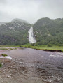
From Kingshouse Hotel to Kinlochleven

The sixth stage of the WHW takes us past the highest point of the entire walk, an unnamed pass at an altitude of 550 metres. After a pleasant walk at the foot of Beinn a’ Chrùlaiste, we reach the pass by climbing theDevil’s Staircase, which is easier than the name of this path might suggest. We then descend along good paths or wide tracks towards the former small industrial town of Kinochlevel.

This walk is part of a multi-day hike: The West Highland Way

Details

2445296
Creation:
Last update:
Last review:
  • Walking
    Activity: Walking
  • ↔
    Distance: 8.90 mi
  • ◔
    Average duration: 5h 05 
  • ▲
    Difficulty: Moderate

  • ⚐
    Back to start: No
  • ↗
    Ascent: + 1,096 ft
  • ↘
    Descent: - 1,854 ft

  • ▲
    Highest point: 1,798 ft
  • ▼
    Lowest point: 36 ft

Photos

Description of the walk

Start from the Kingshouse Hotel.

Official WHW signposting: signposts with a thistle symbol + signposts with a yellow arrow for changes of direction + directional signposts.

(S) With your back to the hotel entrance, turn left and, at the corner of the hotel, turn left again. Cross a river and you’ll come to a T-junction.

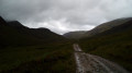
(1) Then follow a small road to the left at the foot of the summit of Beinn a’ Chrùlaise.

(2) After just under a kilometre, leave the tarmac and take a track on the right (gate). Climb gently and then continue along the hillside.

(3) Pass through a gate and continue along the track running parallel to the A82. After about 800 metres, cross a track and continue along the roadside. Cross a bridge over a river, then a footbridge over a torrent.

(4) When the road bends to the left, turn right. Start by climbing alongside a torrent. The gradient gradually increases.

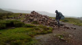
(5) Follow several hairpin bends to reach the famous Devil’s Staircase. There is nothing diabolical, however, about this ascent, which leads easily to an unnamed pass, the highest point of the entire walk (cairn).

(6) Continue northwards and begin the descent. After crossing two streams, climb slightly. Continue northwards and descend again via a few hairpin bends.

(7) Cross a river via a footbridge, then descend gently in a north-north-westerly direction. Pass a cairn and take in the view of Kinlochleven, the destination for this stage.

(8) Come out onto a track; follow it to the left, leaving a reservoir below on your right. Descend into a woodland. Ignore a path branching off to the right and walk alongside a smallreservoir on your left-hand side.

(9) Cross a bridge over a rushing river just downstream of the dam, turn right and continue downhill along the track.

(10) Continuing downhill, walk alongside some water pipes on your right. At the bottom, turn right and cross over these water pipes.

(11) Shortly afterwards, turn right towards the Forest View B&B. Cross a bridge with blue railings. Turn left as you leave the bridge and immediately ignore a turn-off on the right. The gravel path soon gives way to tarmac: carry straight on into Wades Road.

(12) At the bus stop, turn left onto a tarmac path. Follow the river on your left and you’ll come out onto ‘Lochaber Road’ in the centre of Kinlochleven (E).

Waypoints

  1. S : mi 0 - alt. 810 ft - Kingshouse Hotel
  2. 1 : mi 0.19 - alt. 814 ft - T-junction
  3. 2 : mi 0.77 - alt. 810 ft - Barrier – Start of the path
  4. 3 : mi 2.2 - alt. 912 ft - Barrier
  5. 4 : mi 2.95 - alt. 971 ft - Start of the uphill path
  6. 5 : mi 3.64 - alt. 1,509 ft - Devil’s Staircase
  7. 6 : mi 4.08 - alt. 1,798 ft - Unnamed pass
  8. 7 : mi 5.6 - alt. 1,171 ft - Footbridge
  9. 8 : mi 6.54 - alt. 1,020 ft - Trail – Reservoir
  10. 9 : mi 7.2 - alt. 538 ft - Bridge downstream of a small dam
  11. 10 : mi 8.1 - alt. 282 ft - Water pipes
  12. 11 : mi 8.44 - alt. 75 ft - Junction
  13. 12 : mi 8.73 - alt. 43 ft - Bus stop
  14. E : mi 8.9 - alt. 36 ft - Kinlochleven – Lochaber Road

Notes

Equipment:
Waterproof walking boots. Rain gear: rain cape, rucksack cover, etc. Cold-weather gear, depending on your sensitivity to the cold. Midge repellent.

Guidance:
The route is relatively straightforward and the route is very well signposted at junctions. A paper map is useful (at the very least, the one accompanying this description) or a route track on a smartphone (remember to cache the base map beforehand).

Food and drink:
Make sure you have a supply of water and a packed lunch before setting off.
(E) In Kinlochleven, there are bars, restaurants and a mini-market on the left bank of the river.

Accommodation on arrival (E):
- Tailrace Inn, Riverside Road. Tel: +44 - (0)1 855 831 777. Bar and restaurant.
- MacDonald Hotel, Fort William Road. Tel: +44 (0)1 831 539. Bar and restaurant.
- Forest View B&B, Wades Road. Tel: +44 - (0)1 855 831 302. Does not have a restaurant but offers packed lunches for the following day (order the day before; £6 per person in August 2019).

Worth a visit

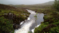
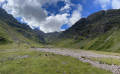
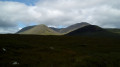
- Between (S) and (4): a pleasant walk with beautiful views of the landscape.
- At point (6): the highest point of the entire walk, with a lovely view (weather permitting).
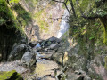
- At points (8), (9) and (10): reservoirs, small dams and penstocks, evidence of the region’s hydroelectric activity.

Reviews and comments

Other walks in the area

For more walks, use our search engine .

The GPS track and description are the property of this route's author. Please do not copy them without permission.