Country:
 City:
City:


Start from the car park at Dammartin-en-Goële Cemetery on Avenue Eugène Hémar. For access by train, see the ‘Practical Information’ section.
(S/E) With your back to the cemetery, turn left and follow theGR®1to the right along Avenue de Saint Ladre. Continue along the avenue via the Chemin de Saint Ladre. At the three-way junction, go straight on.
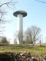
(1) Walk past the riding centre and ignore a path on the left. Walk straight through a residential area. In front of a watchtower, head down to the right along a path marked in red and white (GR®).
(2) Leave the woods and head towards the fields. At the crossroads, go straight ahead, pass under the power lines and, at the next junction, take the road opposite.
(3) At the Ferme de Saint-Ladre, turn right. In the fields, ignore the path branching off to the right and then ignore the one leading into a copse. After the stream, turn right. At the crossroads, follow the road to the right.
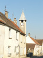
(4) At the stop sign, turn left and pass the Chemin des Clos and the Rue des Suisses. After the bell tower, turn left twice onto Rue Joseph Dieux and then onto the Chemin des Acacias.
(5) Cross over the railway line and then turn right. The path through the fields first runs alongside the Thève, then passes through two copses. At the crossroads, follow the road to the left.
(6) Before entering Loisy, turn right. At the road, take the path on the right and, at the Fork in the road, go left.
(7) Let theGR®1head off to the left. Carry on straight ahead and, at the Carrefour des Marronniers, turn right and keep to the right at the Fork in the road. A little further on, stay on the path that runs alongside the conifers.
(8) At the end, turn left onto Chemin de la Messe. At the next junction, go straight on. At the end of the path, turn left and carry on to the Éventail signpost. Follow the tarmac road to the right.
(9) After a wooden gate, turn right at the crossroads and walk past a blue house. At the fork in the road, turn left; ignore the tarmac area and follow the path along the edge of the woods.
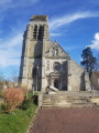
(10) At the end of Chemin de Senlis, veer right and leave the Allée de la Launette behind. At the stop sign, head slightly to the right onto Rue Hubert Vaillant. Pass to the left of the small square and then in front of the church.
(11) Turn right onto Rue du Péron, continue in the same direction along the road and pass the sports complex. Further on, at the junction, turn left and carry straight on until you reach the high-speed railway line.
(12) Cross the bridge over the railway line and ignore the path branching off to the left. At the Fork in the road, keep to the left. At the end of the track, cross the road carefully and turn left, following it along. At the traffic lights, carry on straight ahead.
(13) At the next junction, turn right, take the footpath opposite between the two houses and cross a road to continue straight on along another footpath. At the end, turn right then left. At the end of the street, take the footpath opposite to its end. Pass to the right of number 12 and, at the Stop sign, turn left until you reach the roundabout.
(14) Turn right and head towards the church, crossing the roundabout. Pass to the right of the church. Turn right behind the town hall and continue straight on to the far end of the park. Turn right onto Rue Gérard de Nerval. Turn left until you reach the pedestrian crossing, cross, then follow the footpath on the left past the Othis exit until you reach the roundabout.
(15) Stay on the cycle path at the roundabout. After the roundabout, turn right, take the small path that climbs to the left and follow the stream. Cross at the pedestrian crossing to follow the cycle path that runs alongside Avenue Olympe de Gouges. Without changing direction, follow the path to the woods.
(16) Enter the forest. At the end of Chemin du Petit Puits, turn right onto Avenue Eugène Hémar and, at the end, turn left into the cemetery car park (S/E).

 Visorando Member

 Moderate
 Easy
Easy