Country:
 City:
City:


Start from the car park at the Dammartin-en-Goële cemetery on Avenue Eugène Hémar. For access by train, see the practical information.
(S/E) With your back to the cemetery, turn left twice to take the path and join theGR®1on Rue de la Justice. After the cemetery, cross Rue du Général de Gaulle and take Rue des Oulches opposite. At the left-hand bend, continue straight on along Ruelle des Filoirs.
(1) At the end of the lane, turn right into Rue de la Libération. At the Stop sign, turn left and then follow Chemin des Prés to the right. Pass a path on your left.
(2) Go round the roundabout on the left and pass under the bridge. Continue in the same direction after the second roundabout. Turn left onto the path and follow it to the end.
(3) Turn right onto Boulevard de la République. Go straight on at the roundabout. At the junction, take Avenue de la Gare opposite. Cross Rue Victor Hugo at the traffic lights. Turn left into the small lane just past Rue de l’Europe.
(4) Opposite the station, follow Rue Pasteur to the left, running parallel to the railway line. After the station car park, turn right onto the bridge over the railway line. Take the second path branching off to the right under a power line.
(5) Cross a stream. The path first runs alongside the Montgé Forest before eventually entering it. Further on, go round a field on the right-hand side. Back at the edge of the woods, walk alongside an enclosure and then turn left.
(6) At a meadow, turn right. In the forest, head towards Rue des Blossiers, ignoring two paths coming from the left and then from the right.
(7) First turn left then right to find yourself in front of the church at Montgé-en-Goële. Pass to the right of the church, then head up Rue Neuve to the left. At the Fork in the road, follow Rue de Sépulcre to the left.
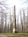
(8) Ignore theGR®1heading off to the right and take the lane opposite. At the Fork in the road, take the left-hand lane. After the Signal de Montgé column, first turn right then left. The lane leads to the road, which you should follow to the left. Walk past the car park.
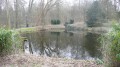
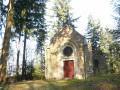
(9) Go through the gate on the right near the chapel. In the park, keep left several times to reach a pond. Pass two bridges on your right.
(10) At the bottom of the descent, turn right then take the second path on the left. Pass a path on your left, then, at the end, turn left. After the barrier, follow the road to the right.
(11) Cross the D401 with care, then head left for 150 m. Turn right into the fields.
(12) At the crossroads, turn left and ignore the dead-end road. After the sewage treatment works, turn left. 300 m further on, turn right towards two trees. Pass under a power line and carry on straight ahead until you reach the railway line.
(13) Carry straight on after the railway line. Take Rue de l’Église on the left. Turn right, walking past the town hall. Pass close to the water tower, then walk past the cemetery and the sports ground. Stay on the road until you reach the bridge over the N 2.
(14) Cross the bridge carefully, then turn right. Take the next path on the left. After a copse, turn left again. Cross the Ru Courtois, ignoring the path on the right.
(15) Cross a ditch, then walk alongside it on the left-hand side, off the path, for almost 1 km. At the sewage treatment works, step over the fallen trees blocking the path to rejoin the road.
(16) Turn left. Pass Rue Clément Ader and go past the roundabout, following the pedestrian path on the left. Use one of the two pedestrian crossings to turn right further on. At the Fork in the road, follow Rue Jean Jacques Rousseau. At the pedestrian crossing, take the path on the left. Cross four streets. At the next one, turn left.
(17) At the end, follow the road to the right. At the traffic lights, take the small lane opposite. At the end of Avenue de l’Europe, ignore the one-way street on the left. At the junction, go straight on until you reach the church.
(18) Turn round and enter the cultural centre on the left. Follow the path to the right and turn left into the street. At the end, turn right into Rue Ganneval. At the next junction, follow Rue Eugène Hémar to the cemetery car park (S/E).

 Visorando Member
 Moderate
 Easy
Easy