Short walk starting from the car park on Route du Boisdhyver

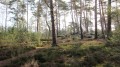
A short walk in the Ermenonville Forest, starting from the car park on Route du Boisdhyver, not far from Ver-sur-Launette. On very hot days, it is best to go in the morning; there is a picnic area at the end of the walk, or in Ver-sur-Launette there is a good restaurant on Place de la Mairie and a selection of shops. The church is open to the public

Details

98134136
Creation:
Last update:
Last review:
  • Walking
    Activity: Walking
  • ↔
    Distance: 5.25 mi
  • ◔
    Average duration: 2h 30 
  • ▲
    Difficulty: Easy

  • ⚐
    Back to start: Yes
  • ↗
    Ascent: + 72 ft
  • ↘
    Descent: - 75 ft

  • ▲
    Highest point: 397 ft
  • ▼
    Lowest point: 292 ft

Description of the walk

(S/E) With your back to the car park, go straight ahead and cross Route du Boisdhyver with care.

(1) Ignore the return path on the right. Continue straight on to the Puits de Loisy crossroads.

(2) Turn left onto the GR®1, ignoring the three junctions.

(3) At Route de l'Éventail, turn right, leaving the GR®, cross the D922 with care and pass Maison Pierette on your left. Ignore the next junction.

(4) At Route Anglaise, turn left and go straight past the junction to reach Petit Carrefour.

(5) Turn onto the first track on the right, heading north-east.

(6) At Chemin de Thiers, turn right and after about 250 m, turn left onto Route de l'Éventail. Pass the junction and head towards the Ermenonville crossroads.

(7) Turn onto the second track on the right, Route de l'Abbaye.

(8) At Chemin de Meaux, turn right and ignore five junctions.

(9) At Chemin de la Mare, turn right and immediately left onto Chemin du Terrier Bourguignon. Cross the D922 carefully, then shortly afterwards the GR®1, and pass two junctions.

(10) Turn right heading due west for about 400 m until you reach the original junction.

(1) Turn left, then cross the Route du Boisdhyver with care and arrive at the car park where there is a picnic area (S/E).

Waypoints

  1. S/E : mi 0 - alt. 331 ft - Car park on Route du Boisdhyver
  2. 1 : mi 0.2 - alt. 335 ft - Initial junction of the circular loop
  3. 2 : mi 0.4 - alt. 338 ft - Puits de Loisy crossroads
  4. 3 : mi 0.88 - alt. 341 ft - Chemin de l'Éventail
  5. 4 : mi 1.4 - alt. 354 ft - Route Anglaise
  6. 5 : mi 1.88 - alt. 344 ft - Abbey Road
  7. 6 : mi 2.27 - alt. 367 ft - Thiers Road
  8. 7 : mi 2.71 - alt. 397 ft - Carrefour d'Ermenonville
  9. 8 : mi 2.99 - alt. 381 ft - Meaux Road
  10. 9 : mi 4.08 - alt. 305 ft - Chemin de la Mare
  11. 10 : mi 4.83 - alt. 312 ft - Junction, turn right
  12. S/E : mi 5.25 - alt. 331 ft - Car park on Route du Boisdhyver

Worth a visit

Always be cautious and plan ahead when you're outdoors. Visorando and the author of this route cannot be held responsible for any accidents occurring on this route.

The GR® and PR® markings are the intellectual property of the Fédération Française de Randonnée Pédestre.

Other walks in the area

For more walks, use our search engine .

The GPS track and description are the property of this route's author. Please do not copy them without permission.