Country:

 City:
City:


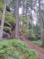
Take the tarmac road leading to the former Camping du Rocher near the football pitches and continue for about 500 metres to park near the Rosskopf restaurant.
(S/E) After crossing the tarmac road, climb the small embankment opposite the Rosskopf inn to join theGR®53forest path.
Red RectangleGR®53
Turn right onto theGR®53towards “Schlosskopf”, a pleasant and easy little path, to reach a multi-way junction at the hamlet of “Schlosskopf” (bench).
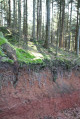
(1) Cross the large crossroads and take the forest path opposite, which climbs gently. You’ll reach the Rutschfelsen (or ‘sliding rock’) on your left.
(2) After about a hundred metres, and once you’ve passed the water reservoir on the left (fenced-off area), you’ll reach the tarmac forest road that climbs up to the Col de la Schlief.
(3) Cross the road and turn slightly left (almost directly opposite) onto the forest path leading to the Col de la Schleif, which runs alongside the tarmac forest road.
Red Ring
The forest path opens out onto a clearing and joins the Eichelkopf Forest Road on the left.
Continue along this road to the Col de la Schleif, just a stone’s throw away.
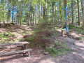
(4) Cross this large picnic area diagonally, passing to the right of the small refuge. Leave the area by following the signposting for “Col de la Wetzlach Backofelsen” and reach the junction of three forest tracks 100 metres behind the refuge.
Head straight ahead onto the Backofelsen route, following the signposts for “Col de la Wetzlach via the Steinerne Maennel”.
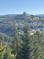
(5) After a few hundred metres, turn right onto the small path leading to the Backofelsen viewpoint (stunning views of the Rocher de Dabo and the surrounding area; picnic spot).
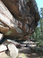
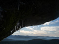
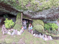
(6) Take the small path that rejoins the original forest track and continue until you reach a large rock on the left. The path descends between blocks of sandstone to reach the vicinity of ‘la Grotte des Cads’, which juts out slightly to the left.
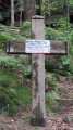
(7) Return to the forest track and, after 20 metres, reach the Hengster Sepp Cross. Continue along the forest track until it joins the Schleif Forest Road. Carry on along this wide, easy forest road to the Wetzlach Pass (benches).
(8) Turn left, following the signpost for “Col de la Schleif and Backofelsen via Steinerne Maennel” along the Wetzlach Forest Road.
(9) After about 200 m, turn left onto the path leading up to the Steinerne Maennel rock formation.
Red Cross
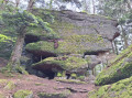
The narrow path climbs towards the rocky ridge of the “Steinerne Maennel” to reach the very curious rock of the same name, consisting of a stack of irregular plateaus (a little dwarf stands guard high up!).
(10) Continue along the forest track until you reach, on the right, a narrow path leading to the Rosskopf Rock, 100 m away.
(11) Return to the forest path which descends towards the Backofelsen Rock viewpoint and the Col de la Schleif.
(6) There is a short optional detour to the Backofenfelsen viewpoint (a second vantage point!), then rejoin the forest path which descends to the Col de la Schleif.
(5) Leave the path at the junction of the forest tracks. Cut across the Col de la Schleif picnic area and head towards the covered barbecue area, where you’ll find the Club Vosgien signposts and markings to start the second circular section of the walk.
Red Rectangle with a white cross
(4) Head towards the Eichelkopf by taking the forest track signposted ‘Route Forestière de l’Eichelkopf’. After about a hundred metres, turn left onto the path signposted ‘Itinéraire de l’Eichelkopf modifié’.
Red Ring
(12) The steep path leads to the ridge of the Eichelkopf rock outcrop. Continue easily along the wide ridge path, flanked by a few rocks, the most remarkable of which (a little dwarf perched up there keeping watch!) is situated at the far end of the rock outcrop on the descent
(caution! narrow and even slippery sections in places!).
At the bottom of the descent, head left for about 100 m and turn right towards the Col du Himbeerfels.
Red Rectangle with a white cross
::13: After about 50 m, you’ll reach the Col du Himbeerfels. From this pass, turn right towards “Himbeerfels”.
Yellow Cross
The forest path climbs until it reaches the first large boulders of the rocky ridge. After about 250 m, take the path on the left.
(14) The narrow, stepped path leads to the Himbeerfels viewpoint (picnic spot).
(15) To return and reach the little dwarves’ cave, descend via a rather steep path that leads to the foot of the rock. For a safer alternative, return via the stepped path and then, after 100 m, head up to the right to reach this unusual sight.
(16) Head back down towards the Himbeerfels Pass.
(13) From the Col du Himbeerfels, walk 20 metres to the crossroads and take the forest track straight ahead. Follow the ‘Schmittenberg Dabo’ signposts along the sloping forest path which joins the Zollstock Forest Road.
(17) Continue along this wide, fairly sandy and flat forest road until you reach the junction with the tarmac-surfaced Schlief Forest Road.
Head up the tarmac road on the left towards the Schleif Pass for about 50 metres, then turn right onto theGR®53forest path.
Red RectangleGR® 53
(3) Head down easily to the right and, following the route in reverse to the one taken on the way there, reach the Relais du Rosskopf (S/E).

 Visorando Member
 Easy
Easy