From Criel-sur-Mer to Le Tréport via the GR®21

The eighth and final day’s walk, taking just over two hours to reach Le Tréport from the campsite at Criel-sur-Mer.

This walk is part of a multi-day hike: Du Havre au Tréport par le GR®21

Details

n°23166021
Creation:
Last update:
Last review:
  • Walking
    Activity: Walking
  • ↔
    Distance: 5.82 mi
  • ◔
    Average duration: 3h 00 
  • ▲
    Difficulty: Moderate

  • ⚐
    Back to start: No
  • ↗
    Ascent: + 390 ft
  • ↘
    Descent: - 417 ft

  • ▲
    Highest point: 338 ft
  • ▼
    Lowest point: 16 ft
  • ⚐ Country: France
  • ⚐ City: Criel-sur-Mer (76910)
  • ⚑
    Start: N 50.026663° / E 1.308726°
  • ⚑
    End: N 50.063148° / E 1.368987°
  • ❏
    IGN map(s): Ref. 2008OT, 2107OT
  • Hour-by-hour weather

Photos

Description of the walk

(S) Start from Rue de la Plage at the end of the campsite. Turn right onto theGR® trail, which runs alongside the Yerres valley below Rue de la Plage (RD222). Join it near the seafront and follow it to the entrance to Criel-sur-Mer. Cross the road carefully; if necessary, take a detour past the beach bungalows. At the car park, head up Rue du Tréport.

(1) Halfway up the hill, turn left onto Rue du Chewington, which climbs and runs along the top of the cliff. Follow it to the area closed off due to rockfalls. Turn right onto Rue Louise, then left onto Rue Jeanne d’Arc. Cut across five streets.

(2) At thesixth junction, turn left onto Rue Sainte-Reine and, at the end, rejoin Rue Chewington along the cliff edge. Turn right and head down Chemin des Douaniers.

(3) Turn right onto Rue de la Manche, then left onto Rue des Prévoyants and right onto Avenue de la Falaise for about 200 metres.

(4) Turn left onto Avenue du Val Heureux and follow it all the way down.

(5) At the T-junction, turn left onto Rue de la Mer, which overlooks the coast.

(6) At the start of the climb, turn right onto Avenue du Val Coquet, which goes up and then down again to the junction with Avenue du Val Fleuri.

(7) Turn left onto this avenue, which climbs to a dead end. The tarmac gives way to a farm track that runs through the fields. At the T-junction, continue to the right until you reach the entrance to the hamlet of Mesnil Sorel.

(8) Do not go through the hamlet but turn left at an angle of less than 90°, onto Rue des Fermes. The tarmac road quickly gives way to a farm track. Keep left at the next three-way junction, leaving the campsite on your right.

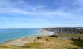
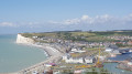
(9) Before the end of the campsite, turn left onto Chemin des Veillées to reach the RD126E at the end, along the cliff edge. Cross the road carefully and continue to the viewpoint. Follow the well-maintained and safe path along the cliff edge. You’ll reach the esplanade, with the building housing the upper entrance to the funicular (an alternative to the stairs leading down to the town), and descend the 365-step staircase leading to the quays of Le Tréport.

(10) At the foot of the stairs, turn left towards the Casino to see the seafront and the cliff from below (E).

Waypoints

  1. S : mi 0 - alt. 52 ft - Bois Joli campsite, near the - moulin sur l'Yères
  2. 1 : mi 0.84 - alt. 59 ft - Rue de Chewington
  3. 2 : mi 1.48 - alt. 194 ft - Rue Sainte-Reine
  4. 3 : mi 1.77 - alt. 141 ft - Rue de la Manche
  5. 4 : mi 1.95 - alt. 171 ft - Avenue du Val Heureux
  6. 5 : mi 2.09 - alt. 98 ft - Rue de la Mer
  7. 6 : mi 2.29 - alt. 112 ft - Avenue du Val Coquet
  8. 7 : mi 2.59 - alt. 141 ft - Rue Val Fleuri
  9. 8 : mi 3.69 - alt. 269 ft - Mesnil Sorel
  10. 9 : mi 4.44 - alt. 331 ft - Chemin des Veillées
  11. 10 : mi 5.58 - alt. 49 ft - The quays at Le Tréport
  12. E : mi 5.82 - alt. 30 ft - Le Tréport pier

Notes

Red and white GR® signposting.

All amenities available in Criel-sur-mer and Le Tréport (E).

(E) The station at Le Tréport/Mers-les-Bains is primarily a coach station, from where you can travel to Abbeville station (by coach) or Beauvais station (by train).

Worth a visit

Le Tréport and Mers-les-Bains.
Eu.

Always be cautious and plan ahead when you're outdoors. Visorando and the author of this route cannot be held responsible for any accidents occurring on this route.

The GR® and PR® markings are the intellectual property of the Fédération Française de Randonnée Pédestre.

Reviews and comments

4.3 / 5
Based on 2 reviews

Reliability of the description
4.5 / 5
Ease of following the route
4 / 5
Route interest
4.5 / 5
User 27558341

Overall rating : 4.7 / 5

Date of your route : Sep 06, 2025
Reliability of the description : ★★★★★ Very good
Ease of following the route : ★★★★★ Very good
Route interest : ★★★★☆ Good
Very busy route : No

Very detailed description, consistent with the markings. Very few hikers for a sunny Saturday.

Machine-translated

User 25455089

Overall rating : 4 / 5

Date of your route : May 19, 2025
Reliability of the description : ★★★★☆ Good
Ease of following the route : ★★★☆☆ Average
Route interest : ★★★★★ Very good
Very busy route : No

Hello

A brilliant walk – the scenery is stunning

Machine-translated

Sofinette6
Sofinette6

Hello,
Just to let you know, the coastal path that runs along the edge of the cliffs is virtually off-limits everywhere following past and potentially future rockfalls! It’s a real shame and very frustrating.

Machine-translated

Other walks in the area

For more walks, use our search engine .

The GPS track and description are the property of this route's author. Please do not copy them without permission.