From ridges to valleys around Saint-Hilaire-Peyroux

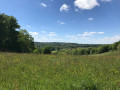
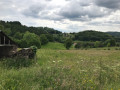
A route that follows a ridge path with lovely views of Sainte-Féréole and descends to the banks of the Couze.

Details

2071300
Creation:
Last update:
Last review:
  • Walking
    Activity: Walking
  • ↔
    Distance: 6.04 mi
  • ◔
    Average duration: 3h 40 
  • ▲
    Difficulty: Moderate

  • ⚐
    Back to start: Yes
  • ↗
    Ascent: + 997 ft
  • ↘
    Descent: - 1,007 ft

  • ▲
    Highest point: 1,280 ft
  • ▼
    Lowest point: 702 ft

Photos

Description of the walk

Starts from the church at Saint-Hilaire-Peyroux (plenty of parking).

Well-maintained route marked in blue.

(S/E) Walk up through the village along the main street, which runs parallel to the D141E at the start (follow the blue markings). Cross the D141 at the school. Continue straight on, passing three streets on your right.

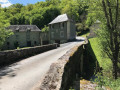
(1) Carry on straight ahead, heading down the road towards the Moulin du Bourget, ignoring the white markings indicating a left-hand bend. Join the D70, follow it to the right and cross the Couze.

(2) Immediately afterwards, take the path that climbs to the right into the woods (this path is not shown on the map).

(3) It joins a small road; follow it to the right and pass through the hamlet of Le Pic. Continue to a junction.

(4) Cross the road and take the path leading uphill (this path is not shown on the map). Before reaching the D70, turn right, staying on the path. Follow this ridge path north-north-east. When you reach a road, turn left onto it.

(5) At Vieilllefond, carry on towards Sourzat, leaving a road leading to La Barberie on your left (see an alternative route in the practical information). Pass two other roads on your right.

(6) At the entrance to Sourzat, turn right before the Fork in the road. After 50m, take the path leading down to the left behind a house. Join the road at Moulin de Saquet and head up to the left along the road.

(7) Take the first path leading uphill to the left. Further on, continue along the road and follow the first street on the right until you reach the D141.

(8) At the junction, turn left onto the departmental road. Leave the road leading to Sainte-Féréole on your left.

(9) Take the first road on the right towards Les Chassagnes. At the Fork in the road, continue to the right towards La Bonde.

(10) Take the path leading down to the right (south; path not shown on the map). When you reach the road, take it on the right to head back up to Saint-Hilaire-Peyroux. In the village, carry on to the church (S/E).

Waypoints

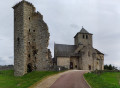
  1. S/E : mi 0 - alt. 951 ft - Church of Saint-Hilaire-Peyroux
  2. 1 : mi 0.73 - alt. 1,083 ft - Brenat
  3. 2 : mi 1.27 - alt. 866 ft - Moulin du Bourguet. After the - Couze (ruisseau) - Affluent de la Corrèze
  4. 3 : mi 1.46 - alt. 991 ft - The Peak
  5. 4 : mi 1.81 - alt. 1,109 ft - Crossroads
  6. 5 : mi 2.81 - alt. 1,263 ft - Vieillefond
  7. 6 : mi 3.34 - alt. 1,178 ft - Sourzat
  8. 7 : mi 4.08 - alt. 1,053 ft - Start of the path
  9. 8 : mi 4.41 - alt. 1,122 ft - D141 road
  10. 9 : mi 4.63 - alt. 1,145 ft - Junction
  11. 10 : mi 5.15 - alt. 997 ft - Start of the path
  12. S/E : mi 6.04 - alt. 951 ft - Church of Saint-Hilaire-Peyroux

Notes

Alternative route:
(5) At Vieillefond, you can turn right to shorten the walk to 7km (signposted path not shown on the map).

Reviews and comments

4.1 / 5
Based on 4 reviews

Reliability of the description
4 / 5
Ease of following the route
5 / 5
Route interest
3.3 / 5
User 27846141
• Edited:

Overall rating : 4 / 5

Date of your route : Oct 13, 2025
Reliability of the description : ★★★★☆ Good
Ease of following the route : Not used / Not applicable
Route interest : ★★★★☆ Good
Very busy route : No

Hello
We wanted to do this hike, but it was very poorly marked in blue
In the end, we walked 6 km more than planned and found that the pink markings were not in the right direction

Machine-translated

Isa-72
Isa-72

Overall rating : 3 / 5

Date of your route : Jun 23, 2024
Reliability of the description : ★★☆☆☆ Disappointing
Ease of following the route : ★★★★★ Very good
Route interest : ★★☆☆☆ Disappointing
Very busy route : No

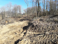
The route is well signposted but not maintained at all between points 4 and 5
Grass, ferns and brambles over 1.5 metres high
No spectacular views, not even of the mills

Machine-translated

anne.valentin
anne.valentin

Overall rating : 4.3 / 5

Date of your route : Aug 09, 2021
Reliability of the description : ★★★★★ Very good
Ease of following the route : ★★★★★ Very good
Route interest : ★★★☆☆ Average
Very busy route : Yes

The problem with this ride is that there are a lot of roads. They’re quiet little roads, but roads all the same (about 50 per cent of the route). There aren’t any spectacular views either, but it’s a nice ride.

Machine-translated

Celineetfrederic
Celineetfrederic

Overall rating : 4.7 / 5

Date of your route : Jan 01, 2021
Reliability of the description : ★★★★★ Very good
Ease of following the route : ★★★★★ Very good
Route interest : ★★★★☆ Good
Very busy route : No

A pleasant walk with excellent signposting. The ridge path with views of Sainte Féreole is particularly lovely

Machine-translated

Other walks in the area

For more walks, use our search engine .

The GPS track and description are the property of this route's author. Please do not copy them without permission.