Country:
 City:
City:


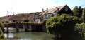


Starting point and access: Coulommiers railway station.
- Transilien – Line P, terminus of a section from Paris-Est.
Take the only exit, Place du 8 mai 1945.
Red and white + yellow markings
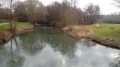
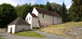
(S) On leaving the station, cross the car park and head straight ahead onto Rue de la Gare. At the end, go round the roundabout on the right, cross Rue Marcel Clavier and follow it to the right, keeping to the left-hand pavement. At number 18, turn left onto a footbridge over a branch of the Grand Morin, then enter the Parc des Capucins. Immediately after the gate, turn right onto a footpath. At the next junction, go straight on. At the foot of an old church (Musée des Capucins), turn left and walk alongside a pond on your right. Ignore a bridge on the right, continue straight on and, at the end of the path, leave the park on the right.
(1) Follow a tree-lined gravel path. At the end, cross a tarmac road, continue straight on, pass a playground on your right and cross the bridge over the Grand Morin. On the other side, cross the road at the pedestrian crossing and follow it to the left. Turn immediately right and walk uphill to the chancel of the church.
(2) At the T-junction, turn right onto Avenue de Rebais (school). After about 40 metres, cross the avenue at the pedestrian crossing and continue in the same direction. At number 6, climb the steps on the left. At the top, continue along a path that curves to the right. At the end of the path, ignore a street on the left and carry on straight ahead along a footpath. Turn left with the footpath and head uphill. Then turn right and continue along the level, shaded footpath with garden fences on the right-hand side.
(3) You’ll come out onto Rue Verte; follow it to the left, climbing slightly. At the end, turn right twice to take Rue des Ouches.
Yellow markings
(4) At the next junction, turn left (let theGR®®11continue straight on). Climb steadily and keep going straight on, taking Rue de la Thibaude, Rue Édouard Branly and Avenue Joffre in turn. Pass by the foot of the monumental water tower and arrive at a roundabout.
No signposts
Go round the roundabout on the left and take Avenue Foch opposite. This will take you to the former Templar Commandery of Coulommiers.
(5) Continue straight ahead, keeping the sports grounds on your left. Just after a ‘no stopping’ sign on the right-hand side, turn right onto a wide grassy track and follow the fence of a care home on your left. Continue between a field on your left and a fence on your right, then between two fields.
Yellow markings
(6) Cross a road at the edge of the hamlet of La Bauderie and follow a cul-de-sac opposite, which is closed to traffic (except for residents) and further on becomes closed to all vehicles except agricultural machinery. Head downhill, cross a stream and head back uphill. Pass the old Charnoy farmstead on your left and continue along the small road with the bell tower of Aulnoy Church clearly in view. Take thefirst left, Rue de l’Église, and enter Aulnoy. Look out for the unobtrusive entrance to the cemetery on your right.
(7) If you wish, enter the cemetery to enjoy a lovely view of the church, which consists only of a chancel and a bell tower. Retrace your steps.
(7) Continue through the village, immediately ignoring a road leading down to the left, pass a bus stop and carry on straight ahead along the road. At the ‘give way’ sign, take thefirst path on the left, pass a small turning circle on the right and head downhill. Cross a small river via a footbridge and reach the banks of the Aulnoy village pond.
(8) Turn left, walk along the right-hand side of the pond and go round roughly half of it. Then take a path through a hedge (where there is a litter bin and a sign) and follow a short stony track to the right. Cross the D402 (take great care, as it is a busy road) and continue straight ahead along a small road to enter Chafoulé. After passing a beautiful house on the left, enjoy a shaded stretch.
(9) Just at the end of the shaded section, take a grassy path on the right and walk between two fields. At the corner of the field on the left, turn left (there are no arrows or markers here) and walk alongside a row of poplars some distance away on your right. At the end of the row, ignore a path branching off to the right and carry on straight towards a farm shed. At the corner of the shed, turn left and walk past the beautiful Grange Justin farmhouse on your right.
(10) At the corner of the wall, take a farm track on the right. Pass the buildings and continue straight on (south-south-west) along the track between the fields. Shortly after a hunting lookout, you’ll reach a T-junction (marker 143). Then turn left (south-east) onto a grassy path. At the end (marker 145), follow a track to the right and walk alongside the wall of a property on your left.
No signposting
(11) At the corner of the wall, continue straight on along flat ground (let the signpostedPR®® trail head down to the left). Walk alongside farm buildings on your left and ignore all offshoots to the left. At a junction (elevation 146), go straight on; the track has given way to a grassy path.
(12) At the next junction, turn left and walk alongside a hedge on your right. In a left-hand bend, take thesecond path on the right and walk gently downhill. At the next junction, head straight ahead, slightly diagonally to the right, onto Rue Michelet. Soon the tarmac gives way to a track. Walk downhill between houses and gardens.
(13) At the bottom, cross the D934 at the pedestrian crossing on the left. On the other side, turn right and then immediately left onto Rue du Champ Joli. Ignore a road on the right and enter the hamlet of Coubertin. Cross the Grand Morin in two stages.
(14) As you leave the bridge, turn right twice to join a gravel track, the Chemin de la Radine. Follow this track for a long stretch through fields, meadows and garden fences. You’ll come out onto a road (with a metal bridge on the right).
Red and white + yellow markings
(15) Follow the road to the left, preferably on the right-hand verge. When the road bends to the left, take a path on the right. Immediately ignore a path branching off to the left and head up into a woodland.
Red and white markings
At the top (with a railway bridge opposite), turn left, pass through a forest gate and keep parallel to the railway line below on your right. At the next junction, carry on straight ahead along a gravel track between houses and gardens. At the Stop sign, turn right and you’ll immediately reach Mouroux station (E).
To return home:
- Transilien – Line P, towards Paris-Est or Coulommiers (single track, single platform).

 Visorando Member
 Very difficult