Country:
 City:


Starting point and access: Conflans-Fin-d’Oise station.
- Transilien – Line J, on the section between Paris-Saint-Lazare and Mantes-la-Jolie via Conflans.
- Transilien – Line L, on the section between Paris-Saint-Lazare and Cergy.
- RER – Line A, on the section between Paris and Cergy.
Take the Place Georges Clemenceau exit, located on the platform shared by Lines A and L, at the rear of the train when arriving from Paris towards Cergy. If arriving on Line J, first go down the stairs leading to Lines A and L, at the front of the train when arriving from Paris-Saint-Lazare towards Mantes-la-Jolie; then walk to the very end of the platform. In all cases, at the end of the corridor leading to the “Clemenceau” exit, turn right to exit onto the station car park (not onto Place Clemenceau).
No signage
(S) With your back to the exit gates, head to the left, go down a flight of stairs and pass a well-known fast-food outlet on your left. Walk a few more metres and turn right onto a road with a 30 km/h speed limit. Before the Stop sign, take the ramp on the left leading up to the bridge.
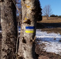
Red and white markings
At the top, turn right and take the bridge across the Seine. On the other side, before another 30 km/h speed limit sign, go down the ramp on the right. At the bottom, head towards the Oise and cross the quay bearing its name.
(1) Follow theGR®2to the right, go under the road bridge and walk alongside the river, which immediately joins the Seine. Walk alongside the river on your left, staying on the wide, grassy verge of the quay.
Red and white + yellow markings
At the ‘Stop’ sign, carry straight on and walk past Andrésy Town Hall.
(2) Shortly afterwards, turn right, cross the quay at the pedestrian crossing and take the gravel path opposite. Turn left then right as the path bends, and you’ll come out onto a street (Rue de l’Église). Follow this street to the left, pass the post office and arrive at the foot of the church.
(3) Continue straight on and, at the three-way junction that appears immediately, turn right into Rue des Courcieux. After a left-hand bend, take thefirst right and climb a flight of steps. At the junction, turn into Impasse des Barils opposite. Cross Rue Marcotte on the left-hand side and head up the cul-de-sac diagonally to the left.
Red and white + yellow markings
At the top, carry on straight ahead with the railway fence on your right (let theGR® head off to the right).
No markings
(4) After about a hundred metres, take the footbridge over the railway line. Then continue along a path between two walls. At the end, follow a street to the right. At the Stop sign, turn left onto Rue des Barils and, after about thirty metres, take Chemin des Vignes on the left. The alleyway soon gives way to a footpath: carry straight on, ignore a few side paths and stay on more or less level ground.
(5) Cross Avenue Maxime Traverse on the right-hand side and, at the small triangular square that appears immediately, take the right-hand path, signposted with a blue arrow for motorists. Cross a perpendicular street and continue along Chemin des Grands Heurts. When this tarmac road bends to the left, carry on straight ahead along a path, keeping a supermarket on your left. At the corner of the shop, turn left onto this path. At the end, follow Rue de Triel to the right and you’ll come to a large roundabout.
(6) Cross the D55 (Avenue Victor Schoelcher) at the pedestrian crossing situated slightly to the right. Follow this busy road to the right for about 150 m. Then turn left onto the Sente rurale des Sablons. Head up this path, which is interspersed with a few hairpin bends, and at the successive junctions, carry on straight ahead until you reach a crossroads directly beneath a power line.
Red and white markings
(7) Turn left, go through a forest gate and follow theGR®2again along a grassy path. Ignore a turning-off on the left and pass the base of a reservoir on the right-hand side. Continue briefly along a road and, when it turns right, carry straight on, go through a metal gate and follow a grassy path bordered by a hedge on the left.
Pass a second gate and rejoin the tarmac road. At the end of the lane, head down Rue du Chapitre to the left. At the Stop sign, go straight on. At the next junction, go straight on again into Rue de l’Abreuvoir. Turn left onto this street when it becomes a one-way street and arrive at the entrance to the church in Chanteloup-les-Vignes.
(8) Then turn right, go through a metal gate, follow Rue de Pissefontaine and walk alongside the Louis Pasteur School. Go through a second gate, turn right into Rue des Marais and pass a small triangular square on your left. Immediately afterwards, turn left onto the Grande Sente des Marais. Head uphill and pass through a residential area. Cross Rue de la Source on your left and continue straight on for a further forty metres or so.
Then turn right onto a discreet path that leads into some scrubland. Ignore a path branching off to the right and wind your way through the scrub. Pass a bend and continue along a path that leads downhill. You’ll come out onto an avenue; follow it to the right as it climbs.
Yellow signposting
(9) Just after a 30 km/h speed limit sign, turn left onto the Deuxième Sente du Moulin à Vent (that is the name of the road). Go down a short flight of steps and continue straight on, going downhill. At a three-way junction, turn left onto the Grande Rue de Pissefontaine and continue downhill. Walk past Place Corroyer on your left, cross the Rue aux Dames on your right and continue straight on along the Rue Saint-Marc.
No signposting
After crossing Rue des Tourelles on the right and then on the left (this street veers slightly off course), continue straight on along Rue Saint-Marc (let thePR® trail branch off to the left). Cross Rue des Murs Blancs on the left and continue along Rue Saint-Marc, which slopes gently downwards. At the end, turn right onto Rue du Général Galliéni (with some lovely houses on the right-hand side). At number 32, take the footbridge on the left over the railway line (Triel-sur-Seine station).
Red and white markings
(10) On the other side, turn right onto Avenue des Combattants. At the Stop sign, first turn right then left to follow Rue Corrouge and walk alongside the arches of the railway viaduct. At the junction, turn left into a one-way street.
No signposting
(11) Just before the street passes under Triel Church, turn right towards the church’s façade and entrance. Turn left again, cross a small car park and go down a flight of steps on the right. At the three-way junction, head down Rue Gallande to the right. Continue for a few dozen metres along the main street and cross it at the pedestrian crossing to join Rue de Seine. Carry on straight ahead until you reach the Quai de Seine.
Yellow markings
(12) Turn right and follow a stony path between the river (on the left) and property walls or fences (on the right), ignoring any side paths on the right. Further on, the path narrows; continue straight on along the banks of the Seine.
(13) At a junction with two gates on the right-hand side – one white and one green – leave the riverbank and head up Rue Fleury on the right. At the end, cross the D190 (take care, as it’s a busy road) and follow it to the left for about a hundred metres.
Take thefirst right, the Sente de la Côte Mathias, then thefirst left, the Sentier des Basses Parties. Cross the bridge over the railway line. At the junction just beyond the bridge, take thesecond right, still following the Sentier des Basses Parties. Turn left onto this path and cross the Sentier des Hautes Parties on your left. Then turn left, ignore a path on the right and you’ll come to a three-way junction.
Red and white markings
(14) Take the path on the left to rejoin theGR®2. Climb gently through a wood, then continue on roughly level ground. Ignore a turn-off to the right and head slightly downhill. At a Fork in the road, turn left and descend more steeply. After about 250 m, take a path on the left and continue downhill. You’ll soon rejoin the tarmac at a junction and head straight down Rue du Bel Air.
At the bottom, at the foot of the railway viaduct on the left-hand side, turn right and then immediately left onto Boulevard Angibout. Climb steeply and continue on level ground, following the railway line below on your left.
No signposting
(15) When you reach Vaux-sur-Seine station, carry on for a further 30 metres or so (let theGR® head off to the right along a footpath) then take the footbridge over the railway line on the left. On the other side, cross the avenue at the pedestrian crossing and then turn right onto Rue du Pressoir. At the junction, carry straight on along Rue Masson.
At the end, turn right and, just before the tunnel under the railway line, turn left into Rue Pigoreau. On the left-hand side, pass Rue des Huilliers then Impasse des Sureaux, and follow Rue du Tertre to the left. You’ll emerge onto Rue du Général de Gaulle (note the Pavillon d’Artois opposite) and follow it to the right. Take thefirst right, Rue de l’Église, and you’ll immediately come to a junction.
(16) Turn slightly to the right, go under the railway line and reach the forecourt of Vaux Church (car park). Retrace your steps.
(16) As you emerge from the underpass beneath the railway line, take Rue de l’Église on the right. Join Rue du Général de Gaulle and follow it to the right again. Take thefirst right onto Chemin des Champeaux. Cross the bridge over the railway line, then turn left with the road. After about a hundred metres, turn right onto Chemin des Acacias (a cul-de-sac). The tarmac quickly gives way to a footpath bordered by a fence on the right-hand side. The path climbs quite steeply.
(17) At a three-way junction, turn left and take a wooden footbridge. Ignore a path leading down to the left and continue on level ground alongside a wall on the right-hand side (view of the Seine on the left). Turn right with the path, still following the wall, climb a flight of steps and emerge onto a street. Follow this street to the left and, at the ‘give way’ sign, go straight on. After No. 12, turn right onto the Chemin des Rosières. After No. 5, continue along a path that crosses a woodland.
At a three-way junction, turn left and pass a few houses on your right. Stay in the woods and ignore the faint tracks on either side. Ignore a path branching off to the right and pass a second group of houses on your right. Follow a fitness trail with exercise equipment. At a junction, continue straight ahead on level ground. The path then splits: take either the left or right branch; the two rejoin further on. Shortly after this junction, turn right onto a narrow lane in a housing estate (Allée du Belvédère). At the end, turn left onto Rue Traversière. At the end of this, cross a road and reach a viewpoint overlooking the Seine.
(18) With your back to the view, follow the street to the left (west). At the junction, take thefirst left, go past a chicane and head downhill. Ignore two turn-offs on the left and continue downhill, keeping to the right-hand side of a wall. At the bottom, turn left into Rue de la Pierre à Poisson. At the Stop sign, turn right. At the traffic lights, go straight on (be careful, the pavements are narrow). Go round the church on the right and you’ll reach a junction at the foot of the church.
Red and white markings
(19) Turn left, running alongside the church. At the junction, head down the Cote Saint-Nicolas to the right. At the T-junction, head down Rue de la Chaîne to the right. At the next junction, go straight on into Rue Georges Clemenceau. At the traffic lights, cross the D14 and continue along the D190 (still Rue Clemenceau). Cross a river, enter Hardricourt and take thefirst right, Rue de la Gare. Head slightly uphill and you’ll soon reach Meulan-Hardricourt station (E).
To return home:
- Transilien – Line J, towards Mantes-la-Jolie (direct access) or Paris-Saint-Lazare (take the underpass).


 Visorando Member
 Easy
 Association / Club / Walk leader