Bringard circular loop to Rougegoutte

A pleasant walk in Rougegoutte, 15 km north of Belfort.
The shaded route is particularly pleasant during heatwaves.
The signposted circular path passes through a beautiful beech forest.
We are in the Vosges mountains: a walk with a good elevation gain.

Details

2349297
Creation:
Last update:
Last review:
  • Walking
    Activity: Walking
  • ↔
    Distance: 6.95 mi
  • ◔
    Average duration: 4h 45 
  • ▲
    Difficulty: Moderate

  • ⚐
    Back to start: Yes
  • ↗
    Ascent: + 1,781 ft
  • ↘
    Descent: - 1,785 ft

  • ▲
    Highest point: 3,009 ft
  • ▼
    Lowest point: 1,506 ft

Photos

Description of the walk

The route starts at the town hall car park, opposite the church, on Rue des Écoles in Rougegoutte.
The route is signposted with a Blue Disc. (At the start, it follows another circular route signposted with a Red Ring)

(S/E) Follow the main road towards the river ‘la Rougegoutte’ and cross it. Turn immediately right onto Rue de l’Église. Continue to the first Fork in the road, then keep slightly to the left (do not cross the stream again). At the second fork in the road, turn right onto Rue du Bringard (the return route will be via the path coming from the left).

(1) After about 200 m, at the crossroads, a sign indicates to take the path on the right towards Plain Baleroy. Take this path, which also leads to the Baerenkopf via the Col des Sept Chemins.
Note: at this point the route splits into two; the return journey will follow the path on the left. Take this path, which also leads to the Baerenkopf via the Col des Sept Chemins.
Further on, carry straight on, passing a path on your left. Walk alongside a pond and continue the climb.

(2) After a flat section, cross a path and continue straight ahead. The path climbs steeply.

(3) At the junction, turn left and, immediately afterwards, cross the Route Forestière to continue climbing straight ahead. Carry on for about 200 m until you reach the junction.

(4) Ignore the paths on both the right and left; take the one in the middle. Pass two paths on the left. In a wide right-hand bend, you’ll reach the highest point of the route, just over 910 m, then a T-junction.

(5) At the junction, the two signposted paths split. The ‘Red Ring’ heads off to the right. The path recommended here, signposted with a ‘Blue Disc’, heads off to the left and reaches the Plain Baleroy after a bend to the left, then to the right.

(6) At the Plain Baleroy, turn left. The junction is marked by a sign (altitude 861 m), signposted for Rougegoutte via Le Bringard, heading west.

(7) Turn right onto the Route Forestière and continue downhill for nearly 2 km.

(8) Follow the signposts carefully to leave the tarmac road and turn left at this junction. At the next junction, turn left and you’ll come to a five-way crossroads.

(9) At this five-way junction, take the second path from the left. The signposts are very helpful.
Carry on downhill; this path is sometimes very wet. Continue to the next crossroads.

(10) Turn right and continue downhill. Pass a path on the right and another on the left to reach the first houses of Le Bringard. Continue downhill along the tarmac road and rejoin the path you took on the way there.

(1) Carry on downhill along Rue du Bringard, then Rue de l’Église, following the River Rougegoutte.

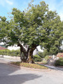
(11) When you reach the church, leave the path you took on the way there and carry on straight ahead until you reach the main road, Rue de Vescemont. Turn left and cross the river to return to the car park where you started; as you pass, take a moment to admire the lime tree, which is over 400 years old (S/E).

Waypoints

  1. S/E : mi 0 - alt. 1,512 ft - Car park at Rougegoutte Town Hall
  2. 1 : mi 0.54 - alt. 1,608 ft - Directions: Plain Baleroy
  3. 2 : mi 1.28 - alt. 1,896 ft - Crossroads after a flat stretch
  4. 3 : mi 2.03 - alt. 2,638 ft - Forest Road
  5. 4 : mi 2.16 - alt. 2,799 ft - Crossroads: continue straight ahead
  6. 5 : mi 2.58 - alt. 2,943 ft - T-junction
  7. 6 : mi 2.88 - alt. 2,828 ft - Plain Baleroy
  8. 7 : mi 3.39 - alt. 2,480 ft - Forest Road
  9. 8 : mi 4.51 - alt. 2,080 ft - Crossroads: leave the tarmac road.
  10. 9 : mi 4.91 - alt. 2,382 ft - Crossroads of five paths
  11. 10 : mi 5.32 - alt. 2,205 ft - Crossroads
  12. 11 : mi 6.76 - alt. 1,512 ft - Crossroads near the church
  13. S/E : mi 6.94 - alt. 1,509 ft - Car park at Rougegoutte Town Hall

Notes

The route is signposted by the department. It does not appear anywhere on the internet.
Visorando was provided with this information by Mr Chevalley, a volunteer at Balisage90, based on the route kindly shared by one of his colleagues.

Worth a visit

The village owes its name to the ‘goutte’ (stream) which has carved its bed into the red sandstone. The river is called La Rougegoutte
The village is first mentioned in the early days of the Rosemont seigneury, established by Louis de Mousson, first Count of Montbéliard, between 1024 and 1070. In 1348, the region became an Austrian possession. In 1648, following the Treaties of Westphalia, the Alsatian possessions of the House of Austria reverted to France.

St George’s Church, 1724 – 19th century
The bell tower is in the Franche-Comté style
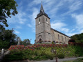
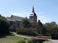
A church at Rougegoutte is mentioned on 6 June 1196 in a document by Pope Celestine III confirming the property and privileges of the chapter of Saint-Maimboeuf in Montbéliard. Probably built in the 12th century, this building stands on a rock with the Rougegoutte stream flowing at its base and served as a church and place of refuge. Saint George is cited as the patron saint from the 16th century onwards. Depicted slaying a dragon, he is carved in relief on the pediment above the portal. Source: Le patrimoine des communes http://www.patrimoine90.fr/Rougegoutte.h...

Tilleul
Around 1578 – Central square
The history of Rougegoutte records the existence of a ‘high court’ on the right bank of the Rosemontoise and a ‘low court’ on the left bank as far as Giromagny. This gave rise to difficulties, further complicated by the establishment of a mining court. Negotiations took place between the latter and the lords of Rougegoutte. It is possible that the latter planted this lime tree in the heart of the village as a sign of confirmation of their rights. The presence of the tree at this location is recorded in the Reinach family archives in 1665. It is subsequently mentioned in 1687 and 1715
Source: Local Heritage.

Reviews and comments

3.9 / 5
Based on 4 reviews

Reliability of the description
4 / 5
Ease of following the route
4.5 / 5
Route interest
3.3 / 5
gilberlou
gilberlou

Overall rating : 3.7 / 5

Date of your route : Aug 25, 2025
Reliability of the description : ★★★★☆ Good
Ease of following the route : ★★★★☆ Good
Route interest : ★★★☆☆ Average
Very busy route : No

A lovely walk through the woods, ideal on hot days. The climb up to Plain Balleroy requires sustained, steady effort. There is a bit of tarmac on the way back, but this allows you to enjoy the beautiful Bringard neighbourhood.

Machine-translated

carolema2
carolema2
• Edited:

Overall rating : 3.3 / 5

Date of your route : Mar 03, 2024
Reliability of the description : ★★★☆☆ Average
Ease of following the route : ★★★★★ Very good
Route interest : ★★☆☆☆ Disappointing
Very busy route : No

It’s hard to get lost: the Blue Disc is clearly visible all the way along.
The walk alternates between wide, bumpy paths with steep gradients and tarmac roads (no cars). There are no views; it’s all through the forest. I found it rather uninteresting in winter.

Machine-translated

d.louis
d.louis

Overall rating : 4.7 / 5

Date of your route : Jul 01, 2021
Reliability of the description : ★★★★★ Very good
Ease of following the route : ★★★★★ Very good
Route interest : ★★★★☆ Good
Very busy route : No

A stony path between markers 2 and 4, which is more like a logging track; sturdy footwear is essential.

Machine-translated

latristesse
latristesse

Overall rating : 4 / 5

Date of your route : Aug 26, 2019
Reliability of the description : ★★★★☆ Good
Ease of following the route : ★★★★☆ Good
Route interest : ★★★★☆ Good

A hike suitable for keen walkers and climbers; the elevation gain, although indicated, is surprising – there’s a steep section.
But there’s no need to worry – just take it at your own pace, and indeed, the route is entirely sheltered;

Machine-translated

Other walks in the area

For more walks, use our search engine .

The GPS track and description are the property of this route's author. Please do not copy them without permission.