The tour of Fort de Giromagny

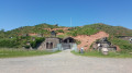
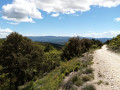
This lovely walk will take you to discover one of the forts designed by General Séré de Rivières to protect the Belfort Gap: Fort Dorsner, built in 1875 and reinforced in 1879.
The walk is marked with a Red Ring.

Details

1529128
Creation:
Last update:
Last review:
  • Walking
    Activity: Walking
  • ↔
    Distance: 3.35 mi
  • ◔
    Average duration: 1h 50 
  • ▲
    Difficulty: Easy

  • ⚐
    Back to start: Yes
  • ↗
    Ascent: + 299 ft
  • ↘
    Descent: - 299 ft

  • ▲
    Highest point: 1,847 ft
  • ▼
    Lowest point: 1,549 ft

Photos

Description of the walk

Park in the car park on Rue des Prés Heydes, 90200 Giromagny. It is located opposite the gendarmerie.

(S/E) Walk up Rue des Prés Heydes and, at the three-way junction, turn left onto Rue Sous la Côte. You will reach a right-angled junction.

(1) Turn right onto Rue d’Auxelles, keep left at the fork just after, then veer right, ignoring a wide path on the left. Then take a small sunken path on the left. Follow the Red Ring markings carefully.
Continue across the meadow.

(2) At the T-junction, turn left onto the wide path leading up to the fort. From this junction, you can see, in the distance, the Mesolithic site of La Grosse Roche. You can reach it by taking a 30-metre detour. Signs mark the way.

(3) After 500m, the path descends slightly. At the start of the descent, leave the path and follow the dirt track to the left, going round the fort.

(4) At the swing gate, go down the path on the left. At the right-hand bend about thirty metres further on, take the sunken path on the left, go down it and continue across the meadow.

(5) At the end of a wide right-hand bend, turn left and carry straight on, ignoring a path branching off to the right. Follow the path as it curves to the left before joining a road.

(6) At the end of the track, head down the tarmac road to reach the first crossroads.

(1) Turn right, then right again to return to the starting car park (S/E).

Waypoints

  1. S/E : mi 0 - alt. 1,549 ft - Car park on Rue des Prés opposite the gendarmerie.
  2. 1 : mi 0.26 - alt. 1,565 ft - Rue d'Auxelles
  3. 2 : mi 0.72 - alt. 1,654 ft - T-junction, left
  4. 3 : mi 1.2 - alt. 1,785 ft - High point of the path to the fort, on the left
  5. 4 : mi 1.68 - alt. 1,808 ft - Tilting barrier
  6. 5 : mi 1.97 - alt. 1,726 ft - Junction, left
  7. 6 : mi 2.48 - alt. 1,617 ft - Route
  8. S/E : mi 3.35 - alt. 1,549 ft - Car park near the - Savoureuse (rivière)

Notes

Visorando was informed by Mr Chevalley, a volunteer member of Balisage90, based on brochures published by the Belfort Territorial Department.

The walk is marked with a Red Ring.

Worth a visit

The mining industry
Giromagny experienced a boom from the 14th century onwards thanks to the mining industry. The exploitation of its mineral resources (silver, copper) fuelled its development. With the former Rosemont mines, Giromagny became a unique industrial hub in the region by the 16th century and had a population of 1,500, whilst Belfort had only a third of that number. The Giromagny presbytery even nearly became the French School of Mines during the Revolution. Mining activity gradually and definitively came to an end in the 19th century.

The Mesolithic site
During the Mesolithic period, climate change contributed to changes in hunters’ behaviour; humans had to adapt and became archers. They carved flint to use for their arrows. Fragments have been found at the Mesolithic site of ‘La Grosse Roche’ in Giromagny.

Fort Dorsner
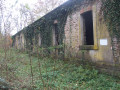
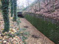
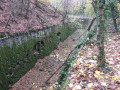
Following the French defeat of 1871, it was decided to protect the Belfort Gap using General Séré de Rivières’ defensive system. Fourteen new forts were built, including the one at Giromagny in 1875, known as Fort Dorsner. Its location near the border gave it a very important role; it was tasked with monitoring the road descending from the Ballon d’Alsace and leading to Belfort. Its armament made this fort the most powerful in the region, as in 1879 it was equipped with an unusual defence system comprising two Mougin turrets, the first of their kind in France. Visits are possible in summer.

Reviews and comments

4.5 / 5
Based on 5 reviews

Reliability of the description
4.4 / 5
Ease of following the route
4.2 / 5
Route interest
4.8 / 5
Phil0712
Phil0712

Overall rating : 4 / 5

Date of your route : Nov 03, 2025
Reliability of the description : ★★★★☆ Good
Ease of following the route : ★★★★☆ Good
Route interest : ★★★★☆ Good
Very busy route : No

A lovely, easy walk with beautiful views. It's a shame we couldn't visit the castle, as it was reserved for a Halloween show.

Machine-translated

Baladeuse66
Baladeuse66

Overall rating : 5 / 5

Date of your route : Apr 23, 2023
Reliability of the description : ★★★★★ Very good
Ease of following the route : ★★★★★ Very good
Route interest : ★★★★★ Very good
Very busy route : No

A walk combined with the mining trail in Giromagny.
A pleasant route through woods and meadows with lovely views over the valleys.
The fort is closed at this time of year, but the outer fortifications are clearly visible. Below, you can ‘approach’ a building that is off-limits to the public (danger: given its condition, do not enter!), but the site has a certain air of mystery.

Machine-translated

jeannerenee
jeannerenee

Overall rating : 5 / 5

Date of your route : Sep 08, 2022
Reliability of the description : ★★★★★ Very good
Ease of following the route : ★★★★★ Very good
Route interest : ★★★★★ Very good
Very busy route : No

A lovely morning walk

Machine-translated

cathymb
cathymb

Overall rating : 4 / 5

Date of your route : Jul 20, 2020
Reliability of the description : ★★★★☆ Good
Ease of following the route : ★★★☆☆ Average
Route interest : ★★★★★ Very good
Very busy route : Yes

I found it difficult to follow the route in the last third (after passing the fort). We took a wrong turn and had to cut through some fields. That said, the walk was really lovely and ideal for a dog

Machine-translated

LFol
LFol

Overall rating : 4.3 / 5

Date of your route : Jun 01, 2020
Reliability of the description : ★★★★☆ Good
Ease of following the route : ★★★★☆ Good
Route interest : ★★★★★ Very good
Very busy route : Yes

A lovely sunny walk in the countryside; the fort is very impressive, especially the moat. However, we took the wrong path several times and ended up returning to our original route by chance, rather than completing a circular route as planned.

Machine-translated

Other walks in the area

For more walks, use our search engine .

The GPS track and description are the property of this route's author. Please do not copy them without permission.