Country:

 City:


Park in the car park at Rougegoutte town hall.
(S/E) Cross the road and take the small path that climbs up behind the church. Head back down, cross a stream, and emerge onto Rue de l’Église; follow this to the right. At the first Fork in the road, continue straight ahead (do not cross the stream again). At the second Fork in the road, turn right onto Rue du Bringard.
(1) After about 200 metres, leave the road and take a signposted path on the right. Walk between some ponds, then head uphill through the woodland on this pleasant path.
(2) At the crossroads, turn left onto the flat path (let the signposted path continue straight ahead). At the T-junction, turn right onto another signposted path. The path climbs steeply for a few hundred metres, then becomes gentler. Keep following the signposts.
(3) Turn left, staying on the signposted path. At the junction that comes up shortly afterwards, turn right.
(4) At the crossroads on a flat stretch, take the first path on the right (the only unmarked one going uphill). You’ll soon reach the Route Forestière du Fayé.
(5) Follow the track to the left for a few metres, then leave it to take a path leading uphill to the right. About twenty metres further on, at a Fork in the road, take the left-hand path, which runs parallel to the forest track before veering off it. This path (unmarked) climbs very steadily to a level stretch. It then descends slightly.
(6) Turn right onto a signposted path.
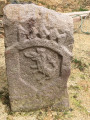
(7) At the highest point of the route, you’ll come to a crossroads of paths: head south-south-west along the barely visible path that starts near a red stone marker. Walk downhill, ignoring the side paths. Cross the forest road again and continue along the signposted path. You’ll come to a small fountain (you can make a round trip to the charming Notre Dame du Grippot Chapel – a steep but short climb).
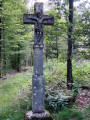
(8) Continue the descent and you’ll soon reach a junction of signposted paths. Turn right onto a well-maintained path leading towards Rougegoutte. Head downwards, initially south-west then west-south-west. Then turn right (west-north-west) and reach the Croix des Côtes.
(9) Continue along the path which descends towards Rougegoutte. At the first houses, the path gives way to a tarmac road. Then turn right to return to the town hall (S/E).

 Visorando Member

 Local authority
 Easy