Country:
 City:


Exit at the front of Bussy-St-Georges station (RER A): exit 3, Aristide Maillol.
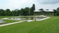
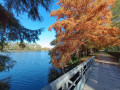
(S) Turn left and walk alongside the station for a short while. At the junction, cross the road and cut diagonally across the park. Cross the street and continue straight ahead onto the esplanade, flanked on either side by two giant statues atop building pediments. At the corner of the esplanade, turn left under a colonnade and cross a street. At the next junction, take the street slightly to the right, then turn left. Follow the path that goes round a pond. Cross a road and walk alongside a second pond.
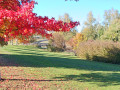
(1) At the end of the pond, leave the path round the pond by taking a path on the right, just before two concrete benches (PR® signposting). Cross a path, then further on, a road. Go down the steps. At the next junction of paths, continue straight ahead, towards “Étang de la Broce” (spelling differs from that on the map). Cross a meadow and arrive at a junction where several paths meet.
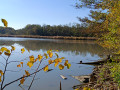
(2) Head towards “Collégien” and walk round the pond on the left along the embankment. Do not walk all the way round the pond, but continue along a tree-lined, straight dual-lane path that runs parallel to it. You’ll come to a low wall; climb over it into the open space, then veer slightly left to cross the RER railway line. Cut across a small tarmac road to enter a landscaped green space. Continue along the path, which emerges at the corner of the fence; exit and turn left along the road that runs alongside the motorway.
(3) Pass under the motorway, follow the road for 200 m, then turn left onto the tarmac road. About 500 m further on, take the path branching off to the right at the edge of a wood. You’ll come to a tarmac road; turn left, walk past an interesting building (a former factory and mill?) then turn right into the car park at the entrance to Taffarette Park. Walk along the edge of the pond, then turn left to go round the church; you might also want to pop a little further on to treat yourself to a pastry at the bakery.
(4) Return to the church and continue round the pond. On the other side, roughly halfway along the pond, do not turn left (towards “Allée des Lions”) but carry on straight ahead. Join the tarmac road and follow it to the left. Pass the sports grounds and arrive at the Taffarette Totems: seven monumental works sculpted by the artist Daniel Stinus from the trunks of sequoia trees felled by the storm of 1999
(5) Carry on until you reach the Allée des Séquoias, turn left, then after 300 m take a dirt track running along the edge of the field on the right. As you approach the D471, the track turns left and follows it for about 100 m before crossing.
(6) Cross the D471 with care, then take an old tarmac road on the left, followed by the first track on the right. Cross a track, then, about 250 m further on, turn left onto a track at plot 193, marked on an oak tree. At the crossroads, take the fifth path/track – the least obvious one – which heads off to the right at 135°.
(7) When you reach a junction of wide paths (Carrefour du Pas du Cheval), turn left at 135°, onto the tarmac track, until you reach the Carrefour de la Ferrandière and its picnic area.
(8) Take the second track on the right (behind the picnic area). After 150 m, turn right onto a path that is unmarked, except for forestry markers. Cross a track, then further on turn right and reach a lovely track.
GRP® yellow-red markings
(9) Turn right, then immediately left: GRP® signposting. Follow this zigzagging path. At the junction, turn left. Cross a track and arrive at the Mare du Cormier: veer left after the pond to reach the bridge leading to the single picnic table in the centre of the circular ditch.
(10) Return to the path and continue along it to the left. Pass a small pond on the right and cross a track. 200 m further on, take a faint path on the right (but signposted), then the first path on the left, then the second on the right.
(11) At the next junction, turn left, then pass under the high-voltage power lines. 100 m further on, at a star-shaped junction, head straight ahead, slightly to the right. Pass two junctions of footpaths, then arrive at a third junction.
Unmarked
(12) Leave the GRP®, veer to the right, then after 200 m veer completely to the left. Cross a track and arrive at a junction (large stockpile of firewood). Turn right onto the track furthest to the left (several site tracks). You are now on a track that follows a gas pipeline (small yellow caps on poles). After about 250 m, you’ll reach a junction with a lovely lane on the right.
(13) Take this straight-ahead lane for about 800 m, until you reach a path on the left (not shown on the map). Follow this path, which is sometimes little more than a faint track passing through small clearings. You’ll reach the edge of the housing estate.
(14) Take the path on the left, which runs alongside the housing estate’s fences. You are now on the edge of the Vieil Étang de Beaubourg, which comes into view a little further on through the branches. At the corner of the pond, continue to the left to walk along the embankment (PR® signposting). After 200 m on the embankment, head down to the right along a slightly steep path. Head back up the opposite side until you reach a tarmac road; follow this between schools and sports grounds until you reach a small triangular green space at a junction.
(15) Cross the green space heading north. At the far end, follow the lovely tree-lined avenue, keeping slightly to the left. Go round the semi-circular roundabout on the right, cross the road to reach the footpath/cycle path on the other side. Take this path on the right. At the Étang de Croissy.
(16) Turn left towards the motorway bridge.
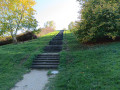
(17) Go under the motorway bridge and take the path on the left. At the fork, turn left. About 100 metres further on, take the flight of steps on the left to climb up the hill. At the top, turn right towards the heritage orchard (in season, there are excellent apples to taste). Enjoy the view over Marne-la-Vallée, walk round the orchard, then head back down towards the foot of the steps.
(18) As soon as you reach the tarmac track, continue to the left, skirting the pond. Cross a road, walk alongside a second pond, until you reach a path leading off to the right towards a bridge spanning the water to an island.
(19) Option: shortcut via the bridge: carry on straight ahead and Torcy station is 300 m away (RER A and coach station).
Alternatively, carry on straight ahead along the edge of the pond. At the end, cross a road, go under the RER line, then walk along the wall of the police station on the opposite side. Turn left along the street and cross at the traffic lights towards the Lycée Emily Brontë. Turn right and cross the road to reach the far end of the Étang de Maubuée.
(20) Walk along the left bank of the pond. Cross a road, continue straight ahead, then walk alongside the Étang des Ibis. At the end, turn left to reach Lognes station (E).
 Visorando Member
 Moderate
 Easy
 Tourist office