Country:

 City:


(S) From the village of Borée, take the road leading to Saint-Martin de Valamas (D215) and follow it for nearly 2 km. Although you’ll be on a tarmac road, this section is downhill and not very busy, and the view isn’t half bad. You’ll reach a hairpin bend above the hamlet of Prévenchères.
(1) Leave the road and take the forest track that starts on the right. The path winds its way under the canopy of trees, cutting across the hillside overlooking the Eysse, the stream flowing a few dozen metres below. The track presents no difficulty as the gradient is very gentle all the way to the Coin de la Scie, which you reach after 2 km. The entire ascent is dominated by the Suc de Sara, whose dark mass rises on the other side of the valley.
(2) After narrowing, the valley splits in two as you reach the Coin de la Scie. Cross the bridge over the stream and turn right onto the track that begins the climb up the opposite slope. The track climbs rapidly, following several hairpin bends through the forest, before skirting the mineral outcrops of the Rocher des Pradoux from below. A little further on, the track crosses the stream, taking a tight hairpin bend to the left.
(3) Climb up the opposite slope, and at the next hairpin bend, let a track branch off straight ahead and turn sharply to the right. The track continues to climb the slope, making two further hairpin bends.
(4) At the flat section, where the track crosses, turn right. Continue along this track, which remains level until it joins the D378.
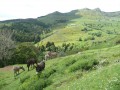
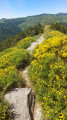
(5) Cross the road to rejoin the footpath on the other side. Let the track continue straight ahead and take the path that branches off to the right, running alongside the tarmac road for about a hundred metres before reaching a fence fitted with a gate for walkers. From this point, the path climbs briskly up the slope, following the edge between woodland and meadow, until it crosses the Montouse ridge. Another gate allows you to leave the mountain pasture, and shortly afterwards, you’ll come out onto a cross-country path.
(6) Turn right and follow this path until you rejoin the D378, which has gone round the hill.
(7) Cross the road, continue along the path opposite – which also runs alongside a wooded edge – and rejoin the departmental road. Cross it and continue straight ahead. About 100 m further on, let the road climb towards the Clède farm, which dominates the landscape a few hundred metres to the left, and turn right onto a winding track that leads into the forest. After a final bend, a straight stretch of the track takes you back to the edge of the woodland just above La Clède.
(8) Continue along the track which climbs after a right-hand bend. This track alternates between wooded sections and open meadows, whilst continuing to climb gently towards the edge of the Cirque des Boutières. As you pass, ignore a large open area on the right where the ruins of old mountain barns are scattered. Only the Fonteysse farm appears to still be in use. Let the track leading to it carry on straight ahead and continue climbing gently to the left. Less than 200 m after the fork, you’ll reach the ridge above Fonteysse.
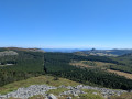
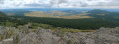
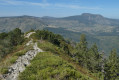
(9) The path continues straight on through a landscape of moorland, whilst you leave the Chaulet hilltop on your left. You’ll arrive in a more wooded area and come to a cross-path. Follow it to the right and, very soon afterwards, you’ll reach the Roches des Cuzets, which offer the first views of the Cirque des Boutières. On reaching the cliff, turn left and follow the path that runs along its edge. As you go, take in the views from several vantage points, which offer glimpses of much of the route from the previous stage.
(10) Once past the last viewpoint, the path moves slightly away from the precipice, returning to a very pleasant forest trail. The proximity to the car park has made this section of the path very busy. You’ll emerge onto the road at the Col de la Croix de Boutière, the end of this stage and of this journey (E).

 Visorando Member
 Easy
 Association / Club / Walk leader
 Difficult