The ‘Two Sara’ Route

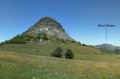
The knoll of Sara is accompanied by a lower peak, but of identical shape. From there, it is customary to refer to the “big Sara” and the “little Sara”. This route takes you up both peaks and involves sections off the beaten track.
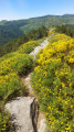
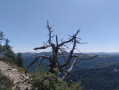
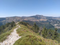
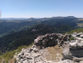
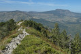
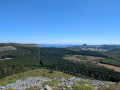
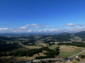
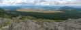
The ascent of the ‘Little Sara’ takes you through particularly wild terrain, and both peaks offer unique panoramic views of the Upper Ardèche, Mont Mézenc and the Gerbier de Jonc.
The GPX track is essential for this route.

Details

24797700
Creation:
Last update:
Last review:
  • Walking
    Activity: Walking
  • ↔
    Distance: 5.05 mi
  • ◔
    Average duration: 3h 50 
  • ▲
    Difficulty: Difficult

  • ⚐
    Back to start: Yes
  • ↗
    Ascent: + 1,693 ft
  • ↘
    Descent: - 1,722 ft

  • ▲
    Highest point: 4,987 ft
  • ▼
    Lowest point: 4,042 ft

Photos

Description of the walk

Park on the hard shoulder by the D378.

(S/E) Take the track heading north, which descends and enters the woods. After three bends, it heads due east and reaches a crossroads.

(1) Let the track descend to the left and carry straight on along a wide path. After a few metres, continue straight on, ignoring a path branching off to the right, and begin a descent leading to a three-way junction.

(2) Take the middle path, which follows the contour line roughly, then, after about a hundred metres, take a grassy path slightly to the right, leaving the main path which leads to a pass that you will reach after climbing the “Petite Sara”. The path passes beneath the cliff and offers the first views of the Gerbier de Jonc. Cross a scree slope and, about 100 metres further on, look out for green and white markings painted on the trees in the beech forest on the left, which mark the boundary of the forest plot.

(3) From there, head up to the left, straight through the forest, following the green and white markings to exit the forest and reach the ridge. Once on the ridge, head up to the left (north-west), following the white markings on the rocks more or less closely. From there, reach the summit (elevation 1424 on the IGN map). Continue along the ridge, carefully following the white markings, which leave the ridge to the right at one point (marked by a cairn). Descend straight down the slope, re-enter the forest and reach a pass.

(4) At the pass, head down to the right (north) and, after a few metres, ignore a path that follows the valley line; instead, take another path on the left which begins the descent, leaves the forest and joins a track at another pass.

(5) Head down to the right along this track, which is joined on the right by another track. Continue for a few more metres past this junction.

(6) Take a path on the left which climbs over scree (marked by a cairn), cutting across the original track. This path climbs through the woods to two cairns which indicate that you should leave it.

(7) Turn right onto a well-marked path and climb gradually through a landscape alternating between scree slopes and trees or shrubs. This will take you to the ridge. Climb to the left, following the ridge to the summit of the knoll of Sara (the ‘Great Sara’). Continue along the ridge to descend to the 1355-metre contour on the IGN map, where you’ll find a cairn and a well-marked path crossing the scree slope.

(8) Take this path on the left, which crosses the scree slope and a small copse before reaching the meadows. From there, return to the pass you encountered earlier.

(5) Follow the track to the right, which climbs gently at first and then more steeply. The track joins a wider one at a hairpin bend.

(9) Take the branch on the left which climbs, makes two hairpin bends and joins the original junction at the start of the walk.

(1) Continue climbing to the right to reach the car park (S/E).
Waypoints

  1. S/E : mi 0 - alt. 4,590 ft - Parking on the hard shoulder beside the D378 - Aigue Nègre (ruisseau) - Affluent de la Loire
  2. 1 : mi 0.52 - alt. 4,455 ft - Junction of the first circular loop
  3. 2 : mi 0.65 - alt. 4,383 ft - Three-way junction
  4. 3 : mi 1.2 - alt. 4,242 ft - End of path
  5. 4 : mi 1.53 - alt. 4,426 ft - Pass
  6. 5 : mi 1.76 - alt. 4,229 ft - Pass. Junction of the 2nd circular loop
  7. 6 : mi 2.16 - alt. 4,049 ft - Path on the left
  8. 7 : mi 2.24 - alt. 4,127 ft - End of trail
  9. 8 : mi 3.33 - alt. 4,455 ft - Cairn
  10. 9 : mi 4.07 - alt. 4,278 ft - Lacet. Junction of three tracks
  11. S/E : mi 5.05 - alt. 4,590 ft - Parking on the hard shoulder beside the D378

Notes

This route is difficult both due to the terrain (rocks, vegetation) and the difficulty in finding your way between (3) and (4) (no path), which accounts for the hike’s ‘difficult’ rating. A fragile cairn is located at (3), above the path; please reinforce it as you pass. The climb up to the ridge after (3) requires careful observation, as progress through the thorny, creeping bushes is difficult.
Duration, including stops: 5 hours
Sturdy footwear is essential.
Please ensure you close the gates for the livestock properly.

Reviews and comments

3.9 / 5
Based on 3 reviews

Reliability of the description
4 / 5
Ease of following the route
3 / 5
Route interest
4.7 / 5
laurent.carraro
laurent.carraro

Thanks for the advice.
I don't know what else to say in the description to emphasise that there are no markers.
Hence the need for the GPX file.
Kind regards,

Machine-translated

KJM
KJM

Overall rating : 4 / 5

Date of your route : Aug 02, 2025
Reliability of the description : ★★★★☆ Good
Ease of following the route : ★★★☆☆ Average
Route interest : ★★★★★ Very good
Very busy route : No

Great hike, but it could do with a bit more signposting.
From up there, you can almost touch the sky.
The view is magnificent.
It took us an extra hour with a 30-minute break for a tasty snack.

Machine-translated

aglaee
aglaee

Overall rating : 3.7 / 5

Date of your route : Nov 01, 2024
Reliability of the description : ★★★★☆ Good
Ease of following the route : ★★☆☆☆ Disappointing
Route interest : ★★★★★ Very good
Very busy route : No

Take care on the climb up to the knoll – don’t follow the path but turn off quickly.
The route is not signposted.

Machine-translated

ludovic.sauvajon
ludovic.sauvajon

Overall rating : 4 / 5

Date of your route : Sep 10, 2023
Reliability of the description : ★★★★☆ Good
Ease of following the route : ★★★★☆ Good
Route interest : ★★★★☆ Good
Very busy route : No

A pleasant route with plenty to see once you reach the summit.

Machine-translated

Other walks in the area

For more walks, use our search engine .

The GPS track and description are the property of this route's author. Please do not copy them without permission.