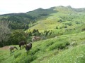
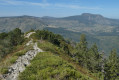
Mont Mézenc as seen from Borée

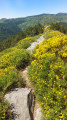
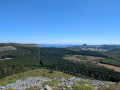
A lovely alternative for climbing Mont Mézenc with this day-long walk. The route passes through ancient villages and stunning landscapes, including the famous Cirque des Boutières. Part of the route is through woodland and is very pleasant.
Do remember to arrange for a car to be waiting at the finish, at the Croix de Peccata.

Details

269556
Creation:
Last update:
Last review:
  • Walking
    Activity: Walking
  • ↔
    Distance: 8.22 mi
  • ◔
    Average duration: 5h 45 
  • ▲
    Difficulty: Moderate

  • ⚐
    Back to start: No
  • ↗
    Ascent: + 2,224 ft
  • ↘
    Descent: - 919 ft

  • ▲
    Highest point: 5,748 ft
  • ▼
    Lowest point: 3,658 ft
  • ⚐ Country: France
  • ⚐
  • ⚐ City: Borée (07310)
  • ⚑
    Start: N 44.896539° / E 4.247589°
  • ⚑
    End: N 44.916015° / E 4.178557°
  • ❏
    IGN map(s): Ref. 2836OT
  • Hour-by-hour weather

Photos

Description of the walk

To reach the car park, head for Borée. In the village, take the D738 towards Chanéac (signposted, though not very visible if you’re approaching from the south). About 1 km from the centre, you’ll see a statue of the Virgin Mary overlooking the village and a large car park.

(S) To start, look out for the Chier (pronounced ‘tchière’), a pile of around 70 stones set just at the edge of the path. Take the path that descends to the left (west-north-west) towards the village. Join the road and follow it to the left to reach the village centre.

(1) Opposite, take a narrow little street. On the left, on a guttering about 1m high, you’ll see a Yellow Cross and a Red Cross (this is to warn those following theGR® de Pays not to confuse it with the path we’re about to take). Take this path; 200 metres further on, leave the track leading up to the Roches de Borée on your left. Walk for about 1 km through woodland and meadows until you reach a main track.

(2) Take the path straight ahead. You’ll enter the forest at a place called l’Escupier. On your right, you’ll see a farm and some yurts. A little further on, you’ll come to a Y-junction.

(3) Take the right-hand branch, which climbs only slightly (the left-hand one climbs steeply). Continue along the side of the valley (on the right bank of the Saliouse) for about 2.5 km. You’ll reach the farm at the hamlet known as Le Rachet. Occasionally, livestock graze on the paths (as the electric fences run alongside them...). There are few residents in this hamlet, but there are dogs – rather unwelcoming, though they are chained up. Leave the track and continue to the right, heading north-east, until you reach the D410 road, then follow it to the right for about 600 metres.

(4) Leave the road and turn sharply left to continue along a path, theGR®73, which has a fairly steep section before joining the D400 road. Follow it straight on until you reach the Croix de Boutières.

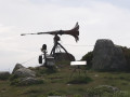
(5) You’ve reached civilisation with a car park; this is also the starting point for short walks to Mezenc. Make the most of the nearby orientation table. Leave the road and set off on the final north-north-easterly climb; the path is well marked, slightly different from what’s shown on the maps, but you can’t go wrong.

(7) Just before the twin-peaked summit, you’ll pass a signposted path on your left – you’ll take this later on. Head up to the right towards the clear, unobstructed summits of Mont Mézenc and enjoy the view.

(6) From the summit, you can begin the descent to the junction, which you’ll recognise.

(7) Take the path opposite, then follow this lovely, wide forest lane which leads to the road (D274) at the Croix de Peccata (E).

Waypoints

  1. S : mi 0 - alt. 3,868 ft - Vierge, car park at the starting point
  2. 1 : mi 0.48 - alt. 3,806 ft - Village, school
  3. 2 : mi 1.24 - alt. 3,661 ft - Path junction
  4. 3 : mi 1.74 - alt. 3,776 ft - At the fork in the road, turn right
  5. 4 : mi 4.12 - alt. 4,383 ft - Leave the road to join the GR
  6. 5 : mi 5.66 - alt. 4,948 ft - Orientation board - Col de la Croix de Boutières (1502m)
  7. 6 : mi 6.98 - alt. 5,732 ft - Summit of Mont Mézenc and orientation board - Mont Mézenc
  8. 7 : mi 7.61 - alt. 5,466 ft - trail junction
  9. E : mi 8.22 - alt. 5,148 ft - Croix de Peccata

Notes

Do remember to leave a car at the end of the route, at the Croix de Peccata.
There is no water along the route, apart from at Borée at the start and at two farms along the way.

Worth a visit

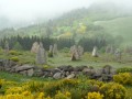
Visit the village of Borée, as well as the drystone shelters. Enjoy the views and the two information boards at the Croix des Boutières and Mont Mézenc.
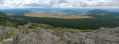
The cliff face of the Cirque des Boutières is what remains of the crater of an ancient volcano.
The walk took us to the bottom of the cirque, then up its slopes.

Always be cautious and plan ahead when you're outdoors. Visorando and the author of this route cannot be held responsible for any accidents occurring on this route.

The GR® and PR® markings are the intellectual property of the Fédération Française de Randonnée Pédestre.

Reviews and comments

4.4 / 5
Based on 3 reviews

Reliability of the description
4.3 / 5
Ease of following the route
4.3 / 5
Route interest
4.7 / 5
Maryma
Maryma
• Edited:

Overall rating : 4 / 5

Date of your route : Aug 18, 2026
Reliability of the description : ★★★★☆ Good
Ease of following the route : ★★★★☆ Good
Route interest : ★★★★☆ Good
Very busy route : No

Further information regarding the following description: “You arrive at the farm in the hamlet known as Le Rachet. Sometimes livestock graze on the paths (the electric fences run alongside the paths...). In this hamlet, there are few residents, but there are dogs – rather unwelcoming, though they are chained up. Leave the path and continue to the right, heading north-east...”
At Raffet Farm, the dogs are still there, and so are their owners. The owners of the property absolutely do not want walkers to go round their farm and continue to the right through their field. It is private property. You should not turn right but carry on straight ahead to the hamlet of Le Cros. On leaving the hamlet, turn right onto the
D410 road. Personally, I turned left a few metres further on at Chanteduc. This shortens the route slightly but, more importantly, reduces the length of the tarmac road.
The GPX file for my route, which goes as far as Les Estables
https://www.sitytrail.com/fr/trails/4971...

Machine-translated

jean marcz2017
jean marcz2017

Overall rating : 4.7 / 5

Date of your route : Sep 27, 2021
Reliability of the description : ★★★★★ Very good
Ease of following the route : ★★★★☆ Good
Route interest : ★★★★★ Very good
Very busy route : No

We did the round trip in a day, and at the Croix de Boutières it’s well worth taking a short detour along the GR 7 (10 mins) to the viewpoint over the Cirque de Boutières, where there’s an information board and a magnificent view

Machine-translated

flor
flor

Overall rating : 4.7 / 5

Date of your route : Jul 26, 2017
Reliability of the description : ★★★★☆ Good
Ease of following the route : ★★★★★ Very good
Route interest : ★★★★★ Very good

A lovely walk, very pleasant as it’s not at all difficult, with magnificent views and very few people, except on the Mézenc.

The route description is very thorough; we only got a bit confused at Borée, at the start, before we managed to follow the directions.
We carried on as far as Les Estables, where we spent the night before setting off again towards Mont Gerbier de Jonc.

Machine-translated

Other walks in the area

For more walks, use our search engine .

The GPS track and description are the property of this route's author. Please do not copy them without permission.