Country:
 City:
City:



PR® (yellow markings)
(S) At Fontenay-le-Fleury / Bois d’Arcy station, take the Bois d’Arcy exit. Walk up the ramp to a junction.
GR® (red and white markings)
(1) Turn right onto the path running alongside a fence on your left, then continue until you reach the road. Follow the road towards Bois d’Arcy until you reach the junction with two streets coming from the left (Gabriel Péri and Raymond Falaize). Cross them in turn, then, at the traffic lights, cross the main road, Rue Alexandre Turpault. Follow it to the left, then walk alongside the prison until the next junction.
(2) Turn right onto Allée Jean Moulin. Pass a fire brigade access road on your left, then head towards the entrance to the Charles Simon Sports Centre. Go round it on the right along a tarmac path (tennis courts on your right). Go behind the hedge and follow it on your right before passing to the right of a prefabricated building. Turn right onto a tarmac path, until you reach a wooded park. Leave this behind and turn left to follow the path running alongside the woodland on your right. Pass through a wooden gate, then walk alongside private properties until you reach a junction.
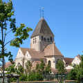
(3) Turn left onto a footpath, cross a street, then continue straight ahead until you reach a Fork in the road. Turn right, walk alongside a pond until you reach the Allée des Chevreuils. Take this to the left, cross Rue Hoche, then continue straight ahead along Rue Perdreau. Turn left onto Avenue Toulouse-Lautrec and walk alongside the Frédéric Mistral School. At the end of the building, turn right onto a concrete path, which then becomes stony, until you reach a small square lined with blocks of flats. Turn right to join Rue Robespierre, then right again until you reach a junction. Continue straight ahead along Rue de Suffren, which runs alongside the rear of Saint-Gilles Church. Carry on in the same direction at the next two junctions until you come to a pedestrian and cycle path.
(4) Take Promenade Arcisienne to the right, alongside a hedge, then onto a cobbled path (keep to the right of the metal posts). Further on, turn into a small wooded area slightly to the left, then take the path leading to the right, towards a flight of steps. Climb the steps, then turn right onto Rue Gary Cooper. Cross the Rigole des Clayes, then turn left alongside the blocks of flats. Cross Rue Marcel Carné. Turn left, then immediately right, until you reach Avenue Fritz Lang. Turn left onto it, then turn right just before the Maison des Associations Lino Ventura. Continue until you reach a wooden footbridge and cross the water via it. On the other bank, turn left, then head down onto the wooden jetty to walk alongside the canal. Continue in this direction until you reach Rue Viviane Romance. Turn right onto this street until you reach the pedestrian crossing. Cross the road to take the path opposite, heading towards the forest. Pass by a viewing point, continue until you reach a fence that curves to the left, and cross the water channel.
(5) Take the path that branches off to the right into the Bois d’Arcy State Forest (signposted). Carry on straight ahead until you reach a crossroads. Turn right onto a track, the Route Forestière du Milieu, until you reach the Carrefour des Trois Frères (three trees at the centre of a triangle of paths). Follow the GR® to the left for about 170 m.
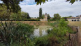
(6) Just after the Route Forestière de Bordure joins on the left (signposted), take a clearly visible path on the right which, after about 125 m, branches off to the left and heads downhill. Carry on, ignoring any side paths, until you reach a wooden gate. Leave it on your right and head towards a wall, before walking alongside the fences bordering the properties. Continue along this path as it bends to the right, until you reach a junction. Take the path on the left, then turn right at the next two junctions. Walk alongside a stream, cross it via a footbridge, then leave the park. Continue straight on until you reach Rue du Stade. Follow it for a few metres, then turn left onto Rue des Nymphéas. Go round the roundabout on the right and enter Parc de Diane at the second metal gate. Go round a house on the right, climb the hill, then walk alongside the fence protecting the Arbre de Diane (a notable tree – information board on site).
Off the marked route
(7) Walk along the fence until you reach a junction. Turn left, leaving a pond on your right-hand side. Continue straight ahead along a path lined with tall trees, then walk past the cottages on the left until you reach a junction. Turn right behind the metal gates, then left at the first junction. At the next junction, take the wide path that leads up into the forest. Cross the Route Forestière des Clayes, then carry on straight ahead to reach a second lane. Cross this too, then take the very wide lane opposite. Carry on straight ahead, passing the Rigole des Clayes, then the Chemin de la Butte de la Cranne, before gradually descending along a narrower path to a T-junction (do not take the track – not shown on the map – which heads down towards the buildings).
(8) Turn right onto the path which continues along a ledge, ignoring the first junction.
GR® (red and white markings) (shown on the ground but not on maps)
At the next junction, take the path which descends steeply to the left down to the Ru Maldroit. Turn right onto the track that runs alongside the stream, bordering the properties. Continue straight on, ignoring all side paths, until you reach a fork in the road in a developed area. Take the wide path on the right, which gradually approaches the Bois de la Cranne Reservoir. Walk alongside the reservoir on your left, then head back up towards the Route des Deux Plateaux (D30). After a few steps, turn right, walk alongside the road on the pedestrianised area running along the fence and climb up to a footbridge.
(9) Cross over the road, then head back down the other side via a first set of steps. Pass a wide path, then cross the car park diagonally to the right. Head towards the car park exit for a few metres and go down the wooden staircase on the left until you reach the first path.
Unmarked
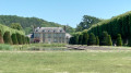
(10) Continue down to the lower path, near a stone wall. Turn left and follow the wall until you reach a small opening leading into the grounds of Plaisir Castle (if this is closed, see 10bis). Enter the grounds, then turn left to reach, on the right, a wide grassy path leading towards the château. Follow it up, passing the château on your right, until you reach the next junction, which marks the start of the pond. Turn right until you reach the junction on the other side of the pond.
- Alternative route if the park entrance gate is closed. Retrace your steps, walking along the park wall on your left, until you rejoin the GR® path, which turns left before running alongside a field on your right, then past an equestrian centre, until you reach Rue de la Bretechelle. Turn left, then left again at the next junction. After the car parks, pass between the village hall buildings, then take the path on the right, walking alongside the side of the castle to reach, at the next junction, the start of the pond.
(11) Turn left to walk along the right-hand side of the pond. At the very end of the path, turn left. Continue in this direction until you reach the entrance to the wooded area. Enter the woods, keeping the outer wall of the park on your right, until you reach a clearing. Turn right to leave the park via the pedestrian gate. Cross Rue François Coppée to reach, on the opposite side, a path leading into the undergrowth. At the Fork in the road, turn right and carry on, ignoring any side paths, until you reach Rue Jules Régnier (wooden gate), then crossthe road.
(12) Continue to the right along a wire fence, pass through a wooden gate, then pass under the first high-voltage power line. Carry on between the two high-voltage power lines until you reach a wide avenue, Route de Plaisir, marking the entrance to the Forêt de Sainte-Apolline (signs). Turn left onto this road until you reach the Carrefour du Château Reyson. Take the second path on the right, then continue straight on for about 1.7 km until you reach a clearing on the right (about 590 m after the Carrefour de la Table Ronde). Turn right onto the wide path that crosses the clearing, until you reach the next crossroads.
GR® (red and white markings)
(13) Continue along this path, ignoring the side tracks, until you reach the edge of the forest. Cross Rue de Villancy coming from the right, then follow Avenue de la République to the next junction (car park on the right-hand side). Cross the avenue and take Chemin Pierreux (a cul-de-sac). After a zigzag, enter the woodland to the left of a gate. At a junction, take Chemin de Bricassard to the right (wire fence on the left) until you reach Route de Chevreuse.
(14) Turn right. At the junction, ignore the road branching off to the right and, a few metres further on, take the Sente de la Fontaine, which runs to the right between a house and a stone wall. After a bend, you’ll reach Rue de la Gouttière. Follow it to the left for 280 m and climb the steps to Grande Rue (cobbled). Follow it to the right, then turn left into a passageway, Rue Traversière. Continue straight on, past Saint-Nicolas Church, until you reach the next junction.
(15) Turn left, take the pavement on the right which goes round the car park, then cross the car park and turn right onto a flight of steps behind a low stone wall. Take Rue du Vieux Château to the right as far as the junction, then turn left onto the path which runs behind a house, before reaching a flight of steps. Cross the Route de Saint-Germain and continue straight ahead along the Sente de l’Orme Imbert, behind a hedge. Go down the steps, then stay on this path, ignoring all side paths for about 700 m, until you reach a wooden gate.
Unmarked section
(16) Turn right onto a small street, which continues as a path behind metal gates, to the right of a property. At the top of the hill, at the junction, turn left and go round a cemetery on the right before joining the Sente des Jardins, behind Saint-Frédéric Church. Walk down the street to the junction, then take the street on the right under the archway. Turn left onto Rue Charles de Gaulle and, after about 170 m, turn left onto Sente des Écoles. At the car park, walk down to Rue des Sablons.
(17) Take the street on the left, pass a street branching off to the right, then, after about 120 m (pedestrian crossing), cross the road to take the footpath that starts behind a metal gate, before walking alongside a school. You’ll come out into a housing estate on Rue Mozart. Walk down it to the junction, then continue straight ahead into a small lane. At the T-junction, take Rue Beethoven on the right until you reach the junction with Rue des Deux Neauphle. Turn right, pass the junction with Rue de la Vierge and continue downhill. Near the railway bridge, turn right onto Rue de la Gare. Follow this road up to the entrance to the car park at Villiers–Neauphle–Ponchartrain station (E).
 Local authority
 Easy
Easy  Visorando Member
 Moderate