


Refine your search for walks in Blieux
Blieux walks


 Circular walk from Blieux to the Mont Chiran Observatory
 Visorando Member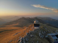
 18.58 mi
 +5,262 ft
 -5,253 ft
 2 days
 Difficult
 Departure from Blieux (Alpes-de-Haute-Provence)
A magnificent, challenging and scenic two-day circular route in the heart of the Verdon Regional Nature Park, starting from the village of Blieux.
The route takes you along the ridges and iconic summits of the massif: the Mourre de Chanier (1,930 m), the Petit Mourre (1,873 m), the Grand Mourre (1,898 m), the Mont Chiran Observatory (1,905 m), then the Hauteur (1,777 m) and the Col de Reibert (1,464 m).
You’ll enjoy 360° views of Lake Sainte-Croix, the Verdon, the Mercantour peaks and the vast expanses of the Verdon. An ideal hike for a wild camp in the heart of nature, amongst airy ridges, scree slopes and pastoral trails.
From Blieux to the Mont Chiran Observatory via the Mourre de Chanier
10.30 mi
+4,626 ft
-1,542 ft
8h 45
 Very difficult
Departure from Blieux (Alpes-de-Haute-Provence)
Very difficult
Departure from Blieux (Alpes-de-Haute-Provence)
First stage of the circular route from the village of Blieux to the Mont Chiran Observatory. You’ll climb gradually towards the ridges to tackle the day’s peaks: the Mourre de Chanier (1,930 m), the highest point of the stage, the Petit Mourre (1,873 m) and the Grand Mourre (1,898 m), before reaching the Mont Chiran Observatory (1,905 m). The panoramic views stretch out over Lake Sainte-Croix, the Verdon and the surrounding mountain ranges, including the Mercantour. Arrival at the observatory marks the end of this first day, with a welcome water source for the campsite.
Le Chiran via Blieux
 9.42 mi
+3,028 ft
-3,031 ft
7h 00
9.42 mi
+3,028 ft
-3,031 ft
7h 00
 Average
Departure from Blieux (Alpes-de-Haute-Provence)
Average
Departure from Blieux (Alpes-de-Haute-Provence)
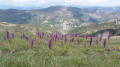
Climb Chiran via another route, starting from the village of Blieux. You will reach the Chiran observatory after a beautiful 1,000 m climb through vegetation typical of the Southern Alps. In spring, this hike is beautiful with its colourful orchids on the plateau. At the summit, there is a magnificent 360° view. This hike is not technically difficult and is very easy to navigate.
From the Mont Chiran Observatory to Blieux
 8.28 mi
+636 ft
-3,711 ft
4h 20
Average
Departure from Blieux (Alpes-de-Haute-Provence)
8.28 mi
+636 ft
-3,711 ft
4h 20
Average
Departure from Blieux (Alpes-de-Haute-Provence)
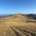
Second stage of the circular route from Blieux to Mont Chiran. You leave the Mont Chiran Observatory and follow the ridges northwards towards L’Hauteur (1,777 m), the day’s highest point. After taking in the views of the Mercantour and the Observatory, you’ll gradually descend towards the Col de Reibert (1,464 m) and then follow the long stony track back to the village of Blieux. A day with a gentler elevation gain, but still very open and offering a change of scenery, which brings this tour of the Verdon peaks to a magnificent close.
The Mont Chiran observatory
 6.24 mi
+2,126 ft
-2,133 ft
4h 45
Average
Departure from La Palud-sur-Verdon (Alpes-de-Haute-Provence)
6.24 mi
+2,126 ft
-2,133 ft
4h 45
Average
Departure from La Palud-sur-Verdon (Alpes-de-Haute-Provence)
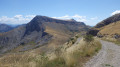
A pleasant hike in a beautiful setting with no difficulties. Just for relaxation.
This hike complements the Portail de Blieux hike described on the website.
Le Pavillon
 8.79 mi
+1,493 ft
-1,522 ft
5h 20
Average
Departure from La Palud-sur-Verdon (Alpes-de-Haute-Provence)
8.79 mi
+1,493 ft
-1,522 ft
5h 20
Average
Departure from La Palud-sur-Verdon (Alpes-de-Haute-Provence)
A visit to a small peak overlooking Lake Sainte-Croix and the Valensole plateau.
Senez - La Clappe
11.85 mi
+2,703 ft
-1,837 ft
7h 50
Difficult
Departure from Senez (Alpes-de-Haute-Provence)
Route Napoléon via theGR®® 406 - Stage 5/6: Senez - La Clappe.
At the foot of the Cadières de Brandis via the Chapelle Saint-Jean
 7.54 mi
+1,535 ft
-1,542 ft
4h 50
Average
Departure from Castellane (Alpes-de-Haute-Provence)
7.54 mi
+1,535 ft
-1,542 ft
4h 50
Average
Departure from Castellane (Alpes-de-Haute-Provence)
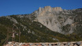
Chasteuil, like Villars-Brandis, is a hamlet nestled at the foot of the Cadières de Brandis cliffs. Initially abandoned in the early 20th century, it has been revitalised since the 1970s.
This walk stays at a high altitude, following a path that runs almost entirely along a ledge above the Verdon.
The tiny Saint-Jean Chapel offers a magnificent view of the Cadières de Brandis, and rumour has it that the Templars’ treasure can be found there.
Clue de la Melle
 9.55 mi
+2,126 ft
-2,100 ft
6h 15
Average
Departure from Senez (Alpes-de-Haute-Provence)
9.55 mi
+2,126 ft
-2,100 ft
6h 15
Average
Departure from Senez (Alpes-de-Haute-Provence)
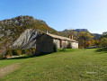
A hike above the Asse Valley offering views of the narrow Melle Gorges and the landscapes of the Alpes-de-Haute-Provence.
You can climb to 1,200 metres, where an isolated chapel on the plateau is the only remnant of a hamlet that was home to great acts of resistance before being destroyed.
Siréniens site at the start of the Col des Lèques
2.50 mi
+276 ft
-262 ft
1h 25
 Easy
Departure from Castellane (Alpes-de-Haute-Provence)
Easy
Departure from Castellane (Alpes-de-Haute-Provence)
Hidden within the Tabori Ravine lies one of the most remarkable sites in the Haute-Provence Geological Nature Reserve. A veritable marine graveyard dating back 40 million years, the Siréniens fossil site contains over two hundred bones of marine mammals closely related to today’s dugongs.
Roman roads of Pays du Verdon
 8.92 mi
+1,348 ft
-1,371 ft
5h 15
Average
Departure from La Palud-sur-Verdon (Alpes-de-Haute-Provence)
8.92 mi
+1,348 ft
-1,371 ft
5h 15
Average
Departure from La Palud-sur-Verdon (Alpes-de-Haute-Provence)
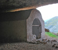
A hike in Pays du Verdon that takes ancient Roman roads, runs alongside an abandoned village and a chapel sheltered by rocks with magnificent landscapes.
The old village of Châteauneuf-les-Moustiers
 1.73 mi
+443 ft
-443 ft
1h 10
Easy
Departure from La Palud-sur-Verdon (Alpes-de-Haute-Provence)
1.73 mi
+443 ft
-443 ft
1h 10
Easy
Departure from La Palud-sur-Verdon (Alpes-de-Haute-Provence)
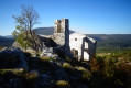
A short walk to the abandoned village of Châteauneuf-les-Moustiers, ideal for a picnic with panoramic views of the Montdenier massif, the heights of the Verdon or the Mourres area.
Châteauneuf-les-Moustiers was abandoned at the beginning of the 20th century. The remaining ruins are impressive in size and number.
 Le Chiran
23.22 mi
+3,950 ft
-3,963 ft
4 hrs
Average
Departure from La Palud-sur-Verdon (Alpes-de-Haute-Provence)
Climb up to Chiran along a track suitable for vehicles, passing through a magnificent forest with a breathtaking view from the observatory. Descend via a very pleasant hiking single track, then along the old Roman road.
Chiran Observatory
 8.39 mi
+3,340 ft
-3,284 ft
6h 45
Difficult
Departure from Majastres (Alpes-de-Haute-Provence)
8.39 mi
+3,340 ft
-3,284 ft
6h 45
Difficult
Departure from Majastres (Alpes-de-Haute-Provence)
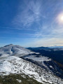
Explore the Chiran Observatory, setting off from Majastre, the least populated commune in the Provence-Alpes-Côte d’Azur region, with just 5 year-round residents.
The Suech Plateau
 5.25 mi
+1,243 ft
-1,243 ft
3h 30
Easy
Departure from Rougon (Alpes-de-Haute-Provence)
5.25 mi
+1,243 ft
-1,243 ft
3h 30
Easy
Departure from Rougon (Alpes-de-Haute-Provence)
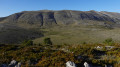
Overlooking the village of Rougon and located at an altitude of over 1,200 metres, the Plateau du Suech offers beautiful panoramic views where, with a little luck, you can admire the griffon vultures of the Verdon.
Rougon via the bridges of Carajuan, Sautet and Tusset, passing through Trigance
 12.36 mi
+3,107 ft
-3,130 ft
8h 25
Very difficult
Departure from Rougon (Alpes-de-Haute-Provence)
12.36 mi
+3,107 ft
-3,130 ft
8h 25
Very difficult
Departure from Rougon (Alpes-de-Haute-Provence)
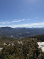
A beautiful circular loop for admiring the Gorges du Verdon in a more intimate way and from different viewpoints. Sumptuous panoramic views of the Grand Canyon and Colle de Breïs and, of course, Point Sublime. A challenging route, well suited to trail runners: it climbs for most of the route but with a reasonable gradient. Then comes a short but fairly steep descent, which proved less difficult than it looked.
Montagne de Robion via the Saint-Trophime Chapel
 9.09 mi
+3,904 ft
-3,907 ft
7 hrs
Very difficult
Departure from Castellane (Alpes-de-Haute-Provence)
9.09 mi
+3,904 ft
-3,907 ft
7 hrs
Very difficult
Departure from Castellane (Alpes-de-Haute-Provence)
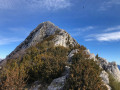
A beautiful hike that takes us to the Saint-Trophime Chapel and the summit for a view of the entire Verdon and the Pre-Alps.
The Samson Corridor tunnels and the Trescaïre towers
 1.74 mi
+2,254 ft
-2,254 ft
2h 45
Easy
Departure from Rougon (Alpes-de-Haute-Provence)
1.74 mi
+2,254 ft
-2,254 ft
2h 45
Easy
Departure from Rougon (Alpes-de-Haute-Provence)
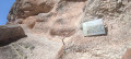
This round trip route takes you to the Samson Corridor, which marks the entrance to the Grand Canyon. It will take you through the tunnels of the Blanc-Martel trail to the Trescaïre viewpoint.The trail follows the Blanc-Martel trail, but is much more accessible and offers a unique experience thanks to the tunnels.The indicated elevation gain, calculated automatically, is incorrect.See the practical information section for details of the minimum equipment required.
Tour de Barbin
 Tourist office
 6.58 mi
+1,752 ft
-1,752 ft
4h 35
Average
Departure from La Palud-sur-Verdon (Alpes-de-Haute-Provence)
6.58 mi
+1,752 ft
-1,752 ft
4h 35
Average
Departure from La Palud-sur-Verdon (Alpes-de-Haute-Provence)
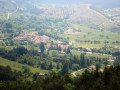
The walk offers beautiful views of the Verdon’s pre-Alpine mountains and features interesting contrasts in vegetation between the sun-facing and north-facing slopes of Barbin.
Bastidon Trail
 10.06 mi
+3,169 ft
-3,143 ft
7h 25
Difficult
Departure from La Palud-sur-Verdon (Alpes-de-Haute-Provence)
10.06 mi
+3,169 ft
-3,143 ft
7h 25
Difficult
Departure from La Palud-sur-Verdon (Alpes-de-Haute-Provence)
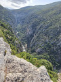
This trail contrasts the scorching heath of the Verdon with the cool, shady forest on the north-facing slopes of Barbin; you will walk through a wild and magnificent landscape.
Chemin du Belvédère de la Dent d'Aire
 4.73 mi
+1,158 ft
-1,175 ft
3h 10
Average
Departure from La Palud-sur-Verdon (Alpes-de-Haute-Provence)
4.73 mi
+1,158 ft
-1,175 ft
3h 10
Average
Departure from La Palud-sur-Verdon (Alpes-de-Haute-Provence)
This route offers remarkable views of the village of La Palud and the surrounding mountains, as well as the Grand Canyon. It is the only trail that provides access to the highest viewpoint above the Gorges du Verdon.
The village of Poil starting from Chabrejas
5.98 mi
+1,184 ft
-1,155 ft
3h 45
Easy
Departure from Senez (Alpes-de-Haute-Provence)
A very beautiful, easy route through ancient lands in the wild lavender country.
A Poil!
 8.87 mi
+1,788 ft
-1,768 ft
5h 40
Average
Departure from Senez (Alpes-de-Haute-Provence)
8.87 mi
+1,788 ft
-1,768 ft
5h 40
Average
Departure from Senez (Alpes-de-Haute-Provence)
A journey to the end of the world, ideal for lovers of nature and tranquillity. And yet we are in the PACA region, in the heart of Haute-Provence, in a wild environment where you can discover the ancient village of Le Poil (in the 19th century, the commune had 350 inhabitants, including more than a hundred in the village).
More walks in Blieux
Select a point of interest below: