Country:
 City:
City:


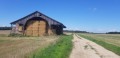
The walk starts from the car park at Place des Tours, opposite Blandy Town Hall. For access by train and bus, see the ‘Practical Information’ section.
(S/E) Opposite the town hall, turn right.
Red and white markings for the GR®1
At the junction, head straight on into Rue Raoul Kourilsky. At the next junction, turn left. Pass the Chemin du Réservoir and then keep right onto the Chemin de l’Aiguillon. Ignore a path on the left and head straight through the fields. Pass the first path on the right. You’ll reach the edge of the motorway.
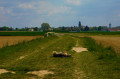
(1) Cross over the motorway and the high-speed rail line. Turn right at the second junction. Pass under the power lines and then walk past the archaeological remains. You’ll reach a crossroads.
(2) Go straight on into the woods, cross the stream. At the end of the path, turn left, away from the bridge and the ford. At the Fork in the road, keep right then turn right onto Rue du Bois Bunet, and continue to the D126.
(3) Cross the road. At the next Fork in the road, head down to the Ru du Goulot and reach the tarmac at a junction.
(4) Cross the road. At the junction, keep left. At the T-junction, turn right. Head downhill opposite the Fork in the road and continue until you approach a bridge.
(5) Cross the Almont then head up onto the tarmac road. Ignore the dead-end on the right. At the end of Rue du Moulin, keep right for 20 metres.
(6) Turn left onto Rue de Melun. Carry straight on until you reach the D215.
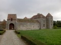
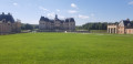
(7) At the Stop sign, turn left and follow the D215 very carefully until you reach the Château de Vaux-le-Vicomte.
(8) Continue along the D215, then turn left and follow the boundary wall of the château grounds to the banks of the Almont.
(9) Follow the river on your left until you reach the D82e2.
(10) Follow it carefully to the left. Go straight on after the bridge. Continue along the one-way street. After number 9, turn right into the alleyway. Pass the small bridge. Climb the steps. Walk along the right-hand side of the small canal until you reach its end.
End of the GR®1 signposting
(11) At the end of Ruelle du Ru, let theGR®1branch off to the right and cross the square diagonally. At the junction of Rue Thiers and Rue du Four, start along Rue de la Bordière and climb the steps on the left. At the top of the steps, walk along the car park on your right and continue straight on to the town hall. Walk past the front of the town hall and turn left. Ignore the hairpin bend to the right. At the small square, keep to the right. Turn left onto Chemin des Hautes Guichardes, and continue to the water tower and a cross-path.
(12) Turn right. Walk along the boundary wall. Cross the D408 carefully and take the path that leads into the fields and eventually joins the D605.
(13) Follow it carefully to the left for 50 metres, then turn left again into the fields. Ignore a path on the right and then another on the left. Pass a detached house. Keep a farm and some houses on your left. Return to the D408.
(14) Cross it carefully . After the copse, take the path on the right until you reach a road. Follow the tarmac to the left until you reach the four-way junction you passed on the way there.
(4) Carry on straight ahead along the tarmac. Go straight on at the three-way junction. After the sewage treatment works, cross the Almont using the footbridge.
(15) Walk alongside the wall on your right. At the top of the hill, turn right onto the one-way street. At the end of Rue Grande, turn left, then take the dead-end road on the right. At the end of the path, turn left and continue to a Fork in the road.
(16) Keep to the left. At the T-junction, take Rue du Centre on the left. Keep to the right at the next two Forks in the road. In the woods, turn left. At the junction, go straight on under the power lines and continue to a T-junction.
(17) Turn right and pass under the high-speed railway line and the A5, then keep to the right at the Fork in the road. The path leads to a road running under the power lines. Follow it to the right for 50 metres, then turn right. Continue straight on until you reach L’Almont.
(18) Cross the bridge. At the next junction, turn left. After No. 16Ter, take a footpath on the left. Pass the Gué de la Planchette by turning right. At the end, turn left onto Rue de la Fontaine. Walk past the château on your left to return to the car park in front of the town hall (S/E).

 Visorando Member

 Moderate
 Easy
Easy