A circular walk from Blandy-les-Tours to Andrezel

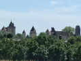
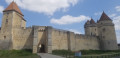
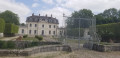
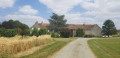
This walk takes you along theGR®1from Blandy-les-Tours to Andrezel on the outward leg. The route passes close to several farms in the Brie Française region and the Château d’Aunoy in the commune of Champeaux.

Details

28797732
Creation:
Last update:
Last review:
  • Walking
    Activity: Walking
  • ↔
    Distance: 15.07 mi
  • ◔
    Average duration: 7h 10 
  • ▲
    Difficulty: Difficult

  • ⚐
    Back to start: Yes
  • ↗
    Ascent: + 236 ft
  • ↘
    Descent: - 249 ft

  • ▲
    Highest point: 331 ft
  • ▼
    Lowest point: 210 ft
  • ⚐ Country: France
  • ⚐ City: Blandy (77115)
  • ⚑
    Start/End: N 48.566757° / E 2.781817°
  • ❏
    IGN map(s): Ref. 2415E, 2416E
  • Hour-by-hour weather

Photos

Description of the walk

The walk starts from the Place des Tours car park, opposite Blandy Town Hall. For access by train, see the practical information.

(S/E) Opposite the town hall, turn right.

Red and white markings for the GR®1

Turn left onto Rue Saint Martin. At the Fork in the road, keep to the right and carry on to the junction. Turn left onto Chemin des Frileux. In the fields, pass under the power lines.

(1) Turn left onto the first path. At the T-junction, turn right. Keep left at the Fork in the road. Then head down the path on the left. Pass the Notre-Dame de Roiblay Chapel.

(2) Carry on straight ahead after the bridge over the River Almont. Cross a track and then pass the oil well. Ignore the hairpin bend to the right.

(3) Go straight on at the junction. Turn left into the dead-end road, then head down the road on the right. Cross the Ru d’Ancœur. Ignore the hairpin bend to the right. At the top of the path, turn left.

(4) Turn right onto the Sentier de la Procession, which runs alongside a power line. At the five-way junction, follow Rue Sarrazin Demaraise to the left. Pass Rue Guillaume de Champeaux, then turn right at the junction.

(5) Walk past the fountain (out of order) then head left until you reach the bakery. Turn right onto Rue Raoul Coutant. Ignore Rue des Champarts and continue to the roundabout.

(6) Take the first exit on the right. After the small square, keep to the left on the tarmac. Walk through the middle of the sheds at the Ferme de Malvoisine and head for a crossroads in the middle of the fields.

(7) Carry on straight ahead until you reach a T-junction. Turn left, ignoring a path on your right.

(8) At the three-way junction, go straight on, then follow the cemetery wall on your left. The path runs alongside a wood before entering the fields. In the hamlet, leave the tarmac road at the fork in the road and, at the crossroads, carefully follow the road to the left.

End of the GR®1 signposting

(9) Leave theGR®1, which veers sharply to the right into the fields. At the Fork in the road, keep to the right, then take the path on the left. Take the first path on the left and, at the crossroads, go straight on along the road.

(10) In front of Mainpincien Farm, continue to follow the D99E carefully to the right. Take the first road on the left. Opposite Ferme des Loges, turn right and walk past the green shed. Pass a path on the left and another on the right.

(11) Follow the tarmac road to the right. At the Stop sign, turn left and, at the Fork in the road, take the one-way street. Turn right into Ruelle du Fossé Maçon. At the end of this, make the first turn left then right.

(12) After the oil well, follow the boundary wall of the Château d’Aunoy on your right until you reach the gate in front of the château’s façade. At the next junction, leave the tarmac by turning left.

(13) Keep the fields on your right until you reach the D47.

(14) Cross the road and head up the hill opposite. Ignore the path on your right and continue along the edge of the woodland. The path descends to a stream.

(15) Follow the Ru d’Ancœur on your right. Cross the D47 again and ignore the Pont Paillard.

(16) At the next junction, cross the stream. Pass a path on your right, then a narrow track on your left. At the Fork in the road, ignore the Ruelle des Clos on the left. Walk to the right of the church and discover the apple press in the middle of the small square. Keeping the castle walls on your right, head towards the town hall (S/E).

Waypoints

  1. S/E : mi 0 - alt. 282 ft - Blandy Town Hall - Château de Blandy
  2. 1 : mi 1.16 - alt. 322 ft - White Cross
  3. 2 : mi 2.11 - alt. 243 ft - Almont (rivière)
  4. 3 : mi 2.74 - alt. 322 ft - Route des Vallées
  5. 4 : mi 3.35 - alt. 312 ft - The Procession Trail
  6. 5 : mi 4.15 - alt. 322 ft - Place bus stop
  7. 6 : mi 4.38 - alt. 322 ft - Roundabout
  8. 7 : mi 5.14 - alt. 328 ft - Malvoisine Farm
  9. 8 : mi 6.38 - alt. 312 ft - Andrezel
  10. 9 : mi 7.5 - alt. 325 ft - Le Truisy
  11. 10 : mi 8.78 - alt. 322 ft - Mainpincien
  12. 11 : mi 10.88 - alt. 325 ft - Champeaux
  13. 12 : mi 11.72 - alt. 308 ft - Oil well - Château d'Aunoy
  14. 13 : mi 12.63 - alt. 315 ft - La Brosse
  15. 14 : mi 13.25 - alt. 285 ft - D 47
  16. 15 : mi 13.91 - alt. 213 ft - Almont (rivière)
  17. 16 : mi 14.44 - alt. 220 ft - Bridge - Almont (rivière)
  18. S/E : mi 15.07 - alt. 282 ft - Blandy Town Hall - Château de Blandy

Notes

Access to the walk.
- By car: Park in the car park in front of Blandy Town Hall, Place des Tours. Please note that this car park has limited capacity; if it is full, look for a parking space in the surrounding streets.
- By train and bus: Mormant station: Transilien Line P (Paris Est station network). On certain days, bus route 24 takes you to the Place à Champeaux bus stop, where you can start the walk at (5). For timetables, check the Transilien website.

Worth a visit

Always be cautious and plan ahead when you're outdoors. Visorando and the author of this route cannot be held responsible for any accidents occurring on this route.

The GR® and PR® markings are the intellectual property of the Fédération Française de Randonnée Pédestre.

Reviews and comments

4.3 / 5
Based on 3 reviews

Reliability of the description
4.3 / 5
Ease of following the route
4.3 / 5
Route interest
4.3 / 5
arnaldoZS69
arnaldoZS69

Overall rating : 4 / 5

Date of your route : Jun 28, 2024
Reliability of the description : ★★★★☆ Good
Ease of following the route : ★★★★☆ Good
Route interest : ★★★★☆ Good
Very busy route : No

A walk in the sunshine at a temperature of 30°C, but covering around ten kilometres in open country
Beautiful castles such as Blandy-les-Tours, Andrezel (private) and Aunoy (private), and a small river
to walk alongside, the Ancoeur
A walk best undertaken in autumn or spring

Machine-translated

Aurelien GIPPET
Aurelien GIPPET

Overall rating : 4.3 / 5

Date of your route : Jun 23, 2024
Reliability of the description : ★★★★☆ Good
Ease of following the route : ★★★★☆ Good
Route interest : ★★★★★ Very good
Very busy route : No

Hello,

Two quick comments: (point 10) After the Ferme des Loges and after passing a path on the left and another on the right, the path straight ahead is rather overgrown and the grass is quite tall, so you might think this isn’t the right way: but you really must carry on straight ahead.
- It might be worth adding to the description – even though the map is very clear – that you need to follow the three sides of the castle wall at Aunoy (point 12).

This walk is truly brilliant. You can get inside the Notre-Dame-du-Roublay chapel by lifting the latch. There’s a slight smell of horse droppings. We’re rewarded with a magnificent view at the end of the walk. I’m 22 and in the prime of my life; I completed it in just over 5 hours.

Enjoy the walk, everyone, and thank you to those who suggested this one.

Machine-translated

Cécile08
Cécile08

Overall rating : 4.7 / 5

Date of your route : Aug 19, 2023
Reliability of the description : ★★★★★ Very good
Ease of following the route : ★★★★★ Very good
Route interest : ★★★★☆ Good
Very busy route : No

A first for Seine-et-Marne. There are a few too many fields, but passing through some of them is well worth the detour. A much-loved circular route that avoids any unnecessary detours. And Blandy Castle is simply magnificent!

Machine-translated

Other walks in the area

For more walks, use our search engine .

The GPS track and description are the property of this route's author. Please do not copy them without permission.