Country:

 City:
City:





(S/E) From the Tourist Office, leave Bédoin via the D974 (Route du Mont Ventoux) for about 500m.
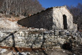
(1) Turn left onto Chemin des Vergers aux Baux. Take five minutes to visit the 16th-century Notre-Dame du Moustier Chapel and return to the path. Continue first between the houses and then across the fields, parallel to the D974, ignoring the streets and paths on the right and left.
(2) At the crossroads, continue straight ahead on Chemin des Roubins. Ignore a path on the right and continue straight ahead until you reach a T-junction.
(3) Turn left towards Les Baux, go around the hamlet on the right and continue straight ahead to Les Fébriers.
(4) At the edge of the forest, a sign indicates the direction of Jas des Landérots. Follow this path marked in yellow. Climb the steep slope and stay on the marked path until you reach the junction with theGR®91Bmarked in white and red. Turn right and you will immediately reach the ruins of Jas des Landérots.
(5) Continue on theGR® and you will come to a track. Follow this track to the left for about 250 metres.
(6) Leave the track and turn right onto theGR® to reach the Jas du Tomple (or Toumple on the IGN map).
You can enjoy the surroundings of this magnificent restored jas for your lunch break. Then return to the track and turn right.
(7) Leave the track and take a shortcut through the woods, which joins it further up. Continue on the right until you reach a crossroads with a cistern on the right.
(8) Take the path on the left that climbs northwards and passes in front of the Jas des Pèlerins. You can't go wrong! The path leaves the forest, crosses a barren, rocky landscape and turns right to reach the last point of interest: the Chapel of Sainte-Croix.
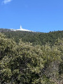
(9) Continue to the summit of Mont Ventoux and its sign indicating 1911m (E).

 SHEEPFOLD UNDER RENOVATION (Jas des Couanches) BY VOLUNTEERS, BEAUTIFUL MORNING FOR TWO,
 Visorando Member
 Easy
Easy 
 Moderate
 Association / Club / Walk leader