In the Marais du Bruant de Romegoux in Geay

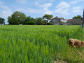
Amidst woods, marshes and small hamlets, you can discover the rural landscape of the villages of Romegoux and Geay. A typical feature of the Romanesque Saintonge region, the 16th- and 12th-century churches adorn a tree-lined, natural trail through the Bruant marshes.

Details

67204316
Creation:
Last update:
Last review:
  • Walking
    Activity: Walking
  • ↔
    Distance: 10.27 mi
  • ◔
    Average duration: 4h 50 
  • ▲
    Difficulty: Moderate

  • ⚐
    Back to start: Yes
  • ↗
    Ascent: + 102 ft
  • ↘
    Descent: - 112 ft

  • ▲
    Highest point: 89 ft
  • ▼
    Lowest point: 10 ft
  • ⚐ Country: France
  • ⚐ City: Romegoux (17250)
  • ⚑
    Start/End: N 45.87024° / W 0.80772°
  • ❏
    IGN map(s): Ref. 1430SB
  • Hour-by-hour weather

Description of the walk

Starting point: School car park in Romegoux; GPS 45°52'12.7"N 0°48'27.3"W

The entire route is marked with a yellow line.

(S/E) On leaving the car park, turn right onto Rue Romagotz, then at the junction, turn right onto Rue de l’Église until you reach the junction with Rue du Midi.

(1) Turn right, then left to reach the junction between the road and the Champ Picard track.

(2) Cross the road and take the path on the right, then turn left. At the next crossroads, enter the forest via the path on the left, which winds along the edge of the marsh until it reaches a road.

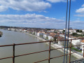
(3) Follow it to the left, skirting the marsh in three zigzags. You’ll emerge onto the D128 near the Moulin du Champ, situated on the River Bruant.

(4) Follow the D128 to the right for 200 m (caution: busy road). Turn left and cross the canal bridge.

(5) Walk alongside it on the right. Pass a bridge and take a path on the right, then turn left to rejoin the D122.

(6) Continue straight on. Pass a junction and carry on to the Babauderie washhouse.

(7) Turn right onto Chemin des Lavandières to discover the church at Geay (Notre-Dame-de-l’Assomption). Continue along Rue de l’Église Romane towards Saint-Porchaire. You’ll arrive near a car park.

(8) You can start the walk here. Cross the D128 towards Saint-Porchaire, first turn left then right with care, and turn right towards La Bougeterie.

(9) On leaving the hamlet, turn left then right into the forest. At the next junction, turn left into the woods. Carry on straight ahead until the final junction. Turn left, then follow the GR® 360 on the opposite side until you reach La Turpinerie.

(10) Carry on along a small road, then turn right at the first junction to reach La Maisonnette.

(11) After La Maisonnette, turn right. Cross the Bruant at the Tressauze mill. Continue to your right through the marsh to the road junction.

(12) Head right towards La Basse Vergnée (water tower). At the end of the road, keep right to reach a Fork in the road leading towards La Haute Vergnée.

(13) Pass it on your right, then immediately take the grassy country lane in the same direction. Carry on straight ahead, crossing two roads, to reach a junction at Les Creuseaux.

(14) Then turn right towards the Croix des Merciers.

(15) Turn left, then right towards the cemetery to return to the starting point (S/E).

Waypoints

  1. S/E : mi 0 - alt. 79 ft - School car park
  2. 1 : mi 0.23 - alt. 75 ft - Rue du Midi
  3. 2 : mi 0.66 - alt. 72 ft - Champ Picard
  4. 3 : mi 1.55 - alt. 20 ft - Route
  5. 4 : mi 2.25 - alt. 20 ft - Moulin du Champ
  6. 5 : mi 2.67 - alt. 13 ft - Canal
  7. 6 : mi 3.69 - alt. 13 ft - D122
  8. 7 : mi 4.07 - alt. 20 ft - Babauderie washhouse
  9. 8 : mi 4.43 - alt. 82 ft - School car park (Geay)
  10. 9 : mi 4.92 - alt. 79 ft - Junction after La Bougeterie
  11. 10 : mi 5.56 - alt. 79 ft - Route to La Turpinerie
  12. 11 : mi 5.93 - alt. 59 ft - Road junction after La Maisonnette
  13. 12 : mi 7.68 - alt. 59 ft - Junction
  14. 13 : mi 8.13 - alt. 39 ft - Haute Vergnée
  15. 14 : mi 9.13 - alt. 79 ft - Les Creseaux
  16. 15 : mi 9.65 - alt. 66 ft - Croix des Merciers
  17. S/E : mi 10.27 - alt. 79 ft - School car park

Notes

Possible starting point at (8): School car park in Geay; GPS 45°52'11.7"N 0°45'57.1"W

Worth a visit

The Church of Saint-Pierre in Romegoux is in the Flamboyant Gothic style, despite being situated in the Romanesque region of Saintonge. It is thought to have been built in a single phase during the first quarter of the 16th century, on the site of an earlier Romanesque church destroyed during the Hundred Years’ War. The church’s façade opens to the west via a Gothic portal flanked by pinnacles.

An early 12th-century church, listed as a historic monument, with a single nave surmounted by a central tower in the tradition of pre-Romanesque churches. Its western façade is very simple, whilst the walls of the nave are decorated with three semicircular arcades. On the west side, traces of a funerary inscription remain.

Always be cautious and plan ahead when you're outdoors. Visorando and the author of this route cannot be held responsible for any accidents occurring on this route.

The GR® and PR® markings are the intellectual property of the Fédération Française de Randonnée Pédestre.

Reviews and comments

4.8 / 5
Based on 2 reviews

Reliability of the description
5 / 5
Ease of following the route
5 / 5
Route interest
4.5 / 5
Guertrüde 17
Guertrüde 17

Overall rating : 5 / 5

Date of your route : Mar 26, 2026
Reliability of the description : ★★★★★ Very good
Ease of following the route : ★★★★★ Very good
Route interest : ★★★★★ Very good
Very busy route : No

A lovely discovery, especially the canal. We’ll soon be doing the walk starting from
Romegoux; it’s longer but also joins the canal on the other side.

Machine-translated

User 15967317

Overall rating : 4.7 / 5

Date of your route : Aug 12, 2025
Reliability of the description : ★★★★★ Very good
Ease of following the route : ★★★★★ Very good
Route interest : ★★★★☆ Good
Very busy route : No

Perfect for warming up, superb in the morning with endless sunflowers

Machine-translated

Other walks in the area

For more walks, use our search engine .

The GPS track and description are the property of this route's author. Please do not copy them without permission.