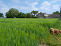
The Bois de la Clie in Les Essards

Set amongst forests, woods and small hamlets, the rural landscape of the commune of Les Essards unfolds before you. A typical example of the Romanesque heritage of the Saintonge region, the 12th-century church and a 15th-century watchtower add to the charm of this tree-lined, natural route.

Details

n°24475440
Creation:
Last update:
Last review:
  • Walking
    Activity: Walking
  • ↔
    Distance: 4.01 mi
  • ◔
    Average duration: 1h 55 
  • ▲
    Difficulty: Easy

  • ⚐
    Back to start: Yes
  • ↗
    Ascent: + 98 ft
  • ↘
    Descent: - 82 ft

  • ▲
    Highest point: 161 ft
  • ▼
    Lowest point: 79 ft

Description of the walk

The entire route is marked with a yellow line.
Start from the school car park in Les Essards, Rue de l’Hôtel de Ville.

(S/E) Keeping the school on your left, cross the grassy area to the road leading to Belle Combe and Le Grand Pallet. Follow it, turning right. At the first houses, at Le Caunat, turn right.

(1) Turn right onto a path and go round a pond surrounded by a wire fence (ornamental ducks). Head down into Belle Combe.

(2) Turn right, cross the valley diagonally and head back up through the woodland to a small road between La Valade and La Devauderie.

(3) Turn right towards La Davauderie and keep left at the three-way junction. At the next right-hand bend, leave the road and follow a path on the left which joins the D119.

(4) Follow the road carefully to the left for about 100 m, then turn right onto a path leading into the woods, which you cross.

(5) On emerging from the woods, turn right onto the road and continue to the hamlet known as Le Chail.

(6) Turn right into the Bois de la Clie and head down to the lowest point.

(7) Head back up to the left through the woods to the road, and follow it to the right for 200 metres.

(8) Before Les Hermands, turn right onto Rue de la Combe des Hermands. At the junction, turn left then right onto Rue de Chez Renoulleau, which you should follow until you reach the D237.

(9) Turn right towards the church, walk past it, then turn right to walk past the town hall and reach the school car park (S/E).

Waypoints

  1. S/E : mi 0 - alt. 128 ft - School car park
  2. 1 : mi 0.84 - alt. 138 ft - Fork in the path
  3. 2 : mi 1.06 - alt. 79 ft - Belle Combe
  4. 3 : mi 1.48 - alt. 144 ft - Road junction
  5. 4 : mi 1.9 - alt. 161 ft - D119
  6. 5 : mi 2.31 - alt. 144 ft - Babin’s Mill
  7. 6 : mi 2.52 - alt. 138 ft - Le Chail
  8. 7 : mi 2.97 - alt. 112 ft - Bois de la Clie, low point
  9. 8 : mi 3.37 - alt. 115 ft - Les Hermands
  10. 9 : mi 3.77 - alt. 141 ft - D237
  11. S/E : mi 4.01 - alt. 131 ft - School car park

Worth a visit

A former watchtower, probably built in the 15th century. Completely renovated at the end of the 20th century, it has become the municipal library.

Reviews and comments

4.3 / 5
Based on 2 reviews

Reliability of the description
4.5 / 5
Ease of following the route
4.5 / 5
Route interest
4 / 5
victorien didier
victorien didier

Overall rating : 4.7 / 5

Date of your route : May 05, 2025
Reliability of the description : ★★★★★ Very good
Ease of following the route : ★★★★★ Very good
Route interest : ★★★★☆ Good
Very busy route : No

Nice.

Machine-translated

andrericheux
andrericheux

Overall rating : 4 / 5

Date of your route : Dec 15, 2024
Reliability of the description : ★★★★☆ Good
Ease of following the route : ★★★★☆ Good
Route interest : ★★★★☆ Good
Very busy route : No

Between points 4 and 5, the path is blocked by an impassable pile of branches (felled trees).
There are two options:
- the one I chose: go round the obstacle through the woods (a few dozen metres – not impossible, but it might prove tricky for some people);
- take a detour by following the D 119 for 250–300 metres (without going as far as the N 137) and turning right onto a path between the fields (along the “Les Cépiats” plot) which leads to the Route du Moulin de Babin, which you then take to the right (still avoiding going as far as the N 137).

Machine-translated

Other walks in the area

For more walks, use our search engine .

The GPS track and description are the property of this route's author. Please do not copy them without permission.