The Sentiers de la Pierre between Crazannes and Port d’Envaux

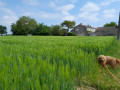
Set against a backdrop of rocky outcrops and woodland, the banks of the Charente and the villages of La Pierre de Crazannes and Port-d’Envaux come into view. Typical of the Romanesque Saintonge region, the 19th-century church, the 15th- and 18th-century castles, and the Sentiers de la Pierre enhance this tree-lined, natural route.

Details

24529608
Creation:
Last update:
Last review:
  • Walking
    Activity: Walking
  • ↔
    Distance: 6.42 mi
  • ◔
    Average duration: 3h 05 
  • ▲
    Difficulty: Easy

  • ⚐
    Back to start: Yes
  • ↗
    Ascent: + 138 ft
  • ↘
    Descent: - 135 ft

  • ▲
    Highest point: 174 ft
  • ▼
    Lowest point: 3 ft
  • ⚐ Country: France
  • ⚐ City: Crazannes (17350)
  • ⚑
    Start/End: N 45.84679° / W 0.70277°
  • ❏
    IGN map(s): Ref. 1430SB
  • Hour-by-hour weather

Description of the walk

The entire route is marked with a yellow line.

Starting point: Crazannes Church; GPS 45°50'49.0"N 0°42'09.7"W

(S/E) Head in the opposite direction to the church, pass the cemetery and follow the road to the left (former railway line), arriving at the junction leading towards Crazanne Castle. The route that follows includes a section alongside the Charente, which is damp and prone to flooding: avoid this in winter, during high tides and periods of heavy rain (no mountain bikes or horses permitted). See the ‘Practical Information’ section for an alternative route.

(1) Turn left towards Crazanne Castle. Continue along the marsh road and turn right, heading towards a road.

(2) Take the path on the left, then turn right and follow the Charente on your right. View of Panloy Castle on the right.

(3) Follow the quay. Cross the ditch marking the boundary of a property and follow it to reach Port-d’Envaux. (You can start the walk here: geographical coordinates in the practical information.) Keep to the left at all times to reach the harbour. 

(4) Turn right and cross a car park. Take the street on the right to reach the D128 at Les Rivauds.

(5) Continue to the right. Before the bridge, turn left, then right onto a grassy path, and continue until you reach a road.

(6) Take the road on the right. Turn left onto the path down into the valley. Cross the D237E3 to the left.

(7) Continue along the stony track, keeping to the left until you reach a T-junction.

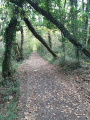
(8) Turn right to enter the Bois Muré (the only remaining trace of the castle: a low wall running alongside the path as it crosses the woods). Continue straight on until you cross the bridge over the A837.

(9) Turn right and walk alongside the motorway. Take the D119E2 on the right.

(10) Cross the bridge, then take the path on the left, then turn right. Carry on straight ahead until you enter a second woodland: turn left to rejoin the road. You’ll reach a junction before the sawmill.

(11) Take the path on the left. It leads past the quarries, then runs alongside a car park before reaching a junction with a church in view.

(12) Turn right, cross the D128, pass the town hall and walk through the park on the right to return to the car park (S/E).

Waypoints

  1. S/E : mi 0 - alt. 62 ft - Crazannes Church
  2. 1 : mi 0.4 - alt. 43 ft - Crazannes Castle
  3. 2 : mi 0.81 - alt. 7 ft - Road junction
  4. 3 : mi 1.25 - alt. 3 ft - Panloy Castle
  5. 4 : mi 1.88 - alt. 13 ft - The harbour
  6. 5 : mi 2.1 - alt. 33 ft - Les Rivauds
  7. 6 : mi 2.43 - alt. 43 ft - Gibrand
  8. 7 : mi 2.82 - alt. 52 ft - D237E3
  9. 8 : mi 3.45 - alt. 151 ft - Fork in the road, Le Bois Muré
  10. 9 : mi 4.06 - alt. 157 ft - A837
  11. 10 : mi 4.55 - alt. 112 ft - D119E2
  12. 11 : mi 5.39 - alt. 62 ft - The Crazannes Stone
  13. 12 : mi 5.85 - alt. 79 ft - Road junction
  14. S/E : mi 6.42 - alt. 62 ft - Crazannes Church

Notes

After (1), the route that follows includes a section running alongside the Charente, which is damp and prone to flooding: avoid this in winter, during high tides and periods of heavy rain (private property: mountain bikes and horses not permitted). Follow the straight railway track for 1 km ( ... ), then turn left onto the street leading into Port-d’Envaux and head down towards the quay.

Alternative starting point (4): Pré Valade in Port-d’Envaux; GPS 45°50'04.5"N 0°40'34.6"W

Worth a visit

The church at Crazannes dates from 1874 and was built in the Neo-Gothic style.

Crazannes Castle is a listed historic monument; it was built at the end of the 15th century. In the grounds, you can explore a Romanesque chapel, a keep and a dovecote. Guided tours of the castle are available.

Panloy Castle comprises two Renaissance pavilions flanking a Louis XV-style main building. In the grounds, there is a perfectly preserved 17th-century dovecote (guided tours available).

Les Échappées Nature museum complex: toilets, free self-guided tours; guided tours of the Pierre de Crazannes.

Reviews and comments

4.7 / 5
Based on 3 reviews

Reliability of the description
4.7 / 5
Ease of following the route
4.7 / 5
Route interest
4.7 / 5
User 3791706

Overall rating : 4.3 / 5

Date of your route : Jul 06, 2026
Reliability of the description : ★★★★☆ Good
Ease of following the route : ★★★★☆ Good
Route interest : ★★★★★ Very good
Very busy route : No

a well-signposted route.
It’s interesting for its heritage (castles, etc.).
Tree-lined, which is lovely during this heatwave.
Picnic tables and toilet facilities.

Machine-translated

Claire1803
Claire1803

Overall rating : 4.7 / 5

Date of your route : Aug 23, 2025
Reliability of the description : ★★★★★ Very good
Ease of following the route : ★★★★★ Very good
Route interest : ★★★★☆ Good
Very busy route : No

A beautiful hike, at least for the first 4 km: castles, the Charente river and a small village. Then the path enters the woods and the markings are harder to find.
Fortunately, the route on the app is very well marked

Machine-translated

josiane cousin
josiane cousin
• Edited:

Overall rating : 5 / 5

Date of your route : May 01, 2025
Reliability of the description : ★★★★★ Very good
Ease of following the route : ★★★★★ Very good
Route interest : ★★★★★ Very good
Very busy route : No

A pleasant walk, well signposted (not to be undertaken in winter, as the paths can sometimes be muddy).

Machine-translated

Other walks in the area

For more walks, use our search engine .

The GPS track and description are the property of this route's author. Please do not copy them without permission.