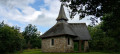
A woodland walk to Mirwart Castle

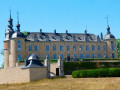
Set off to explore the vast forest of Saint-Hubert from Mirwart, taking a more open route through the rural hills of Arville. On the return journey, the route follows the meandering course of the River Lomme and its numerous passages under the railway line before climbing up the avenue leading to Mirwart Castle, which was splendidly renovated at the start ofthe 21st centuryand transformed into a hotel, restaurant and venue for receptions, seminars and outdoor events.

Details

104494220
Creation:
Last update:
Last review:
  • Walking
    Activity: Walking
  • ↔
    Distance: 9.87 mi
  • ◔
    Average duration: 5h 20 
  • ▲
    Difficulty: Moderate

  • ⚐
    Back to start: Yes
  • ↗
    Ascent: + 876 ft
  • ↘
    Descent: - 896 ft

  • ▲
    Highest point: 1,644 ft
  • ▼
    Lowest point: 876 ft

Photos

Description of the walk

(S/E) Setting off from the church, the route soon heads into the forest.

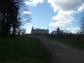
(1) Just before entering the first wooded section of the road, take a short break and look back for your first view of the castle without the power lines from the village centre! After passing a few clearings, the route crosses the Parfond Ry stream and reaches the Fagne des Taons, a final clearing situated to the east of the walk.

(2) Follow the path to the picnic area on the edge of the forest to the north of the village of Arville.

(4) Turn right, follow the edge of the woodland for a while, then head off to the right (past the crop protection gate) to go round the back of Daimont Castle.

(5) Continue down to the railway line and turn right to follow the path that leads to the Lomme, passing by the two micro hydroelectric power stations (6) and (7). Walk alongside the Sainte-Adeline Canal and cross to the other side via the metal footbridge which has replaced the wooden one opposite the Rocher de Marie de Gobaille (which was swept away by the floods of summer 2021).

(8) Continue along the path.

(9) Admire Mirwart Castle from a new angle and continue along the small road until you reach the first footpath, which you should take to the right.

(10) Walk down the path to the footbridge leading to the Saint-Roch pond and turn slightly to the left.

(11) Carry on along the path to the small bridge over the Lomme.

(12) Take the path that climbs to the right. After a few bends, it comes out opposite Mirwart Castle.

(13) All that remains is to admire it, perhaps take a look around the grounds, or pop into the bar or restaurant of this luxury hotel for a glimpse of the interior. Then head straight back to the starting point (S/E).

Waypoints

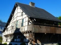
  1. S/E : mi 0 - alt. 1,060 ft - Mirwart Church - Église Saint-Roch (Mirwat)
  2. 1 : mi 0.22 - alt. 1,181 ft - A village street just before a wooded section
  3. 2 : mi 2.72 - alt. 1,568 ft - View of the Fagne des Taons
  4. 3 : mi 3.63 - alt. 1,575 ft - Crossroads
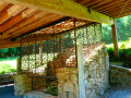
  5. 4 : mi 4.35 - alt. 1,414 ft - Arville picnic shelter and barbecue area
  6. 5 : mi 5.91 - alt. 1,257 ft - View of Daimont Castle
  7. 6 : mi 6.61 - alt. 994 ft - Micro hydroelectric power station - Lomme (rivière) - Belgique
  8. 7 : mi 7.04 - alt. 951 ft - Micro hydroelectric power station - Lomme (rivière) - Belgique
  9. 8 : mi 7.53 - alt. 935 ft - Picnic table opposite Marie Gobaille’s Rock - Lomme (rivière) - Belgique
  10. 9 : mi 8.66 - alt. 945 ft - Bridge over the railway line, view of the castle - Lomme (rivière) - Belgique
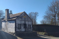
  11. 10 : mi 8.78 - alt. 919 ft - The former Mirwart ice house - Lomme (rivière) - Belgique
  12. 11 : mi 8.96 - alt. 896 ft - Picnic table - Étangs Saint-Roch
  13. 12 : mi 9.36 - alt. 915 ft - A small bridge over the - Lomme (rivière) - Belgique
  14. 13 : mi 9.67 - alt. 1,047 ft - Mirwart Castle
  15. S/E : mi 9.87 - alt. 1,060 ft - Mirwart Church - Église Saint-Roch (Mirwat)

Worth a visit

The Mirwart Provincial Estate, its ponds and fish farm.

Other walks in the area

For more walks, use our search engine .

The GPS track and description are the property of this route's author. Please do not copy them without permission.