Country:
 City:
City:


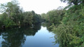
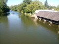
The route starts at the car park on Rue de Courcelles, near the bridge over the River Loir
Yellow signposting
(S/E) Turn onto Rue de Courcelles with your back to the bridge over the Loir; after about fifty metres, turn left onto Impasse de la Tour. The cul-de-sac, which is initially tarmac-surfaced, gives way to a wide path.
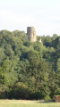
(1) Turn left about a hundred metres after the tarmac ends, and climb up to the feudal tower via the steps. Do not try to rejoin the road; continue towards the castle ruins along the path, following the signs: ‘Visite par le grand fossé’ (Visit via the great moat). The path branches off to the right at the edge of the woods, then bends to the left as it approaches the D2. Turn right onto a gravelled track to reach the D2, which you’ll join on the right-hand side.
(2) Leave the D2 after about a hundred metres, just before a bend, by turning left onto a small road, then immediately right towards Les Hauts de Courcelles.
(3) Once past the hamlet, turn left onto Allée la Sourderie, which soon leads onto a grassy track. Keep to the right as you descend to enter the woods, then turn left at the Fork in the road into the Bois du Refuge. The track leads onto the gravelled Allée du Berruet. This becomes tarmac-surfaced once past La Bonne.
(4) Once past Le Breuil, cross the small side road to join the Chemin de Chambord, then keep left at the Fork in the road onto the small road leading to the Pâtis des Anglais and then Les Vignes.
No signposting
(5) Turn right onto the cross-road, followed by a track. Keep right at the Fork in the road onto the Chemin de la Croix des Vignes. Follow the busiest track until you reach the cross.
(6) Turn left onto the cross-road, then left again onto the Route de la Plaine, which leads towards Lignères church. Turn right onto the Route du Vendômois, with your back to the church.
(7) On leaving Lignères, turn left onto the tarmac Chemin du Biternay. When you reach Le Biternay, turn left down the lane, passing the first house on your right. After 75 m, turn right onto the grassy path that goes round the hamlet, then keep to the right at the Fork in the road to walk alongside the small wood. Ignore the path leading downhill towards La Touche and continue until you reach a crossroads with four paths.
(8) Turn right until you reach a crossroads, where you should turn left onto a side street heading towards La Thibaudière. Stay on this road, which bends to the right towards La Thibaudière.
(9) On leaving the hamlet, take the grassy path on the right which leads to Sainte-Ouzille as you emerge from a wooded area. Cross the Route de Sainte-Ouzille. Opposite, a road leads to the Grenouille sports facilities in Pezou. Turn left at the junction, then right at the crossroads immediately after passing the sports facilities. The road crosses the River Loir.
White-red markings (GR® 35 –GR® 655 West)
(10) Turn right at the end of the bridge (view of a washhouse on the River Loir), ignoring the first turn-off on the left towards Pezou church. Turn right onto the main street, with your back to the church, then take the first street on the right. This is followed by a wide lane and then a grassy path which crosses a branch of the River Loir via a footbridge. The route follows the Fossé de la Mardelle.
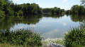
(11) Turn right onto the wide cross-road ‘Près de la Ramée’, which follows the River Loir on your right. The road becomes ‘Près de Baigneux’ as it runs between a lake and the River Loir, then moves away from the river towards the railway line. Turn right, following the railway line on your left, then cross it via a level crossing.
(12) Take the side street on the right immediately after the level crossing. This follows the N10 expressway before branching off at the sewage treatment works to join the D357. Ride along the hard shoulder on the left. Keep to the right at the roundabout , taking care.
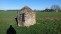
(13) Continue in the same direction as you leave the roundabout, along a compacted track. This track runs close to the N10 again as it heads towards the Tour de Grisset. The track leads onto a grassy path just before the tower.
(14) Turn right onto the side street, then turn left towards Montbalière. Cross the Route du Plessis, then, once in the hamlet, head along the Route de Montbalière, ignoring the turn-off on the left. Pass the Chemin de la Fosse on your left.
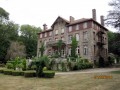
(15) About a hundred metres after the Chemin de la Fosse, leave the tarmac and continue straight on along the grassy path. At the junction, turn right onto the gravel track. Pass the Manoir de Beauregard on your right. The track becomes the Rue de la Fontaine as you reach the first houses in Fréteval.
(16) Turn left onto Rue du Plessis, a side street. Cross the railway line at the level crossing. Take the first street on the left, Rue du Mail.
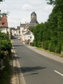
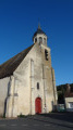
(17) Take a path on the right leading to the church, just after the junction between Rue du Plessis and Rue de la Gare. Cross Rue des Prêtres and continue straight ahead, with your back to the bell tower. Turn left at the junction to head along Rue du Pont, which crosses the River Loir. Turn right as soon as you’ve crossed the river to return to the starting point of the walk (S/E).


 Visorando Member

 Easy
Easy