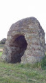
In the plains of Rocé

A short, easy walk starting from the village of Rocé, set in beautiful woodland surroundings.

Details

2903636
Creation:
Last update:
Last review:
  • Walking
    Activity: Walking
  • ↔
    Distance: 5.49 mi
  • ◔
    Average duration: 2h 35 
  • ▲
    Difficulty: Easy

  • ⚐
    Back to start: Yes
  • ↗
    Ascent: + 66 ft
  • ↘
    Descent: - 72 ft

  • ▲
    Highest point: 423 ft
  • ▼
    Lowest point: 358 ft
  • ⚐ Country: France
  • ⚐ City: Rocé (41100)
  • ⚑
    Start/End: N 47.807638° / E 1.146794°
  • ❏
    IGN map(s): Ref. 2020SB
  • Hour-by-hour weather

Photos

Description of the walk

Park in the car park in front of the church.

(S/E) Take Rue de la Palue southwards, with the church on your left. Then turn right into Rue du Presbytère, pass the town hall and ignore the path on the left.

(1) At the very end of the street, turn left. Carry on straight ahead, ignoring the paths to the right and left.

(2) Cross the D11 near the cemetery and continue straight ahead. Ignore the two paths on the right, then the one on the left.

(3) Take the next left. Carry on straight ahead on the tarmac road, which rejoins at the access road to La Fuie.

(4) Turn right onto Rue de Vendôme, then left onto Rue de Villeclèche.

(5) Just before a small wood on the right, turn left. At the four-way junction (elevation 116), carry straight on.

(6) Take the track on the left and continue straight on towards Les Bordes. Pass through this hamlet to join the D92.

(7) Turn right onto the road and follow it carefully, then take the first field track on the right. Turn left at a 90° angle, then right towards a copse. Once you reach the corner of the copse (marker 124), turn left towards Pellebas.

(8) Follow the road to the left until you reach the junction with the D111. Make the first turn right then left to join the track between the fields. At the T-junction, turn left towards Rocé. Continue along Rue de la Bremaudière until you come out onto the D92 (Rue de la Caustière) at the first houses.

(9) Keep left and carry on straight ahead to reach the church and the car park (S/E).

Waypoints

  1. S/E : mi 0 - alt. 394 ft - Church car park
  2. 1 : mi 0.32 - alt. 413 ft - End of Rue du Presbytère
  3. 2 : mi 0.65 - alt. 413 ft - D 111 – cemetery
  4. 3 : mi 1.2 - alt. 420 ft - At the fork in the road, turn left towards La Fuie
  5. 4 : mi 1.67 - alt. 420 ft - Rue de Vendôme
  6. 5 : mi 2.14 - alt. 394 ft - Turn left at the fork
  7. 6 : mi 2.49 - alt. 358 ft - Turn left towards the hamlet of Les Bordes
  8. 7 : mi 3.27 - alt. 404 ft - D 92
  9. 8 : mi 4.62 - alt. 394 ft - Pellebas
  10. 9 : mi 5.38 - alt. 397 ft - Rocé – D92
  11. S/E : mi 5.49 - alt. 394 ft - Church car park

Reviews and comments

4.5 / 5
Based on 2 reviews

Reliability of the description
5 / 5
Ease of following the route
5 / 5
Route interest
3.5 / 5
User 26411498

Overall rating : 4.7 / 5

Date of your route : Aug 11, 2025
Reliability of the description : ★★★★★ Very good
Ease of following the route : ★★★★★ Very good
Route interest : ★★★★☆ Good
Very busy route : No

A fairly long "short" hike, lots of plains and fields, quite a few false flats, quite windy that day, a breath of fresh air in the countryside... Good training for me as I aim to gradually increase my strength, distance and hiking time...

Machine-translated

denouvel
denouvel

Overall rating : 4 / 5

Date of your route : Aug 30, 2020
Reliability of the description : Not used / Not applicable
Ease of following the route : ★★★★★ Very good
Route interest : ★★★☆☆ Average
Very busy route : No

A short walk in the countryside; nothing particularly exciting to see or discover.

Machine-translated

Jean-Louis Pinault
Jean-Louis Pinault
• Edited:

In fact, you always have to recalculate the altitudes before posting the walks. I think this is because altitude errors accumulate at each GPS measurement point when you record the track.
Jean-Louis

Machine-translated

MONIQUEB1954
MONIQUEB1954
• Edited:

Thanks for the correction. There must be a problem with the elevation gain, as on another walk in the Loir-et-Cher I’ve got an elevation gain of 1,884 metres. I’ll need to have a closer look.
Have a nice day
Monique

Machine-translated

slinky
slinky ★
• Edited:

Hello Jean-Louis Pinault, and thank you for pointing that out; I’ve just made the changes.
Have a nice day

Machine-translated

Jean-Louis Pinault
Jean-Louis Pinault
• Edited:

Hello,
I’m really looking forward to this lovely walk. For now, I just wanted to point out that you’ll need to recalculate the altitudes and delete a line (waypoint (9)) that was automatically generated by Visorando and might be a bit confusing.
Have a lovely day.
Jean-Louis

Machine-translated

Other walks in the area

For more walks, use our search engine .

The GPS track and description are the property of this route's author. Please do not copy them without permission.