A circular walk through the Perche and Haut-Vendômois regions starting from Rocheux

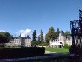
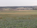
Starting from Rocheux and its imposing 13th-century castle – which was remodelled in the 19th century and later became the Château des Énigmes – this varied route takes you through wooded areas and pretty hamlets, whilst offering panoramic views of the Haut Vendômois.

Details

14893552
Creation:
Last update:
Last review:
  • Walking
    Activity: Walking
  • ↔
    Distance: 6.53 mi
  • ◔
    Average duration: 3h 05 
  • ▲
    Difficulty: Moderate

  • ⚐
    Back to start: Yes
  • ↗
    Ascent: + 131 ft
  • ↘
    Descent: - 131 ft

  • ▲
    Highest point: 489 ft
  • ▼
    Lowest point: 364 ft

Photos

Description of the walk

The walk starts at the car park situated along the wide driveway leading to the entrance of Rocheux Castle, known as the ‘Château des Énigmes’, in Fréteval.

Yellow markings.

(S/E) Turn your back on the castle to reach the small road, which you’ll follow to the left. Leave a wide avenue on your left and immediately turn left onto a grassy path.

(1) Turn left after a good hundred metres, then follow the edge of the woodland on your left.

(2) Turn left onto the D2, then immediately right onto the forest track. Take the path on the left just before the gate closing off the main track. Ignore the side paths into the woodland. Continue straight on at the crossroads at the edge of the woodland to follow the edge of a new plot on your right.

(3) On leaving the woods, continue along the central path, ignoring the side paths to the left and right, heading north-west. The track eventually follows the edge of a small copse before reaching a crossroads.

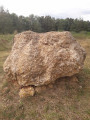
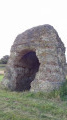
(4) Turn left onto the wide path until you reach the D2 shortly after the area set aside for the display of a large stone.

(5) Carefully turn right onto the D2 and, at the junction, continue uphill towards Les Hauts de Courcelles. Turn immediately left as you leave the hamlet onto the small road, which is followed by a track.

(6) Ignore the turn-off to the left and continue downhill towards the Bois du Refuge. At the junction just after this, carry on straight ahead to enter the woods. Once inside the woods, keep to the left at the Fork in the road to follow the contour lines. The forest track leads onto the Allée du Berruet at the edge of the Bois du Refuge. This gravelled track becomes tarmac as you approach the hamlet of Le Breuil.

(7) Turn left onto Rue du Breuil and immediately turn right onto Chemin de Chambord. At the Fork in the road, keep to the right onto the tarmac-surfaced Chemin du Pâtis des Anglais. Turn left at the place known as Les Vignes, then continue straight on at the two successive crossroads to reach Allée des Noues Charron. The tarmac gives way to a grassy track which you should follow, ignoring the various side paths, until you reach a wide, compacted track.

(8) Turn left onto the track. This crosses a farmstead with livestock buildings, then becomes tarmac and eventually joins the D12, which you take to the right to return to Rocheux Castle, the starting point of the walk (S/E).


Waypoints

  1. S/E : mi 0 - alt. 476 ft - Car park - Château de Rocheux
  2. 1 : mi 0.22 - alt. 472 ft - Turn left after a good hundred metres
  3. 2 : mi 0.93 - alt. 472 ft - Turn left to join the D2
  4. 3 : mi 1.63 - alt. 463 ft - Middle path at the crossroads
  5. 4 : mi 2.26 - alt. 486 ft - Turn left onto the wide avenue
  6. 5 : mi 2.66 - alt. 459 ft - Turn right onto the D2
  7. 6 : mi 3.55 - alt. 420 ft - Downhill towards the Bois du Refuge
  8. 7 : mi 4.34 - alt. 377 ft - Turn left onto Rue du Breuil
  9. 8 : mi 5.51 - alt. 472 ft - Turn left onto a wide avenue
  10. S/E : mi 6.53 - alt. 476 ft - Car park - Château de Rocheux

Notes

This well-signposted walk can be enjoyed in all seasons.

Worth a visit

At the start of the walk, the 13th-century Château des Énigmes, which was remodelled in the 19th century, offers a fun and original tour.

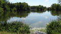
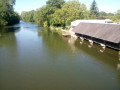
In Fréteval, the keep of the Carolingian feudal castle overlooks a vast natural landscape shaped by the River Loir.

Reviews and comments

4.5 / 5
Based on 2 reviews

Reliability of the description
5 / 5
Ease of following the route
5 / 5
Route interest
3.5 / 5
Aurmi
Aurmi

Overall rating : 4.7 / 5

Date of your route : Oct 17, 2021
Reliability of the description : ★★★★★ Very good
Ease of following the route : ★★★★★ Very good
Route interest : ★★★★☆ Good
Very busy route : Yes

A very pleasant walk,
Quite varied scenery – woods, fields, hamlets, paths and roads
And if we’d known, we’d have taken our dog on this walk; we didn’t come across a single hunter

Machine-translated

bionat
bionat

Overall rating : 4.3 / 5

Date of your route : Oct 06, 2021
Reliability of the description : ★★★★★ Very good
Ease of following the route : ★★★★★ Very good
Route interest : ★★★☆☆ Average
Very busy route : No

The walk begins with a lovely view of the Château des Énigmes.
A pleasant, wooded path between 1 and 3, then from 6 to Les Haies.
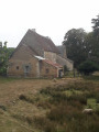
The rest of the route, which is less interesting, runs through farmland (with industrial livestock sheds and poultry houses after 8).
But we realise that it is not always easy to find paths when agricultural activity is encroaching more and more on the countryside. Thank you.

Machine-translated

Other walks in the area

For more walks, use our search engine .

The GPS track and description are the property of this route's author. Please do not copy them without permission.