From one hill to the next, starting from the Croix de Bel viewpoint

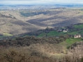
A beautiful route with a significant elevation gain, sheltered by woodland and offering lovely views over the north-eastern valley of the commune

Details

n°71574821
Creation:
Last update:
Last review:
  • Walking
    Activity: Walking
  • ↔
    Distance: 6.24 mi
  • ◔
    Average duration: 4h 00 
  • ▲
    Difficulty: Moderate

  • ⚐
    Back to start: Yes
  • ↗
    Ascent: + 1,260 ft
  • ↘
    Descent: - 1,276 ft

  • ▲
    Highest point: 2,018 ft
  • ▼
    Lowest point: 1,332 ft

Description of the walk

Starting point: Croix de Bel viewpoint.

(S/E) To the right of the viewpoint (panoramic view of the Aubrac and Cantal mountains), follow the path downwards running parallel to the D43 (viewpoint over the Glassac valley). Take the hairpin bend to the left and you’ll reach a crossroads.

(1) Carry on straight ahead until the next junction.

(2) Take the path to the left, then turn right towards Lusclade. After the house, at the boundary marker, turn left onto the road towards Le Jouanenc.

(3) At Le Jouanenc, at the cross, continue along the forest track, cross the Ruisseau d’Entérieux and join the tarmac road coming from Les Trémolèdes.

(4) Carry on to the left until you reach the junction for La Grallière.

(5) Turn right towards La Grallière (second track on the right).

(6) At La Gralière, take the forest track on the left. Head uphill until you reach the junction. Turn right. Spring 20 m away. Alternative routes are possible (see practical information).

(7) Continue to Les Courets along a well-maintained track.

(8) Carry on and, once you reach the D651, turn left towards La Capelle del Vern. You’ll come to a farm track at a bend.

(9) Take the track on the left and, at the junction, turn right towards Puech del Vern (viewpoint over the Testet valley and the Cantal).

(10) At Puech del Vern, stay on the road and take the track on the left until you reach the next road.

(11) Turn right. At the first bend, take the path on the left until you reach the Route de la Croix de Bel. Turn left and continue towards Poux. At the cross, carry on to the left, past a shed, until you reach a path.

(12) Head down this track to the left. You’ll reach a junction. Leave Lusclade on your left and carry on to the junction you passed on the way out.

(2) Keep straight on until you reach the road. Turn right, then take the path on the right (a slightly steep climb). You’ll come back to the junction from the outward journey.

(1) Take the path on the left to reach the Croix de Bel viewpoint (S/E).

Waypoints

  1. S/E : mi 0 - alt. 1,827 ft - Croix de Bel Viewpoint
  2. 1 : mi 0.28 - alt. 1,696 ft - Junction A/R
  3. 2 : mi 0.6 - alt. 1,493 ft - Common A/R junction
  4. 3 : mi 1.16 - alt. 1,407 ft - Le Jounanenc
  5. 4 : mi 1.61 - alt. 1,401 ft - Junction with a road
  6. 5 : mi 2.09 - alt. 1,591 ft - Crossroads towards La Gralière
  7. 6 : mi 2.46 - alt. 1,493 ft - La Gralière
  8. 7 : mi 2.92 - alt. 1,745 ft - Source
  9. 8 : mi 3.17 - alt. 1,604 ft - Les Courets
  10. 9 : mi 3.39 - alt. 1,670 ft - La Capelle del Vern
  11. 10 : mi 3.9 - alt. 2,011 ft - Puech del Vern
  12. 11 : mi 4.63 - alt. 1,801 ft - Route
  13. 12 : mi 5.04 - alt. 1,844 ft - Lice
  14. S/E : mi 6.24 - alt. 1,827 ft - Croix de Bel Viewpoint

Notes

Possible alternative to (7):

a) At the spring, turn back and head up into the woods towards the hamlet of La Bessière. 
b) After 500 m, at the La Bessière road, stay on the road to the right and continue for 1 km (viewpoint over the Caylaret).
c) At the junction at the foot of Singlande, take the road on the right as far as the cross. Resume at point (9)

Practical information:

Picnic table: Croix de Bel viewpoint.

Recommendations:

- Wear sturdy footwear.
- Bring some food and drink.
- Walkers undertake the route at their own risk. They remain responsible for any accidents they may suffer and for any damage they may cause to others (forest fires, damage to property, pollution, etc.).
- Stick to the marked paths and do not take shortcuts. If the route has been altered, follow the new signposting.
- Be considerate. We are not the only ones using the paths; be mindful of others.
- Take your rubbish away with you. Leave no trace of your visit; do not throw anything on the ground; carry a rubbish bag with you.
- Keep your dog on a lead, particularly near homes or livestock.
- Close gates and fences behind you, and walk around crops. We should respect the work of those who shape and preserve our environment.
- Observe the rules in certain areas.
- Do not light fires. Areas with dense vegetation (forests) or those that are too exposed (scrubland, dry heathland, etc.) can catch fire very quickly.
- Do not drink water from streams. Clear water does not necessarily mean it is safe to drink.
- Check hunting seasons; some routes may be dangerous.

Worth a visit

Nearby:

In the village of Goutrens:

The Espace Georges Rouquier, a museum dedicated to the filmmaker who captured rural life, director of *Farrebique* and *Biquefarre*, and a cinema.

E15th-century processional cross, listed as a historic monument, on display in Goutrens church.

Playground.

Café/restaurant.

In Cassagnes-Comtaux:

A former15th-century fortified town, church, old houses and ruins.

Marcillac vineyards; the Cros wine estate (sales and tastings).

Panoramic views over the Marcillac vineyards, the Clairvaux valley and Bruéjouls.

The Serre dolmen, listed as a historic monument.

In La Palairie:

The ‘Nos Campagnes Autrefois’ museum on rural life before 1950

Reviews and comments

4.7 / 5
Based on 1 review

Reliability of the description
5 / 5
Ease of following the route
4 / 5
Route interest
5 / 5
Office de tourisme du Pays Rignacois

Thank you for your review. Enjoy your walks in the Rignac region!

Machine-translated

EMCI13
EMCI13

Overall rating : 4.7 / 5

Date of your route : Sep 19, 2025
Reliability of the description : ★★★★★ Very good
Ease of following the route : ★★★★☆ Good
Route interest : ★★★★★ Very good
Very busy route : No

A beautiful route with stunning views. A bit of road but not too much. Beautiful houses and vegetation that shelters us from the sun. We had a wonderful time. A hike that really works up an appetite, despite everything 😉
Don't forget to visit the dolmen on your way back, starting from the cross, following the signposted route.

Machine-translated

Other walks in the area

For more walks, use our search engine .

The GPS track and description are the property of this route's author. Please do not copy them without permission.