From one end of Val-de-Saâne to the other, France’s first ‘com-com’

Val-de-Saâne was the first ‘communauté de communes’ (inter-municipal association) established in France (1964), formed by the merger of four municipalities: Anglesqueville, Eurville, Thiédeville and Varvannes.
Winner of the first national ‘Village que j’aime’ award in 1969.
Now known as ‘Terroir de Caux’
A walk starting in Anglesqueville, following the Saâne upstream to Varvannes, climbing up to Eurville, descending to Imbleville and returning via the Saâne to the centre of Val-de-Saâne.
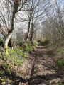
A distillation of the Cauchoix landscapes: a valley, woods and the cultivated plateau.

Details

8418527
Creation:
Last update:
Last review:
  • Walking
    Activity: Walking
  • ↔
    Distance: 8.00 mi
  • ◔
    Average duration: 4h 05 
  • ▲
    Difficulty: Moderate

  • ⚐
    Back to start: Yes
  • ↗
    Ascent: + 472 ft
  • ↘
    Descent: - 476 ft

  • ▲
    Highest point: 472 ft
  • ▼
    Lowest point: 253 ft
  • ⚐ Country: France
  • ⚐ City: Val-de-Saâne (76890)
  • ⚑
    Start/End: N 49.703841° / E 0.963006°
  • ❏
    IGN map(s): Ref. 1909OT, 1910SB
  • Hour-by-hour weather

Description of the walk

Car park at the community centre.

(S/E) With your back to the car park, turn left onto Route de Varvannes until you reach a T-junction.

(1) Turn right and follow theGR® 212 signposts along Rue des Amis de la Nature; this road becomes a track opposite the Ermitage (animal shelter). Continue straight on until you reach a junction.

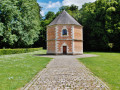
(2) At the crossroads, leave theGR® and take the path on the right which, after 400 metres – having crossed the Saâne and passed an old mill – leads you to the little church of La Fontelaye and its small cemetery.

(3) After taking in the scenery, retrace your steps to the crossroads you left earlier, rejoin theGR® on your right and continue to a T-junction
If you have a little time, follow theGR® for 150 metres to the right and you’ll see the Fontaine Saint-Sulpice.

(4) Leave theGR® and turn left; you’ll soon come to the Chemin du Mont Mirel, which you should take to the right. After 50 m, at another junction, turn left to head straight back towards Anglesqueville via Rue du Vieux Moulin. Just past a factory on your right, rejoin theGR® and follow it to the right this time, returning to the triangular junction you passed on the way out.

(1) Turn left and, after crossing the Saâne, take a path running alongside it to the right – the Promenade du Tortillard (a former local railway line) – and follow this path as far as the third bridge (Rue des Peupliers).

(5) Cross the bridge and, at the end of Rue des Peupliers, turn left, then immediately right, and walk between the church and the town hall (the former post office). Cross a street and you’ll reach Rue du Faubourg.

(6) Follow this street as it bends to the left and, a little further on, turn right onto the small Rue des Passereaux, which joins Rue des Prés just before a bend that you take as you head uphill. After passing the cemetery and a few houses, you’ll come to a Fork in the road with Rue des Genêts.

(7) Turn left onto this street, which goes downhill and leads to Route d’Eurville. Cross it using the pedestrian crossing (watch out for traffic) and turn right a few metres before leaving it to the left onto a small road which soon becomes a track running parallel, at first, to the Route d’Eurville, then climbs, over slightly rutted ground, to the village of Eurville, which you approach by walking past a holiday village.

(8) Take a path veering slightly to the left which goes round the village and crosses Rue du Beau Soleil; follow this to the left. The road descends towards the Saâne valley and, after 800 metres, crosses theGR® 212. Follow it to the left and you will soon reach Château de la Couture.

(9) Take the footbridge on the right to reach the old postern gate with its drawbridge, then retrace your steps, cross the Saâne again and rejoin theGR®, which you follow to the right.
You can admire the castle, built in 1491, from a small viewing point on the GR®.
From the château, the route follows the Saâne, passes an old mill (the spinning mill) and joins Rue du Mont Varin, which theGR® continues along. Walk past the sewage treatment plant and, at the end of the street, you’ll reach Route d’Eurville, where you turn right.

(10) Opposite number 123, cross at the pedestrian crossing and take the first street on the left; then, on Place Daniel Boucour, turn into the first lane on your right (signposted ‘car park’), which quickly becomes a footpath, and cross the Saâne again via a pretty footbridge.

(11) Just after the footbridge, turn left to rejoin the Promenade du Tortillard. Just past the tennis courts, turn right onto Rue des Peupliers until you reach the Foyer Rural car park (S/E).

Waypoints

  1. S/E : mi 0 - alt. 292 ft - Car park at the community centre
  2. 1 : mi 0.2 - alt. 318 ft - T-junction
  3. 2 : mi 1.22 - alt. 400 ft - La Fontelaye crossroads
  4. 3 : mi 1.49 - alt. 328 ft - Église Saint-Martin (La Fontelaye)
  5. 4 : mi 2.37 - alt. 387 ft - Saint-Sulpice Fountain crossroads
  6. 5 : mi 4.13 - alt. 292 ft - Bridge over the - Saâne (fleuve)
  7. 6 : mi 4.25 - alt. 308 ft - Rue du Faubourg
  8. 7 : mi 4.55 - alt. 397 ft - Les Genêts housing estate
  9. 8 : mi 5.21 - alt. 430 ft - Eurville Holiday village.
  10. 9 : mi 6.19 - alt. 266 ft - Château de la Couture
  11. 10 : mi 7.67 - alt. 285 ft - Junction with the Route d’Eurville
  12. 11 : mi 7.79 - alt. 289 ft - Footbridge
  13. S/E : mi 8 - alt. 292 ft - Car park at the community centre

Notes

Refreshments in Val de Saane
Restaurant in Val de Saane

Worth a visit

(2) Saint-Martin’s Church in La Fontelaye. Cemetery with a few old graves (1791...).
(4) 150 m away, the Saint-Sulpice Fountain, whose waters are said to cure skin diseases and help children to walk.
(5) In Anglesqueville, the Church of Saint-Wandrille (16th–18th centuries). (Cross depicting a crucified parish priest).
(8) In Eurville, the old 16th-century Saint-Gilles Church (a copy of Murillo’s ‘Assumption’, 1845).
(9) Château de la Couture, built from 1491 onwards, main façade rebuilt in 1872. The leadwork on the roof is by Ferdinand Marrou (1836–1917).
- Near the spinning mill (between the points (8) and (9)), the Church of Saint John the Baptist in Imbleville (1522). In the churchyard, a cross donated by Zanon de Dampierre in 1510.

Always be cautious and plan ahead when you're outdoors. Visorando and the author of this route cannot be held responsible for any accidents occurring on this route.

The GR® and PR® markings are the intellectual property of the Fédération Française de Randonnée Pédestre.

Reviews and comments

5 / 5
Based on 2 reviews

Reliability of the description
5 / 5
Ease of following the route
5 / 5
Route interest
5 / 5
PissyRandonneurs
PissyRandonneurs

Overall rating : 5 / 5

Date of your route : Mar 20, 2026
Reliability of the description : ★★★★★ Very good
Ease of following the route : ★★★★★ Very good
Route interest : ★★★★★ Very good
Very busy route : No

A lovely walk enjoyed in bright sunshine. An easy route to follow, mainly along forest paths or across open countryside.
The little church of La Fontelaye set in its green surroundings, Imbleville Castle with its magnificent garden, and the village of Val de Saâne all add greatly to the appeal of this walk.
Well worth a go!

Machine-translated

MousseMousse
MousseMousse

Overall rating : 5 / 5

Date of your route : Apr 22, 2022
Reliability of the description : ★★★★★ Very good
Ease of following the route : ★★★★★ Very good
Route interest : ★★★★★ Very good
Very busy route : Yes

A lovely walk through the countryside and along the river. The highlight of this walk is the magnificent castle and its surroundings.

Machine-translated

Other walks in the area

For more walks, use our search engine .

The GPS track and description are the property of this route's author. Please do not copy them without permission.