From Gonzeville to Veules-les-Roses, from flax blossoms to the sea

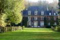
This short journey through the Pays de Caux will charm you with its steep-sided paths, dovecotes, castles and other skilfully restored manor houses. In the countryside where Bourvil once lived, the air is fragrant with the scent of flax. Upon arrival in Veules-les-Roses, you’ll discover France’s smallest river, which flows into the English Channel at a pebble beach typical of the Normandy coast.
Make sure you have asecond vehicle for the return journey.

Details

n°46351
Creation:
Last update:
Last review:
  • Walking
    Activity: Walking
  • ↔
    Distance: 12.47 mi
  • ◔
    Average duration: 5h 50 
  • ▲
    Difficulty: Moderate

  • ⚐
    Back to start: No
  • ↗
    Ascent: + 135 ft
  • ↘
    Descent: - 509 ft

  • ▲
    Highest point: 407 ft
  • ▼
    Lowest point: 30 ft
  • ⚐ Country: France
  • ⚐ City: Gonzeville (76560)
  • ⚑
    Start: N 49.765863° / E 0.807905°
  • ⚑
    End: N 49.876677° / E 0.798893°
  • ❏
    IGN map(s): Ref. 1909OT
  • Hour-by-hour weather

Description of the walk

Start at Gonzeville Town Hall.

(S) Take Rue du Calvaire, continue for 100m and turn right onto Rue de Bouffray, continuing for approximately 600m.

(1) In Héberville, turn right towards Bourville. 300 metres past the church, take the farm track on the left (for 300 metres) and turn right onto the fork that leads to ‘La Folie’ farm. Turn right to reach the Ferme du Moulin 300 metres further on. Go round the farm on the right to reach Bourville. Opposite the church stands the memorial to the great comic actor.

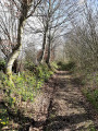
(2) Take the road that climbs alongside the church and continue straight ahead along the partly sunken track for 250m; at the end, turn left and head up towards Gelleville.

(3) Just past the farm, turn left (200m) then right. Walk past the dovecote typical of the Pays de Caux. Turn right onto the D437, then left once and right onto the Petit Val for 600m.

(4) Cross the D70 and continue for about 100 metres, then turn left onto the sunken path which leads to the Rue aux Chiens. Head uphill to your left.

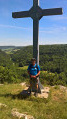
(5) On leaving Houdetot, turn right onto the country lane for 600 metres, which takes you to the wayside cross at the junction with the D468.

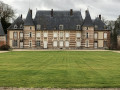
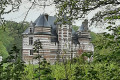
(6) Turn right for 300 metres, then turn right again. Pass in front of Silleron Castle. After the castle, take the first street on your left and continue for about 500 metres to reach the junction of the D75 and D4.

(7) Take the road straight ahead leading to the Iclon Chapel. Go round the chapel, pass the Château d’Iclon and take the path on your right. Pass under the high-voltage power lines. Continue for 200 metres, then turn left and, 300 metres further on, turn right.

(8) Enter Blosseville via the “Les Moutons” campsite. In Blosseville, turn right onto the D69 until you reach the Cavée Gros Jean (about 300 metres away).

(9) Then turn left and follow the farm track for 700 metres. You’ll reach the road leading down to the Chapelle du Val.

(10) At the chapel, continue to the left to reach Veules-les-Roses. Cross the Voie Charles de Gaulle (D925) to reach the River Veules

(11) Follow this river – the smallest in France – along its right bank to reach the beach (E).
Waypoints

  1. S : mi 0 - alt. 407 ft - Gonzeville Town Hall
  2. 1 : mi 0.74 - alt. 381 ft - Héberville
  3. 2 : mi 2.88 - alt. 279 ft - Bourville Church
  4. 3 : mi 3.7 - alt. 308 ft - Gelleville
  5. 4 : mi 5.08 - alt. 276 ft - D70, opposite
  6. 5 : mi 6.18 - alt. 285 ft - On leaving Houdetot, turn right
  7. 6 : mi 7.04 - alt. 276 ft - D468, wayside cross, turn right
  8. 7 : mi 8.34 - alt. 230 ft - Junction of the D75 and D4, opposite
  9. 8 : mi 9.99 - alt. 213 ft - “Les Moutons” campsite
  10. 9 : mi 10.64 - alt. 194 ft - Cavée Gros Jean
  11. 10 : mi 11.45 - alt. 95 ft - Chapelle du Val
  12. 11 : mi 11.96 - alt. 46 ft - Veule (fleuve)
  13. E : mi 12.47 - alt. 30 ft - Veules-les-Roses beach

Notes

Héberville: restaurants and shops.
Blosseville: restaurants and food shops
Veules-les-Roses: catering and food.

Worth a visit

Gonzeville: Saint Samson’s Church (16th century), old-fashioned school (single-classroom school, visits by appointment).
Clos: typical farmhouses of the Pays de Caux.
Héberville: church, restaurants and food shops.
Bourville: Memorial stone in honour of Bourvil (André Raimbourg).
Gelleville: Cauchoix-style dovecote.
Silleron: Silleron Castle.
Iclon: Chapel and castle.
Blosseville: restaurants and shops.
Veules-les-Roses: France’s smallest river, a charming village, a beach, restaurants and shops. A walk along the watercress beds.

Reviews and comments

5 / 5
Based on 1 review

Reliability of the description
5 / 5
Ease of following the route
5 / 5
Route interest
5 / 5
rando50
rando50

Overall rating : 5 / 5

Date of your route : May 25, 2023
Reliability of the description : ★★★★★ Very good
Ease of following the route : ★★★★★ Very good
Route interest : ★★★★★ Very good
Very busy route : No

A route taken in the spring. You walk through villages and fields; everything is green in the spring. The ‘highlight’ of the route is, of course, Veules-les-Roses. Allow a good two hours for the visit, if possible avoiding public holidays! Silleron Castle, a listed historic monument, is open to visitors (including the grounds). The friendly caretaker invited us in!

Machine-translated

Other walks in the area

For more walks, use our search engine .

The GPS track and description are the property of this route's author. Please do not copy them without permission.