From D’Auffay Town Hall to La Trompette

A walk suitable for all ages around the town of Auffay (Val-de-Scie). This is the route used for the ‘Octobre Rose’ walk and the Telethon.

Details

23644404
Creation:
Last update:
Last review:
  • Walking
    Activity: Walking
  • ↔
    Distance: 5.76 mi
  • ◔
    Average duration: 2h 50 
  • ▲
    Difficulty: Easy

  • ⚐
    Back to start: Yes
  • ↗
    Ascent: + 240 ft
  • ↘
    Descent: - 249 ft

  • ▲
    Highest point: 486 ft
  • ▼
    Lowest point: 299 ft
  • ⚐ Country: France
  • ⚐ City: Auffay (76720)
  • ⚑
    Start/End: N 49.717726° / E 1.100004°
  • ❏
    IGN map(s): Ref. 1910SB, 2009OT, 2010SB
  • Hour-by-hour weather

Description of the walk

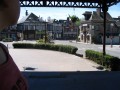
Start from Place Bleckede at Val-de-Scie Town Hall: car park opposite the town hall.

(S/E) Set off from the far end of the square and take the ramp at the back of the car park. It then veers to the right to join Rue du Vieux Château.

(1) Keep to the right. Turn left onto Chemin de l’Ancien Abattoir and follow the path to the right. Turn right onto Rue Émile Delacroix, continue to the junction with Rue Henri Fleury and turn right. At the end of this street, cross at the pedestrian crossing, then head left onto Route d’Ordemare and continue to the Fork in the road with Chemin de la Trompette.

(2) Keep to the right on theGR®210(marked in white and red). Continue along the dirt track that follows on from it, cross a road to reach another junction.

(3) Go straight on to emerge from the undergrowth before entering a wooded area again. You’ll reach a crossroads.

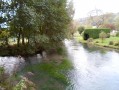
(4) Leave the path and turn right. Then keep to the right to pass under the bridge of the Rouen–Dieppe railway line. You’ll reach a small bridge over the River Scie: take some photos of the old mill.

(5) Cross the river and arrive in Vassonville via the Chemin de la Source. Turn left twice towards the church, then go round it on the left towards the road of the same name, keeping to the right twice. Continue straight on at the first junction and arrive at a second one with the Route du Brise Cailloux.

(6) Keep left and continue to the hamlet of Les Criquets. Pass through it, keeping to the right, before joining the Route d’Auffay-Tôtes (D22).

(7) Cross it and turn right to follow it alongside; ride single file if necessary: be careful, there is little room at the side. When you reach the “Legos”, turn left and continue straight ahead across the plain along a track. Keep going straight ahead until you reach the street that continues from it, Rue François Cavelier. Carry on until you reach Aufray, practically opposite the station

(8) Stay on the left-hand pavement to walk alongside Rue Gambetta, without crossing the level crossing. Carry on until you reach the underpass beneath the railway line.

(9) Cross at the pedestrian crossing, go down the stairs and pass under the railway line. On the other side, take the path on the right-hand side. Ignore a junction, continue alongside the River Scie, then cross it to emerge onto Chemin de Lavanne. Then first turn right then left in front of the town hall and return to the starting point (S/E).

Waypoints

  1. S/E : mi 0 - alt. 308 ft - Bleckede car park
  2. 1 : mi 0.08 - alt. 341 ft - Rue du Vieux Château
  3. 2 : mi 0.49 - alt. 381 ft - Chemin de la Trompette (GR210)
  4. 3 : mi 1.2 - alt. 371 ft - Junction
  5. 4 : mi 1.61 - alt. 430 ft - Crossroads – take the path on the right
  6. 5 : mi 1.84 - alt. 328 ft - Moulin sur la - Scie (fleuve)
  7. 6 : mi 2.14 - alt. 367 ft - Route du Brise Cailloux
  8. 7 : mi 3.31 - alt. 479 ft - D27
  9. 8 : mi 5.39 - alt. 315 ft - Auffray – left-hand pavement - Gare d'Auffay
  10. 9 : mi 5.55 - alt. 305 ft - Staked section
  11. S/E : mi 5.76 - alt. 308 ft - Bleckede car park

Notes

No specific equipment is required apart from the basic gear for a family or group hike.

Worth a visit

Le Moulin sur la Scie at (5).

Always be cautious and plan ahead when you're outdoors. Visorando and the author of this route cannot be held responsible for any accidents occurring on this route.

The GR® and PR® markings are the intellectual property of the Fédération Française de Randonnée Pédestre.

Reviews and comments

4.5 / 5
Based on 2 reviews

Reliability of the description
4.5 / 5
Ease of following the route
4.5 / 5
Route interest
4.5 / 5
User 23679450

Overall rating : 4.7 / 5

Date of your route : Jun 24, 2026
Reliability of the description : ★★★★★ Very good
Ease of following the route : ★★★★★ Very good
Route interest : ★★★★☆ Good
Very busy route : No

A really good walk – an easy route to follow, though the start is a bit tricky to find when setting off from the car park in the centre of L’Auffay. Highly recommended for keen walkers.

Machine-translated

FACHERIS76
FACHERIS76

Overall rating : 4.3 / 5

Date of your route : Dec 15, 2025
Reliability of the description : ★★★★☆ Good
Ease of following the route : ★★★★☆ Good
Route interest : ★★★★★ Very good
Very busy route : No

Uninteresting start in Auffay, then a beautiful path through Chasse Marrée, followed by Flaubert's footsteps, and back via the Longuet plain!
A good impression remains!

Machine-translated

Other walks in the area

For more walks, use our search engine .

The GPS track and description are the property of this route's author. Please do not copy them without permission.