Country:

 City:
City:


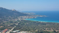
The starting point is deliberately located at the “Aregno Plage” stop, but a car park nearby will also do. Alternative parking is available on the left at (1), on the small road branching off to the right when coming from Île-Rousse, if the beach car park is full.
(S/E) Take the road running alongside the railway line, towards Île-Rousse. At the car park, turn right, cross the railway line, and follow the path between the houses and a small stream, until you reach the back of the petrol station, beside the T80.
(1) Cross very carefully – heavy traffic. Set off straight ahead, slightly to the right, onto the small road leading towards the campsite and various holiday rentals.
(2) At the junction, take a short left-right turn towards Le Balanea campsite. Follow the campsite’s perimeter and continue in the same direction until you reach a road at the back of the San Cipriano business park
(3) Take this road to the right for about a hundred metres, then turn left onto the dirt track: yellow signpost – Santa Corbara. Follow this for approximately 600 metres.
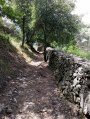
(4) Leave the track and turn right onto a small path (marked in yellow), and begin the real climb up towards Corbara. This section is quite steep in places, but it is shaded and fairly easy to navigate. Halfway up, you’ll pass two restored fountains.
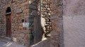
(5) At the junction, turn right, reach the first houses at the bottom of the village, and follow the narrow streets to reach the D151.
(6) Follow it to the right, go round the car park on the left, then take a sharp left-hand bend to reach the Collegiate Church of Santa Nunziata.
(7) Walk past the church, ignore the first street on the left leading to the Museum (a dead end) and take the next one, Rue San Rocco. Continue along Rue Borgo, heading uphill.
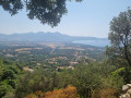
(8) Before the hairpin bend, follow the small cobbled lane on the left which continues straight ahead. Carry on along a hillside path (offering the best view of this walk) which turns left at a 90° angle and becomes a little stony before joining the D151 at a very sharp bend, opposite the Chapel of Saints Peter and Paul.
(9) Cross the D151 very carefully due to the lack of visibility on the left, take the path opposite, and head back down towards the sea. Follow this long, almost straight path, which is quite steep, until you reach a tarmac road. Carry on straight ahead.
(10) Take a narrow path on the left, between the houses, to rejoin a tarmac section. Turn left again and follow this road for about 150 metres
(11) At this point, leave the road and head left onto a dirt track which first crosses a field, continues through woodland, then across heath-style pastureland. Pass just below a sheepfold: please ensure you leave the gates as you find them. This will take you back to the ascent route.
(4) Turn right and follow the outward route in the opposite direction to return to the start (S/E).
 Visorando Member
 Moderate