Cuiron, Ramasse and Les Conches from Jasseron

Starting from Jasseron, a climb through the forest leads to the Cuiron viewpoint (view over the Bourg plain), which then drops down to the Ramasse valley and on to the village. From there, a good path climbs up to the Chapelle des Conches and its panoramic views before returning to Jasseron. There are a few possible variations to enhance the route.

Details

92308806
Creation:
Last update:
Last review:
  • Walking
    Activity: Walking
  • ↔
    Distance: 12.53 km
  • ◔
    Average duration: 4h 45 
  • ▲
    Difficulty: Moderate

  • ⚐
    Back to start: Yes
  • ↗
    Ascent: + 421 m
  • ↘
    Descent: - 418 m

  • ▲
    Highest point: 573 m
  • ▼
    Lowest point: 294 m

Photos

Description of the walk

Park at Place Bernard Chanel or the adjacent Place André Galland. On Sundays, market day, you can set off from Place Sans-Soucis after the Saint-Joseph retirement home.

(S/E) Take the path at the far end of the square (Sentier des Pies) and turn left at the end of it to follow the Chemin de la Fontaine and join the D936 (Rue Charles Robin). Turn right to follow this street.

(1) Continue straight ahead and pass a narrowing of the road: take care as there is heavy traffic on this stretch.

(2) Leave this road and turn right onto Route de l’Abbé Gringoz.

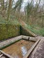
(3) At the first bend, leave the road and take the path that starts in front of an old water intake, and follow it straight on until it leads to the Combes site.

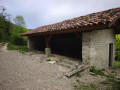
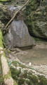
(4) Turn right to pass in front of the recently renovated Combes wash house. Follow the correct path, which runs level for a while before climbing through the forest. Each time, ignore the tracks branching off to the right to stay on the ascending path, which leads to a tarmac road at a hairpin bend.

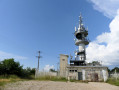
(5) Follow this road and, at the next hairpin bend, head straight on to the Cuiron viewpoint: panoramic views over the Bresse plain as far as the Beaujolais and Mâconnais hills, with a climbing site below.

(6) Continue along the balcony path that runs alongside the road to the cul-de-sac and head for the adjacent Col de la Pérouse.

(7) Follow the correct path on the left towards Ramasse (signposted), which descends steadily to the village.

(8) Upon reaching Ramasse from above, take the road on the left that runs along the hillside. On this road, which crosses the village, there is a panoramic view of the valley. Head to the junction signposted Notre-Dames des Conches.

(9) Turn left onto the street, which turns into an excellent path that climbs steadily until it emerges from the forest into a pasture.

(10) Continue along the path on the right which runs alongside the fence, leading out onto the road towards the Notre-Dame des Conches Chapel. Continue to the right to reach it.

(11) Continue along the GRP® (yellow and red markings): views of La Bresse, Le Revermont and the high peaks of the Jura in the distance. Carry on until you reach the tarmac road, turn left then right, following the GRP® markings.

(12) At the bend, ignore the path leading towards the Col de France (signposted) and continue straight on along the wide track between the pastures for about 200 m, until you come to a small path.

(13) Follow this path, which leads into the undergrowth on the slope between the hedges (remnants of walls). You will emerge onto the Route du Col de France (D936) at a place called Tire-Mâle. Turn left and walk carefully alongside the road until you reach the pedestrian crossing.

(14) Cross with the same caution to take the quieter Chemin de Tiremale. At the end of this path, rejoin the route you took on the way up and continue to the right to return to Place Bernard Chanel (S/E).

Waypoints

  1. S/E : km 0 - alt. 294 m - Place Bernard Chanel
  2. 1 : km 0.4 - alt. 300 m - Rue Charles Robin - Église Saint-Jean-Baptiste (Jasseron)
  3. 2 : km 0.66 - alt. 308 m - Route de l'Abbé Gringoz
  4. 3 : km 1.17 - alt. 336 m - Epingle - Start of the path
  5. 4 : km 2.74 - alt. 441 m - Les Combes
  6. 5 : km 4.07 - alt. 527 m - Tarmac road
  7. 6 : km 4.85 - alt. 561 m - Cuiron viewpoint
  8. 7 : km 5.52 - alt. 511 m - Col de la Pérouse - Col de Pérou se (507m)
  9. 8 : km 7.25 - alt. 356 m - Ramasse from above
  10. 9 : km 7.63 - alt. 354 m - Notre Dames des Conches junction
  11. 10 : km 9.14 - alt. 505 m - Signpost, exit from the pasture
  12. 11 : km 9.68 - alt. 511 m - Notre-Dame des Conches Chapel - Notre Dames des Conches (Ramasse)
  13. 12 : km 10.58 - alt. 465 m - Leaving the GRP
  14. 13 : km 10.76 - alt. 461 m - Return path to Tiremale
  15. 14 : km 11.58 - alt. 317 m - Crossing the road
  16. S/E : km 12.53 - alt. 294 m - Place André Galand

Notes

No water along the route. Mainly good paths, apart from the final descent to Tiremale on a narrower track. Some sections may be slippery in wet weather.

The various churches, with the exception of Notre-Dame des Conches, are sometimes open.

(1) On the way, you can make a short detour to the Church of Saint-Jean-Baptiste (12th–16th centuries), with its simple architecture and some remarkable statues

(8) You can take a short detour to the right to reach the church and enjoy the view over the Ramasse valley and its two villages, the upper and lower ones.

(10) You can head up to the ridge at Trou du Sac and follow it along the GRP®: a slightly more rugged and exposed route above the cliff.

Worth a visit

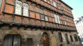
The Church of Saint-Jean-Baptiste in Jasseron (at the start or end of the route), the recently renovated Combes wash house, the magnificent panorama from the viewpoint.

A short detour from the Col de la Pérouse to the Cabane du Maquis, a site commemorating the Resistance. Go straight on at the pass; after about 300 m, at the signpost, follow the path to the left, cross the site and rejoin the GR®59, which leads back to the pass.

Highlights: views, church.

Notre-Dame des Conches.

Always be cautious and plan ahead when you're outdoors. Visorando and the author of this route cannot be held responsible for any accidents occurring on this route.

The GR® and PR® markings are the intellectual property of the Fédération Française de Randonnée Pédestre.

Other walks in the area

For more walks, use our search engine .

The GPS track and description are the property of this route's author. Please do not copy them without permission.