Country:

 City:


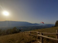
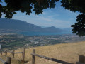
Park at the Montagny paragliding landing area, Route des Sartos in Sonnaz.
(S/E) Set off north-north-east towards the forest, along the path that climbs and leads above the hamlet of Fournet, ignoring the multitude of paths on either side until you reach a flat stretch.
(1) First turn right then left, and carry on straight ahead to reach the crossroads at a place called Les Buffards.
(2) Head due north, still through the forest, until you reach the Malpassant cross-path.
(3) Cross it and carry on straight ahead along the path that runs to the left of a reservoir. Continue downhill towards Méry until you reach Rue de la Ponaise.
(4) Turn left onto it, leaving the church on your right, and, at Place de la Fontaine, turn left down Rue d’Argentine, then right onto Rue de la Béthanie until you reach the junction with the D211, marked with a cross on your left.
(5) Turn right onto the D211 (Route de la Fruitière) and follow it for about fifty metres until you reach a pedestrian crossing. Turn left between a small copse of trees and a house and continue straight on; the path heads south-west and reaches a junction with the Chemin de Lachat.
(6) Carry on straight ahead towards the south-west. The gradient levels out and you reach a crossroads (IGN elevation 284).
(7) Turn sharply left and join the D16 opposite No. 117 Chemin du Pont à Meil.
(8) Turn right and pass the sign for the Méry exit; then, a few dozen metres further on, turn left and continue due south along the track which, through the Marais Vuillerme and running alongside Le Tillet, leads to the Sonnaz tennis courts and the ‘Stop’ sign before the D211.
(9) Follow it to the right for about a hundred metres, then at the junction, turn left onto Chemin de l’Échelette. After four bends in the road and passing close to two crosses, you’ll reach the starting point (S/E).
 Visorando Member
 Moderate

 Difficult