Country:

 City:


Head to Sainte-Croix-en-Jarez and park in the visitors’ car park near the Chartreuse. The walk starts from this car park.
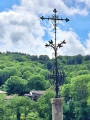
(S/E) Leave the car park by turning left, walk down for about twenty metres to reach the road below, where there is a cross, and turn right. After about forty metres, take the dirt track on the right and follow it uphill. Cross a road and carry on straight ahead until you reach a second tarmac road. Cross this and take the dirt track opposite, heading uphill across the fields. You’ll come to a junction where the Croix du Sud stands.
(1) Turn right onto a dirt track, passing a farm on your right. Keep to the right on the main track, cross the road and continue straight ahead. At the Fork in the road, turn left and continue along the main track until you reach a tarmac road.
(2) Turn left onto this tarmac road and, after about twenty metres, follow the dirt track on the right. Follow the signposts along this track, which makes a wide circular loop to the left, and ignore the side paths branching off to the right. You will reach the tarmac road again; turn right to cross a bridge over a small stream. Continue uphill to reach the village of Seyoux.
(3) Just before entering the village, at the Fork in the road, keep left, continuing uphill (Route de Seyoux). A few metres further on, ignore the road branching off to the right and carry on straight ahead. At the next junction in the village, keep left onto the Route de Seyoux. When you reach another junction, turn left, continuing uphill, and walk for about 40 metres.
(4) Turn left and follow the sharp hairpin bend to take the dirt track uphill, leaving the last houses of the village on your right. Continue uphill, staying on the main track, until you reach a crossroads with a hiking signpost (La Croix du Cerisier).
(5) Turn onto the path furthest to the left and continue uphill. Carry on straight ahead, then follow the ridge until you reach a crossroads at elevation 661.
(6) Carry on straight ahead until you reach a Fork in the road, then take the left-hand path downhill to the crossroads at La Croix du Mazet.
(7) Cross the junction and the departmental road, then take the dirt track leading uphill opposite, at the hiking signpost. Head into the forest and follow the main track straight on, ignoring the side paths to the right and left, and follow the signposts until you reach the hamlet of La Croix de Montvieux, by the side of the departmental road.
(8) Cross the road opposite the entrance to the Croix de Montvieux restaurant and, after a small car park, take a dirt track on the right, heading downhill and running parallel to the road. Continue downhill until, about fifty metres further on, you reach a road which you should quickly leave to take the track on the left. Continue downhill until you reach a crossroads.
(9) Turn left uphill to cross the main road again and continue opposite along the wide, uphill dirt track. At the top, keep to the right and continue downhill until you reach a fork in the path and a hiking signpost. Continue downhill towards La Grange Rouet.
(10) Head towards the restaurant entrance, walk past it and continue downhill to the left. After a hairpin bend, leave the road and take a dirt track branching off to the left, where you’ll find a hiking signpost.
Carry on along this gently sloping track, leave the woods, walk for about a hundred metres and reach a crossroads where there is a hiking signpost.
(11) Go straight on for about fifty metres, then turn right, almost in the opposite direction. Continue along the path downhill until you reach a tarmac road. Cross this and take Allée de Montrevel opposite to reach the hamlet of Montrevel.
(12) At the first junction, turn right and head downhill. About twenty metres further on, ignore a path branching off to the left and continue downhill. The path isn’t very visible, but you must persevere and continue downhill, following a hedge. Enter the woods and, at the bottom of the descent, wade across a stream and continue uphill on the other side. You’ll reach a tarmac road and a hamlet (Route des Maranches) at a place called Les Maranches.
(13) Walk for about twenty metres until you reach a Fork in the road and turn right onto Allée des Maranches. Continue along this road uphill until it becomes a dirt track, passing between houses, and reach a junction.
(14) Carry on straight ahead, ignoring the track branching off to the right. When you reach a road, cross it and continue along the track opposite, towards the village of Pavezin. This track becomes tarmac; carry on straight ahead, passing the start of Rue de Perrochia on your left, then a turn-off on the right, until you arrive in front of Pavezin Town Hall.
(15) Carry on straight ahead along the Route de la Chartreuse, then, on leaving the village, take the dirt track on the left towards the sewage treatment works. Continue down this track until you reach a road at a hairpin bend.
(16) Cross it and take the dirt track opposite that runs alongside the stream. Join the road again and turn right onto it. At the next junction, turn left towards Petit Valluy and head for the hamlet of La Chappey.
(17) At the 90° left-hand bend by a cross, take the dirt track that runs straight ahead to the right. At the fork in the road, keep to the right; then, about fifty metres further on, veer left and carry on straight ahead. Continue down this path until you reach the tarmac road you took at the start of the walk. Turn right and retrace your steps back to the car park, turning left after the cross (S/E).

 Visorando Member
 Easy

 Difficult