Crête des Alleyrons

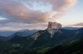
An easy walk with a superb view on arrival of Mont Aiguille and the Grand Veymont.

Details

27070350
Creation:
Last update:
Last review:
  • Walking
    Activity: Walking
  • ↔
    Distance: 2.79 mi
  • ◔
    Average duration: 2h 30 
  • ▲
    Difficulty: Moderate

  • ⚐
    Back to start: Yes
  • ↗
    Ascent: + 1,404 ft
  • ↘
    Descent: - 1,404 ft

  • ▲
    Highest point: 5,505 ft
  • ▼
    Lowest point: 4,101 ft

Photos

Description of the walk

This walk starts from the car park at the Gresse-en-Vercors ski resort.

(S/E) From the dip in the hairpin bend at the ski resort car park, follow the wide, stony forest track that heads straight ahead.

(1) After a good hundred metres, take the path that veers sharply to the left, heading towards the Crête du Brisou. The path passes beneath the Blavet ski lift and, immediately afterwards, crosses a ski run before climbing a little further into the forest.

(2) At the top of the short slope, follow the path that veers sharply to the right into a wide clearing to reach the summit of the Blavet ski lift.

(3) Continue straight ahead, still heading towards the Crête du Brisou, and enter the woodland on the Crête des Alleyrons.
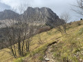
The path then follows the ridge almost all the way to the summit and, once at the edge of the forest, leaves the ridge itself to follow a very well-marked path to the summit, just below the top station of the Alleyrons ski lift.

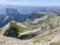
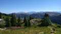
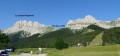
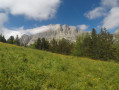
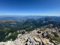
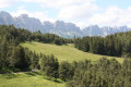
(4) The view opens up: the Dévoluy to the east, the Grand Veymont to the west, Mont Aiguille to the south and the Deux Sœurs to the north. You’ll also find two picnic tables.

The return journey follows the same route back to the ski area car park (S/E).

Waypoints

  1. S/E : mi 0 - alt. 4,101 ft - Car park at the Gresse-en-Vercors resort
  2. 1 : mi 0.08 - alt. 4,131 ft - Junction
  3. 2 : mi 0.38 - alt. 4,373 ft - Wide clearing
  4. 3 : mi 0.52 - alt. 4,472 ft - Start of the ridge
  5. 4 : mi 1.4 - alt. 5,505 ft - Elevation 1678, turning point
  6. S/E : mi 2.79 - alt. 4,101 ft - Car park at the Gresse-en-Vercors resort

Notes

The path follows the signposted Crête du Brisou route, with signposts and yellow markings, and blue dots in the forest on the Crête des Alleyrons.

Reviews and comments

3.8 / 5
Based on 5 reviews

Reliability of the description
3.8 / 5
Ease of following the route
4 / 5
Route interest
3.6 / 5
User 28044120
• Edited:

Overall rating : 5 / 5

Date of your route : Nov 09, 2025
Reliability of the description : ★★★★★ Very good
Ease of following the route : ★★★★★ Very good
Route interest : ★★★★★ Very good
Very busy route : Yes

A very beautiful hike to do, it climbs quite a bit along the way, which really works your thighs, but the view at the end is definitely worth it.
I highly recommend this hike.

Machine-translated

myrtilles
myrtilles

Overall rating : 4.3 / 5

Date of your route : Aug 10, 2024
Reliability of the description : ★★★★☆ Good
Ease of following the route : ★★★★☆ Good
Route interest : ★★★★★ Very good
Very busy route : No

Hike completed on 10 August 2024. A magnificent view from the summit that made me forget the climb, which was a bit steep for me. I’ve lost my red cap with ‘Mongolia’ written on it. If anyone finds it, please let me know. It really is from Mongolia...

Machine-translated

TrisranVDB
TrisranVDB

Oh yes... that’s right, I forgot to mention: be careful, as the paths are muddy and slippery in winter. And it’s cold, too.
That’s it.

Machine-translated

stephane.s
stephane.s

Overall rating : 1.3 / 5

Date of your route : Mar 02, 2024
Reliability of the description : ★★☆☆☆ Disappointing
Ease of following the route : ★☆☆☆☆ Very disappointing
Route interest : ★☆☆☆☆ Very disappointing
Very busy route : No

This hike is dangerous in snow or rain!
The ascent is very steep and very difficult if it has rained or snowed – it’s slippery. With even a tiny bit of snow at higher altitudes, the end of the circular route is not visible and completely inaccessible, which makes the final part of this hike extremely dangerous. As the path on the way up was far too steep and slippery to walk down, I had to go under the chairlift along a downhill slope which must be great on skis but absolutely not in hiking boots, and there had been no warning about the difficulty of finding this path, which was completely covered in snow at the summit and had no clear signposting.

Machine-translated

Bacch
Bacch

Overall rating : 4 / 5

Date of your route : Jan 29, 2024
Reliability of the description : ★★★★☆ Good
Ease of following the route : ★★★★★ Very good
Route interest : ★★★☆☆ Average
Very busy route : No

It’s easier to plan a circular route of the same length than a simple return journey

Machine-translated

Fle85
Fle85

Overall rating : 4.3 / 5

Date of your route : May 18, 2023
Reliability of the description : ★★★★☆ Good
Ease of following the route : ★★★★★ Very good
Route interest : ★★★★☆ Good
Very busy route : Yes

The walk was cut short due to fog and very slippery ground.

Machine-translated

Other walks in the area

For more walks, use our search engine .

The GPS track and description are the property of this route's author. Please do not copy them without permission.